| North Mekinac River | |
|---|---|
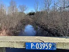
 From bridge P-03959, steel-wood, under embankment (1982), Rang du Haut-du-Lac Nord, Saint-Tite | |
| Location | |
| Country | Canada |
| Physical characteristics | |
| Source | |
| • location | Grandes-Piles |
| • coordinates | 46°44′07″N 72°36′38″W / 46.73528°N 72.61056°W |
| • elevation | 302 m (991 ft) |
| Mouth | |
• location | Rivière des Envies at Saint-Tite |
• elevation | 131 m (430 ft) |
| Length | 28 km (17 mi) |
The North Mekinac River flows from North to South, in three municipalities (Sainte-Thècle, Grandes-Piles and Saint-Tite), in Mauricie region, Mékinac Regional County Municipality,[1] Quebec, Canada.
Science
According to the research station set up by the Benthos Network (2008), the North Mékinac River is in good health. Note: Based on the composition of the benthic community collected on the natural substrate of streams and the condition of the habitat, the monitoring of the health of the benthos (natural substrate) allows the assessment of the health status of shallow streams with coarse and soft substrate.[2]
Toponymy
The toponym "Rivière Mékinac du Nord " was registered on December 5, 1968 in Commission de toponymie du Québec.[3]
Photos
- Rivière Mékinac Nord
 Panel on Bridge P-03959,[4] steel-wood, under embankment (1982), rang du Haut-du-Lac Nord, Saint-Tite
 From bridge P-03959, steel-wood, under embankment (1982), rang Haut-du-Lac Nord, Saint-Tite
See also
References
- ↑ "Territory of the RMC Mékinac" (PDF) (in French). 2004-10-19. p. 1. Retrieved 2023-11-19.
Mekinac RMC map
- ↑ SAMBBA (December 2015). "Batiscan River Water Master Plan" (PDF) (in French). Société d'aménagement et de mise en valeur du bassin de la Batiscan (SAMBBA). pp. 169 from 359. Retrieved 2023-11-19.
- ↑ "Rivière Mékinac du Nord cite web". Commission de toponymie Quebec. Government of Quebec. 1968-12-05. Retrieved 2023-11-19.
- ↑ "Inventaire et inspection des structures". Ministère des Transports et de la Mobilité durable (in French). Government of Quebec. 2023-11-21. Retrieved 2023-11-21.
External links
- Municipality of Sainte-Thècle: Official website (in French)
- Mékinac Regional County Municipality: Official website(in French)
- Municipalité régionale de Grandes-Piles: Official website(in French)
This article is issued from Wikipedia. The text is licensed under Creative Commons - Attribution - Sharealike. Additional terms may apply for the media files.