North Athens
Περιφερειακή ενότητα Βορείου Τομέα Αθηνών | |
|---|---|
 Municipalities of the former Athens prefecture | |
| Coordinates: 39°35′N 20°20′E / 39.583°N 20.333°E | |
| Country | Greece |
| Region | Attica |
| Capital | Cephissia |
| Area | |
| • Total | 140.7 km2 (54.3 sq mi) |
| Population (2011) | |
| • Total | 598,847 |
| • Density | 4,300/km2 (11,000/sq mi) |
| Time zone | UTC+2 |
| • Summer (DST) | UTC+3 (EEST) |
| Postal codes | 14x xx, 15x xx |
| Area codes | 2106x, 2108x |
| ISO 3166 code | GR-A1 |
| Car plates | ΥΑ, ΥΒ, ΥΕ, ΥΖ, ΥΗ, ΖΖ, ΖΗ, ΖΚ, ΖΜ, ΙΒ, ΙΕ, ΙΖ, ΙΗ, ΙΚ, ΙΜ, ΙΟ, ΙΡ, ΙΤ, ΙΥ, ΧΕ, ΧΖ, ΧΗ, ΧΡ, ΧΤ, ΧΥ, ΧΧ, ΗΒ, ΟΑ, ΟΒ, ΟΕ, ΟΖ, ΟΗ, ΟΙ, ΟΚ, ΟΜ, ΟΝ, ΟΟ, ΟΤ, ΟΥ, ΟΧ, ΧΜ, ΖΕ, ΖI, ΖΟ |
| Website | www.patt.gov.gr |
North Athens (Greek: Βόρειος Τομέας Αθηνών) is one of the regional units of Greece. It is part of the region of Attica. The regional unit covers the northeast-central part of the agglomeration of Athens.
Administration
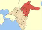
As a part of the 2011 Kallikratis government reform, the regional unit North Athens was created out of part of the former Athens Prefecture. It is subdivided into 12 municipalities. These are (number as in the map in the infobox):[1]
- Agia Paraskevi (3)
- Amarousio (8)
- Chalandri (35)
- Filothei-Psychiko (33)
- Irakleio (17)
- Kifisia (21)
- Lykovrysi-Pefki (22)
- Metamorfosi (23)
- Nea Ionia (25)
- Papagou-Cholargos (28)
- Penteli (29)
- Vrilissia (9)
See also
References
This article is issued from Wikipedia. The text is licensed under Creative Commons - Attribution - Sharealike. Additional terms may apply for the media files.
