| |
|---|---|
 | |
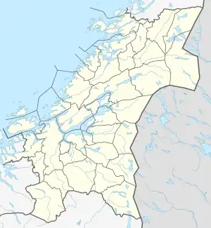
 Location of the river  Nea River (Norway) | |
| Location | |
| Countries | Norway, Sweden |
| Counties | Trøndelag, Jämtland |
| Municipalities | Tydal, Selbu, Åre, Berg |
| Physical characteristics | |
| Source | Sylsjön |
| • location | Åre, Jämtland, Sweden |
| • coordinates | 62°55′49″N 12°09′06″E / 62.93028°N 12.15167°E |
| • elevation | 851 metres (2,792 ft) |
| Mouth | Selbusjøen at Mebonden |
• location | Tydal, Trøndelag, Norway |
• coordinates | 63°13′44″N 11°01′52″E / 63.22889°N 11.03111°E |
• elevation | 157 metres (515 ft) |
| Length | 80 km (50 mi) |
| Basin size | 2,082.89 km2 (804.21 sq mi) |
| Discharge | |
| • average | 70 m3/s (2,500 cu ft/s) |
| Basin features | |
| River system | Nea-Nidelvvassdraget |
| Tributaries | |
| • left | Rotla |
| • right | Tya |
Nea (Norwegian), Ganka (Southern Sami), or Nean (Swedish) is an 80-kilometre (50 mi) long river which has runs through the municipalities of Tydal and Selbu in Trøndelag county, Norway and Åre Municipality in Jämtland county, Sweden. The river Nea is a part of the Nea-Nidelvvassdraget watershed. Some of the main villages along the river include: Østby, Ås, Aunet, and Gressli in Tydal and Flora, Hyttbakken, Selbu, and Mebonden in Selbu.
The river is first named Nean at the eastern end of the artificial lake Sylsjön, which lies in Åre Municipality and Berg Municipality in Sweden. Below the dam, the river flows for 6 kilometres (3.7 mi), crossing the Swedish-Norwegian border where the name becomes Nea, before entering the lake Nesjøen. On the downstream side of the lake, the river continues through the smaller lake Vessingsjøen before continuing on its westward course. At the municipal center of Ås the river Tya joins it. After that, it follows the Tydalen valley and meets the river Rotla about 15 kilometres (9.3 mi) east of the village of Mebonden where it ends when it flows into the lake Selbusjøen.[1]
See also
References
- ↑ Store norske leksikon. "Neavassdraget" (in Norwegian). Retrieved 2011-03-01.