| Natoas Peak | |
|---|---|
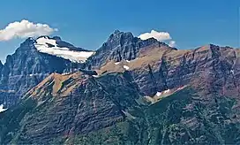 Natoas Peak is the rugged summit centered and snowy Mount Merritt is to left | |
| Highest point | |
| Elevation | 9,480 ft (2,890 m)[1] |
| Prominence | 596 ft (182 m)[1] |
| Coordinates | 48°52′29″N 113°45′47″W / 48.87472°N 113.76306°W[2] |
| Geography | |
 Natoas Peak | |
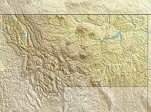
| Parent range | Lewis Range |
| Topo map | USGS Ahern Pass, MT |
| Climbing | |
| First ascent | Bruce Murphy and Bill Mathews, August 1964[1] |
Natoas Peak (9,480 feet (2,890 m)) is located in the Lewis Range, Glacier National Park in the U.S. state of Montana.[1][3] Natoas Peak is 1.10 miles (1.77 km) northeast of Mount Merritt.
First ascent by Bruce Murphy and Bill Mathews, August 1964.
See also
References
- 1 2 3 4 "Natoas Peak, Montana". Peakbagger.com. Retrieved December 26, 2018.
- ↑ "Natoas Peak". Geographic Names Information System. United States Geological Survey, United States Department of the Interior. Retrieved December 26, 2018.
- ↑ Ahern Pass, MT (Map). TopoQwest (United States Geological Survey Maps). Retrieved December 26, 2018.
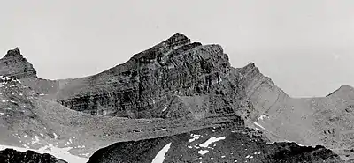
Natoas Peak, aerial view, south aspect. circa 1925
This article is issued from Wikipedia. The text is licensed under Creative Commons - Attribution - Sharealike. Additional terms may apply for the media files.