This is a list of the National Register of Historic Places listings in Sumner County, Tennessee.
This is intended to be a complete list of the properties and districts on the National Register of Historic Places in Sumner County, Tennessee, United States. Latitude and longitude coordinates are provided for many National Register properties and districts; these locations may be seen together in a map.[1]
There are 38 properties and districts listed on the National Register in the county, including 1 National Historic Landmark. Another 2 properties were once listed but have been removed.
See also National Register of Historic Places listings in Davidson County, Tennessee for additional properties in Goodlettsville, a city that spans the county line.
| Anderson – Bedford – Benton – Bledsoe – Blount – Bradley – Campbell – Cannon – Carroll – Carter – Cheatham – Chester – Claiborne – Clay – Cocke – Coffee – Crockett – Cumberland – Davidson – Decatur – DeKalb – Dickson – Dyer – Fayette – Fentress – Franklin – Gibson – Giles – Grainger – Greene – Grundy – Hamblen – Hamilton – Hancock – Hardeman – Hardin – Hawkins – Haywood – Henderson – Henry – Hickman – Houston – Humphreys – Jackson – Jefferson – Johnson – Knox – Lake – Lauderdale – Lawrence – Lewis – Lincoln – Loudon – Macon – Madison – Marion – Marshall – Maury – McMinn – McNairy – Meigs – Monroe – Montgomery – Moore – Morgan – Obion – Overton – Perry – Pickett – Polk – Putnam – Rhea – Roane – Robertson – Rutherford – Scott – Sequatchie – Sevier – Shelby – Smith – Stewart – Sullivan – Sumner – Tipton – Trousdale – Unicoi – Union – Van Buren – Warren – Washington – Wayne – Weakley – White – Williamson – Wilson |
This National Park Service list is complete through NPS recent listings posted January 12, 2024.[2]
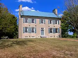
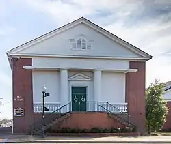
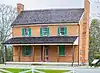
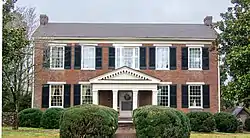
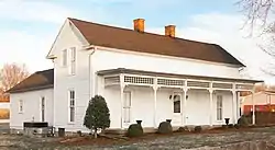
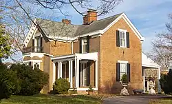
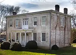
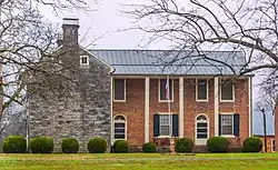
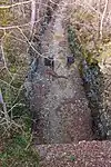
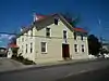
Current listings

.jpg.webp)
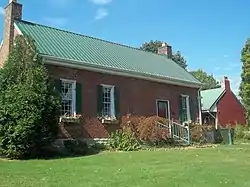
.JPG.webp)


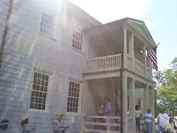

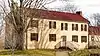
Former listings
| [3] | Name on the Register | Image | Date listed | Date removed | Location | City or town | Description |
|---|---|---|---|---|---|---|---|
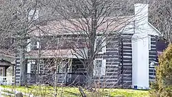
| 1 | Fairvue |  Fairvue |
June 10, 1975 (#75002162) | April 4, 2005 | 4 mi. S of Gallatin on U.S. 31E (Rozella Way below Plantation Blvd) |
Gallatin | Formerly a National Historic Landmark (note: home still exists, but it was delisted after residential development on plantation grounds) |
| 2 | Talley-Beals House | August 22, 1977 (#77001296) | June 5, 1990 | N of Hendersonville off Saunderville Rd. |
Hendersonville | House burned to the ground due to lightning strike on May 28, 1990.[7] |
See also
References
- ↑ The latitude and longitude information provided in this table was derived originally from the National Register Information System, which has been found to be fairly accurate for about 99% of listings. Some locations in this table may have been corrected to current GPS standards.
- ↑ National Park Service, United States Department of the Interior, "National Register of Historic Places: Weekly List Actions", retrieved January 12, 2024.
- 1 2 Numbers represent an alphabetical ordering by significant words. Various colorings, defined here, differentiate National Historic Landmarks and historic districts from other NRHP buildings, structures, sites or objects.
- ↑ "National Register Information System". National Register of Historic Places. National Park Service. April 24, 2008.
- ↑ The eight-digit number below each date is the number assigned to each location in the National Register Information System database, which can be viewed by clicking the number.
- ↑ Location derived from this Bledsoe's Fort-related website; the NRIS lists it as "Address Restricted"
- ↑ "Fire destroys historic Hendersonville home". The Tennessean. May 29, 1990. p. 2B. Retrieved August 29, 2022 – via Newspapers.com.
| Topics | |
|---|---|
| Lists by state |
|
| Lists by insular areas | |
| Lists by associated state | |
| Other areas | |
| Related | |
Municipalities and communities of Sumner County, Tennessee, United States | ||
|---|---|---|
| Cities | Sumner County map | |
| Town | ||
| CDPs | ||
| Unincorporated communities | ||
| Footnotes | ‡This populated place also has portions in an adjacent county or counties | |