
Location of Siskiyou County in California
This is a list of the National Register of Historic Places listings in Siskiyou County, California.
This is intended to be a complete list of the properties and districts on the National Register of Historic Places in Siskiyou County, California, United States. Latitude and longitude coordinates are provided for many National Register properties and districts; these locations may be seen together in an online map.[1]
There are 21 properties and districts listed on the National Register in the county, including 1 National Historic Landmark.
This National Park Service list is complete through NPS recent listings posted January 12, 2024.[2]
Current listings
| [3] | Name on the Register[4] | Image | Date listed[5] | Location | City or town | Description |
|---|---|---|---|---|---|---|
| 1 | Camp Tulelake | 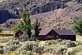 Camp Tulelake |
March 12, 2018 (#100002176) |
Hill R., 2 mi. S of jct. with CA 161, Tule Lake National Monument 41°58′09″N 121°33′56″W / 41.969199°N 121.565430°W |
Tulelake | Originally a Civilian Conservation Corps camp established in 1935. During World War II, a maximum security prison camp for incarcerating dissident interned Japanese Americans (1943) and German prisoners of war (1944–1946). |
| 2 | Captain Jack's Stronghold | 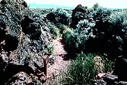 Captain Jack's Stronghold |
September 20, 1973 (#73000259) |
S of Tulelake, Lava Beds National Monument 41°49′18″N 121°30′18″W / 41.821667°N 121.505°W |
Tulelake | |
| 3 | Dunsmuir Historic Commercial District | 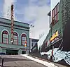 Dunsmuir Historic Commercial District |
November 10, 1982 (#82000993) |
Roughly bounded by Sacramento and Shasta Aves., Spruce and Cedar Sts. (both sides) 41°12′37″N 122°16′16″W / 41.210278°N 122.271111°W |
Dunsmuir | |
| 4 | Edgewood Store | 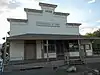 Edgewood Store |
March 10, 2004 (#04000140) |
24505 Edgewood Rd. 41°27′28″N 122°25′52″W / 41.457778°N 122.431111°W |
Edgewood | |
| 5 | Lewis Falkenstein House | 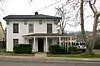 Lewis Falkenstein House |
December 31, 1979 (#79000554) |
401 S. Gold Street 41°43′48″N 122°38′30″W / 41.73°N 122.641667°W |
Yreka | |
| 6 | Forest House | 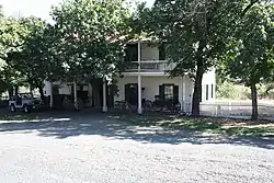 Forest House |
July 14, 2011 (#11000433) |
4204 California State Route 3 41°40′24″N 122°41′09″W / 41.673457°N 122.685696°W |
Yreka | Center of Forest House Ranch, and a stagecoach stop and travelers' rest on old private toll road. |
| 7 | Fort Jones House | 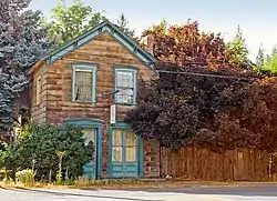 Fort Jones House |
April 22, 1976 (#76000533) |
Main St. 41°36′19″N 122°50′28″W / 41.605278°N 122.841111°W |
Fort Jones | |
| 8 | William Harlow Cabin | June 3, 1991 (#91000699) |
Elliot Cr. Rd. No. 1050, 1 mi. from Joe Bar Subdivision 41°59′59″N 123°06′04″W / 41.999722°N 123.101111°W |
Seiad Valley | ||
| 9 | Hospital Rock Army Camp Site | 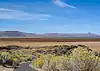 Hospital Rock Army Camp Site |
October 2, 1973 (#73000227) |
S of Tulelake, Lava Beds National Monument 41°49′45″N 121°28′31″W / 41.829167°N 121.475278°W |
Tulelake | |
| 10 | Hotel Macdoel | February 11, 1982 (#82002275) |
Montezuma Ave. and Mt. Shasta St. 41°49′43″N 122°00′10″W / 41.828611°N 122.002778°W |
Macdoel | ||
| 11 | Lava Beds National Monument Archeological District | 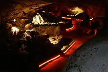 Lava Beds National Monument Archeological District |
March 21, 1991 (#75002182) |
Address Restricted |
Tulelake | |
| 12 | Lower Klamath National Wildlife Refuge | 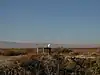 Lower Klamath National Wildlife Refuge |
October 15, 1966 (#66000238) |
Lower Klamath Lake, east of Dorris 41°56′48″N 121°39′53″W / 41.946667°N 121.664722°W |
Dorris | Extends into Klamath County, Oregon. This national wildlife refuge, established in 1908, was the first large block of public land set aside for wildlife management purposes. Because of its origins in the Klamath Basin reclamation project, it became an ongoing example of the tensions between conservation and commercial demands in public land management.[6] |
| 13 | McCloud | 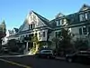 McCloud |
March 16, 1990 (#90000444) |
Roughly bounded by Columbero Dr., Main St., W. Minnesota Ave., and Lawndale Ct. 41°15′16″N 122°08′18″W / 41.254444°N 122.138333°W |
McCloud | |
| 14 | Sawyers Bar Catholic Church | 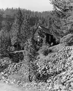 Sawyers Bar Catholic Church |
July 7, 1978 (#78000792) |
Klamath National Forest 41°18′03″N 123°08′10″W / 41.300833°N 123.136111°W |
Sawyers Bar | |
| 15 | Schonchin Butte Fire Lookout | 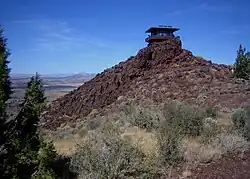 Schonchin Butte Fire Lookout |
September 5, 2017 (#100001559) |
Lava Beds National Monument 41°44′17″N 121°31′45″W / 41.738107°N 121.529096°W |
Tulelake | |
| 16 | Shasta Inn and Weed Lumber Company Boarding House |  Shasta Inn and Weed Lumber Company Boarding House |
November 10, 1980 (#80000869) |
829 and 877 N. Davis St. 41°25′53″N 122°22′48″W / 41.431389°N 122.38°W |
Weed | |
| 17 | Thomas-Wright Battle Site | November 15, 1978 (#78000366) |
S of Tulelake in Lava Beds National Monument 41°46′13″N 121°31′25″W / 41.770278°N 121.523611°W |
Tulelake | ||
| 18 | Upper Klamath River Stateline Archaeological District | July 10, 2017 (#100001283) |
Address restricted |
Beswick | ||
| 19 | West Miner Street-Third Street Historic District | 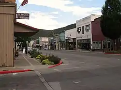 West Miner Street-Third Street Historic District |
December 11, 1972 (#72000258) |
102-402 W. Miner St. and 122-419 3rd St. 41°44′01″N 122°38′07″W / 41.733611°N 122.635278°W |
Yreka | |
| 20 | White's Gulch Arrastra | December 22, 1978 (#78000793) |
E of Swayers Bar 41°16′53″N 123°04′31″W / 41.281389°N 123.075278°W |
Sawyers Bar | ||
| 21 | Yreka Carnegie Library |  Yreka Carnegie Library |
March 26, 1992 (#92000270) |
412 W. Miner St. 41°43′57″N 122°38′17″W / 41.7325°N 122.638056°W |
Yreka |
See also
Wikimedia Commons has media related to National Register of Historic Places in Siskiyou County, California.
References
- ↑ The latitude and longitude information provided in this table was derived originally from the National Register Information System, which has been found to be fairly accurate for about 99% of listings. Some locations in this table may have been corrected to current GPS standards.
- ↑ National Park Service, United States Department of the Interior, "National Register of Historic Places: Weekly List Actions", retrieved January 12, 2024.
- ↑ Numbers represent an alphabetical ordering by significant words. Various colorings, defined here, differentiate National Historic Landmarks and historic districts from other NRHP buildings, structures, sites or objects.
- ↑ "National Register Information System". National Register of Historic Places. National Park Service. July 9, 2010.
- ↑ The eight-digit number below each date is the number assigned to each location in the National Register Information System database, which can be viewed by clicking the number.
- ↑ Huston, Ann E. (May 1990), National Register of Historic Places Registration Form: Klamath Lake Reservation (PDF), retrieved March 3, 2016.
| Topics | |
|---|---|
| Lists by state |
|
| Lists by insular areas | |
| Lists by associated state | |
| Other areas | |
| Related | |
Municipalities and communities of Siskiyou County, California, United States | ||
|---|---|---|
| Cities | Siskiyou County map | |
| CDPs | ||
| Unincorporated communities | ||
| Indian reservation | ||
| Ghost towns | ||
| Footnotes | ‡This populated place also has portions in an adjacent county or counties | |
This article is issued from Wikipedia. The text is licensed under Creative Commons - Attribution - Sharealike. Additional terms may apply for the media files.