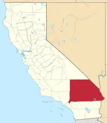
Location of San Bernardino County in California
This is a list of the National Register of Historic Places listings in San Bernardino County, California.
This is intended to be a complete list of the properties and districts on the National Register of Historic Places in San Bernardino County, California, United States. Latitude and longitude coordinates are provided for many National Register properties and districts; these locations may be seen together in an online map.[1]
There are 103 properties and districts listed on the National Register in the county, including 1 National Historic Landmark.
This National Park Service list is complete through NPS recent listings posted January 12, 2024.[2]
Current listings
| [3] | Name on the Register[4] | Image | Date listed[5] | Location | City or town | Description |
|---|---|---|---|---|---|---|
| 1 | 6 Mile Corral | April 26, 2021 (#100004572) |
Morningstar Mine Rd. in Mojave National Preserve Coordinates missing |
Cima vicinity | ||
| 2 | 8 Mile Corral | April 26, 2021 (#100004575) |
Near Kelso-Cima Rd. in Mojave National Preserve Coordinates missing |
Cima vicinity | ||
| 3 | 10 Mile Corral | April 26, 2021 (#100004573) |
Morningstar Mine Rd. in Mojave National Preserve Coordinates missing |
Cima vicinity | ||
| 4 | A. K. Smiley Public Library |  A. K. Smiley Public Library |
December 12, 1976 (#76000513) |
125 W. Vine St. 34°03′15″N 117°11′02″W / 34.054283°N 117.183892°W |
Redlands | |
| 5 | Aiken's Wash National Register District | May 24, 1982 (#82002239) |
Mojave National Preserve[6] 35°14′22″N 115°44′55″W / 35.239429°N 115.748613°W |
Baker | ||
| 6 | Archeological Site CA SBR 3186 | February 10, 1981 (#81000170) |
Address Restricted |
Silver Lakes | ||
| 7 | Archeological Site CA-SBR-140 | June 10, 2003 (#03000119) |
Address Restricted |
Baker | ||
| 8 | Archeological Site No. D-4 | October 25, 1985 (#85003435) |
Address Restricted |
Needles | ||
| 9 | Archeological Site No. E-21 | October 25, 1985 (#85003430) |
Address Restricted |
Parker | ||
| 10 | Atchison, Topeka and Santa Fe Railway Passenger and Freight Depot | 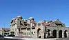 Atchison, Topeka and Santa Fe Railway Passenger and Freight Depot |
February 2, 2001 (#01000025) |
1170 W. 3rd St. 34°06′17″N 117°18′31″W / 34.104722°N 117.308611°W |
San Bernardino | |
| 11 | Auerbacher Home | 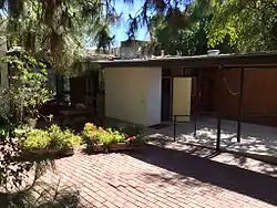 Auerbacher Home |
August 1, 2012 (#12000442) |
121 Sierra Vista Dr. 34°01′18″N 117°09′02″W / 34.021595°N 117.15063°W |
Redlands | |
| 12 | Barnwell RSLCC Headquarters | April 26, 2021 (#100004577) |
Hart Mine Rd. near Ivanpah Rd. in Mojave National Preserve 35°17′31″N 115°14′10″W / 35.2919°N 115.2361°W |
Nipton vicinity | ||
| 13 | Barnwell Corral and Wells | April 26, 2021 (#100004578) |
Near Barnwell on Hart Mine Rd. in Mojave National Preserve Coordinates missing |
Nipton vicinity | ||
| 14 | Barton Villa | 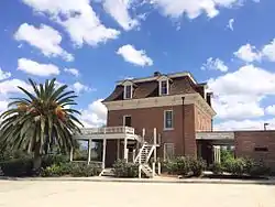 Barton Villa |
October 24, 1996 (#96001176) |
11245 Nevada St. 34°02′58″N 117°12′58″W / 34.049444°N 117.216111°W |
Redlands | |
| 15 | Beverly Ranch | 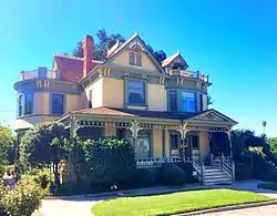 Beverly Ranch |
February 11, 2004 (#04000018) |
923 W. Fern Ave. 34°02′39″N 117°11′16″W / 34.044167°N 117.187778°W |
Redlands | |
| 16 | Bitter Spring Archaeological Site (4-SBr-2659) | December 20, 1982 (#82000981) |
Address Restricted |
Barstow | ||
| 17 | Black Canyon-Inscription Canyon-Black Mountain Rock Art District | 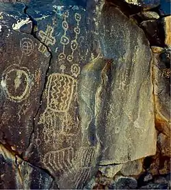 Black Canyon-Inscription Canyon-Black Mountain Rock Art District |
September 12, 2000 (#00001046) |
Address Restricted |
Hinkley | |
| 18 | Black Tank Corral | June 2, 2021 (#100004592) |
Near I-15 Coordinates missing |
Baker vicinity | ||
| 19 | Blackwater Well | November 21, 2000 (#00001326) |
Granite Wells Road[7] 35°21′29″N 117°20′54″W / 35.358021°N 117.348385°W |
Red Mountain | ||
| 20 | Bono's Restaurant and Deli | 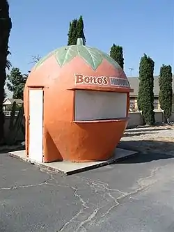 Bono's Restaurant and Deli |
January 10, 2008 (#07001353) |
15395 Foothill Blvd. 34°06′23″N 117°28′09″W / 34.1063°N 117.46917°W |
Fontana | |
| 21 | CA SBr 1008A, CA SBr 1008B, CA SBr 1008C | May 24, 1982 (#82002241) |
Address Restricted |
Johannesburg | ||
| 22 | Calico Mountains Archeological District | March 30, 1973 (#73000430) |
Address Restricted |
Yermo | ||
| 23 | The California Theatre | 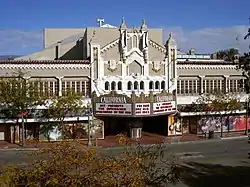 The California Theatre |
December 22, 2009 (#09001116) |
562 W. 4th St. 34°06′25″N 117°17′44″W / 34.106814°N 117.29545°W |
San Bernardino | |
| 24 | Carnegie Public Library Building | 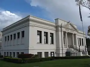 Carnegie Public Library Building |
June 23, 1988 (#88000894) |
380 N. La Cadena Dr. 34°04′08″N 117°19′22″W / 34.068889°N 117.322778°W |
Colton | Now houses Colton Area Museum |
| 25 | City Transfer and Storage Company Warehouse | October 23, 2023 (#100009474) |
440 Oriental Ave. 34°03′31″N 117°11′17″W / 34.0585°N 117.1880°W |
Redlands | ||
| 26 | Cottonwood Corral | April 26, 2021 (#100004571) |
Near Morningstar Mine Rd. in Mojave National Preserve Coordinates missing |
Cima vicinity | ||
| 27 | Counsel Rocks | August 23, 2021 (#100006816) |
Address Restricted |
Essex vicinity (Mojave National Preserve) | ||
| 28 | Cow Camp | 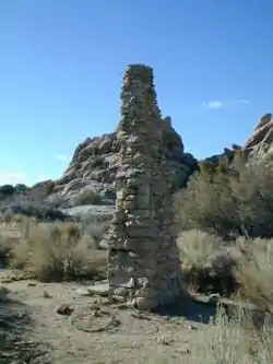 Cow Camp |
October 29, 1975 (#75000228) |
Southwest of Twentynine Palms in Joshua Tree National Park 34°02′15″N 116°10′02″W / 34.0375°N 116.167222°W |
Twentynine Palms | |
| 29 | Crowder Canyon Archeological District | June 16, 1976 (#76000514) |
Address Restricted |
San Bernardino | ||
| 30 | Cucamonga Service Station | 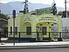 Cucamonga Service Station |
July 23, 2018 (#100002675) |
9670 Foothill Blvd. 34°06′24″N 117°35′39″W / 34.1067°N 117.5941°W |
Rancho Cucamonga | |
| 31 | Cut Tank Corral | April 26, 2021 (#100004570) |
Near Morningstar Mine Rd. in Mojave National Preserve Coordinates missing |
Cima vicinity | ||
| 32 | Deer Spring Corral | April 29, 2021 (#100004590) |
Near Cima Rd. in Mojave National Preserve Coordinates missing |
Cima vicinity | ||
| 33 | Dove Corral | April 26, 2021 (#100004579) |
Remote location in New York Mountains in Mojave National Preserve Coordinates missing |
Nipton vicinity | ||
| 34 | Robert J. Dunn House | 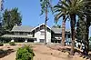 Robert J. Dunn House |
July 24, 2017 (#100001336) |
1621 Garden St. 34°01′48″N 117°09′32″W / 34.030027°N 117.158953°W |
Redlands | |
| 35 | Eagle Well Petroglyph Site | July 27, 2015 (#15000470) |
Address Restricted |
Barstow | ||
| 36 | El Garces | .tiff.jpg.webp) El Garces |
May 17, 2002 (#02000537) |
950 Front St. 34°50′27″N 114°36′20″W / 34.840833°N 114.605556°W |
Needles | |
| 37 | Dr. Orville S. Ensign House | 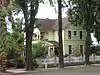 Dr. Orville S. Ensign House |
March 20, 2012 (#12000126) |
304 S. Laurel Ave. 34°03′39″N 117°39′09″W / 34.060908°N 117.652634°W |
Ontario | |
| 38 | Euclid Avenue |  Euclid Avenue |
August 10, 2005 (#05000843) |
From 24th St. in Upland to Philadelphia St. in Ontario 34°09′01″N 117°39′02″W / 34.150278°N 117.650556°W |
Upland and Ontario | |
| 39 | First Christian Church of Rialto | 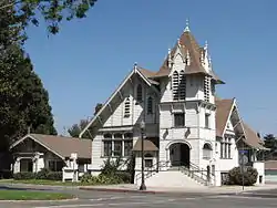 First Christian Church of Rialto |
February 20, 2003 (#03000037) |
201 N. Riverside Ave. 34°06′10″N 117°22′09″W / 34.102778°N 117.369167°W |
Rialto | |
| 40 | Fontana Farms Company Ranch House, Camp No. 1 | 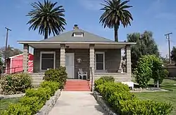 Fontana Farms Company Ranch House, Camp No. 1 |
November 1, 1982 (#82000982) |
8863 Pepper St. 34°05′34″N 117°26′28″W / 34.092778°N 117.441111°W |
Fontana | |
| 41 | Fontana Pit and Groove Petroglyph Site | April 17, 1980 (#80000838) |
Address Restricted |
Fontana | ||
| 42 | Fossil Canyon Petroglyph Site |  Fossil Canyon Petroglyph Site |
March 3, 2003 (#02000980) |
Rainbow Basin 35°01′46″N 117°02′12″W / 35.0294°N 117.0367°W |
Barstow | |
| 43 | Foxtrot Petroglyph Site | 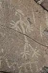 Foxtrot Petroglyph Site |
February 23, 1995 (#95000044) |
Address Restricted, Marine Corps Air Ground Combat Center Twentynine Palms |
Twentynine Palms | Area of rock art panels more than 2 kilometres (1.2 mi) long. |
| 44 | Frankish Building | 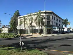 Frankish Building |
August 11, 1980 (#80000839) |
200 S. Euclid Ave. 34°03′45″N 117°39′01″W / 34.0625°N 117.650278°W |
Ontario | |
| 45 | Goffs Schoolhouse | 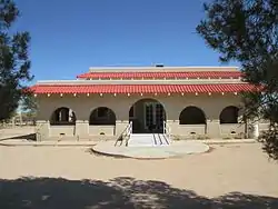 Goffs Schoolhouse |
October 11, 2001 (#01001102) |
37198 Lanfair Rd. 34°55′12″N 115°03′18″W / 34.92°N 115.055°W |
Goffs | |
| 46 | Government Holes | April 26, 2021 (#100004586) |
Cedar Canyon Rd. near Rock Spring in Mojave National Preserve Coordinates missing |
Cima vicinity | ||
| 47 | Guapiabit–Serrano Homeland Archaeological District | October 26, 2020 (#100001258) |
Address Restricted |
Hesperia vicinity | ||
| 48 | Hackberry Corral | April 26, 2021 (#100004583) |
Near Lanfair Rd. in Mojave National Preserve Coordinates missing |
Goffs vicinity | ||
| 49 | Harvey House Railroad Depot | 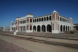 Harvey House Railroad Depot |
April 3, 1975 (#75000458) |
Santa Fe Depot 34°54′17″N 117°01′26″W / 34.904722°N 117.023889°W |
Barstow | |
| 50 | Highland Historic District | 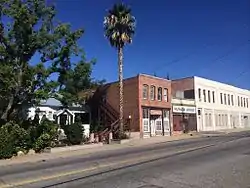 Highland Historic District |
April 5, 2001 (#01000333) |
Roughly bounded by Cole and Nona Ave., Pacific and Church Sts. 34°07′40″N 117°12′29″W / 34.127778°N 117.208056°W |
Highland | |
| 51 | Hofer Ranch | 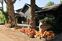 Hofer Ranch |
July 8, 1993 (#93000596) |
11248 S. Turner Ave. 34°02′56″N 117°35′05″W / 34.048889°N 117.584722°W |
Ontario | |
| 52 | Integratron | 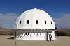 Integratron |
April 23, 2018 (#100002317) |
2477 Belfield Blvd. 34°17′40″N 116°24′13″W / 34.294330°N 116.403749°W |
Landers | |
| 53 | Judson and Brown Ditch | 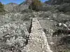 Judson and Brown Ditch |
September 29, 2015 (#15000646) |
Crosses San Bernardino FCD Rd. 34°06′14″N 117°06′14″W / 34.103915°N 117.103805°W |
Redlands | Linear noncontiguous feature that extends from Highland to Redlands |
| 54 | Kelso Depot, Restaurant and Employees Hotel | 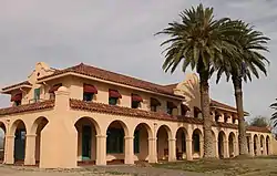 Kelso Depot, Restaurant and Employees Hotel |
August 2, 2001 (#01000760) |
Kelbaker Rd., junction of Kelbaker and Cima Rds. at Union Pacific Railroad crossing 35°00′44″N 115°39′09″W / 35.012222°N 115.6525°W |
Kelso | Boundary increase approved January 31, 2019 |
| 55 | Keys Desert Queen Ranch | 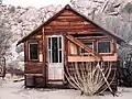 Keys Desert Queen Ranch |
October 30, 1975 (#75000174) |
Southwest of Twentynine Palms in Joshua Tree National Park 34°02′36″N 116°09′59″W / 34.043333°N 116.166389°W |
Twentynine Palms | |
| 56 | Kimberly Crest | 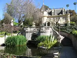 Kimberly Crest |
March 28, 1996 (#96000328) |
1325 Prospect Dr. 34°02′16″N 117°10′21″W / 34.037778°N 117.1725°W |
Redlands | |
| 57 | Lanfair Corral | April 26, 2021 (#100004584) |
Near Lanfair Rd. in Mojave National Preserve Coordinates missing |
Goffs vicinity | ||
| 58 | Sam and Alfreda Maloof Compound | 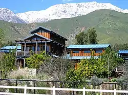 Sam and Alfreda Maloof Compound |
November 9, 2010 (#03000471) |
5131 Carnelian St. 34°09′40″N 117°36′56″W / 34.161111°N 117.615556°W |
Alta Loma | |
| 59 | Mary's Cave | August 23, 2021 (#100006817) |
Address Restricted |
Essex vicinity (Mojave National Preserve) | ||
| 60 | Marl Springs Corral | April 26, 2021 (#100004576) |
Near Old Government Rd. in Mojave National Preserve Coordinates missing |
Kelso vicinity | ||
| 61 | Mescal Mining District | June 5, 2023 (#100004815) |
9.1 miles (14.6 km) southeast of the intersection of Cima Rd. and I 15 35°25′45″N 115°33′05″W / 35.4292°N 115.5513°W |
Cima vicinity | ||
| 62 | Mill Creek Zanja | 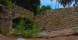 Mill Creek Zanja |
May 12, 1977 (#77000329) |
Sylvan Blvd. E to Mill Creek Rd. 34°03′44″N 117°07′23″W / 34.062222°N 117.123056°W |
Redlands | |
| 63 | Mojave Road | 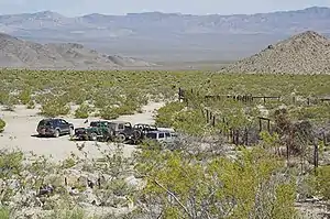 Mojave Road |
September 27, 2021 (#100007003) |
Mojave Rd., Mojave National Preserve 34°00′53″N 117°41′23″W / 34.014722°N 117.689722°W |
Baker vicinity | |
| 64 | Moyse Building | 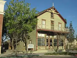 Moyse Building |
February 28, 1979 (#79000522) |
13150 7th St. 34°00′53″N 117°41′23″W / 34.014722°N 117.689722°W |
Chino | |
| 65 | Murphy Well Corral | April 26, 2021 (#100004594) |
Nipton Rd. in Mojave National Preserve Coordinates missing |
Nipton vicinity | ||
| 66 | Natural Corral | April 29, 2021 (#100004591) |
Near I-15 in Mojave National Preserve Coordinates missing |
Baker vicinity | ||
| 67 | New City of Mentalphysics Historic District | January 17, 2023 (#100008539) |
59700 Twentyninepalms Hwy. 34°08′07″N 116°21′35″W / 34.1353°N 116.3596°W |
Joshua Tree | ||
| 68 | Newberry Cave Site | November 21, 2000 (#00001325) |
Address Restricted |
Newberry Springs | ||
| 69 | OX Ranch Headquarters | April 26, 2021 (#100004580) |
Lanfair Rd. in Mojave National Preserve Coordinates missing |
Goffs vicinity | ||
| 70 | Old San Antonio Hospital |  Old San Antonio Hospital |
January 2, 1980 (#80000840) |
792 W. Arrow Hwy. 34°05′58″N 117°39′34″W / 34.099444°N 117.659444°W |
Upland | |
| 71 | Ontario and San Antonio Heights Waiting Station |  Ontario and San Antonio Heights Waiting Station |
September 25, 2012 (#12000813) |
1251 W. 24th St. 34°09′05″N 117°40′20″W / 34.151511°N 117.672223°W |
Upland | A passenger station for the Ontario and San Antonio Heights Railroad streetcar line |
| 72 | Ontario Baseball Park | September 20, 2021 (#100006913) |
SE of North Grove Ave. and East 4th St. intersection (NE corner John Galvin Park) 34°04′36″N 117°37′41″W / 34.0768°N 117.62805°W |
Ontario | ||
| 73 | Ontario State Bank Block | 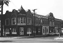 Ontario State Bank Block |
January 8, 1982 (#82002242) |
300 S. Euclid Ave. 34°03′42″N 117°39′02″W / 34.061667°N 117.650556°W |
Ontario | Demolished to make way for lowering Euclid Avenue below the railroad tracks. |
| 74 | Pacific Electric Etiwanda Depot | 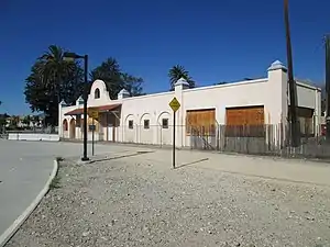 Pacific Electric Etiwanda Depot |
March 21, 2011 (#11000119) |
7092 Etiwanda Ave. 34°07′30″N 117°31′23″W / 34.125°N 117.523056°W |
Rancho Cucamonga | |
| 75 | Payne Corral | April 26, 2021 (#100004585) |
Off Cedar Canyon Rd. near Rock Spring in Mojave National Preserve Coordinates missing |
Cima vicinity | ||
| 76 | Pioneer Deep Space Station | 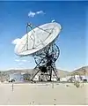 Pioneer Deep Space Station |
October 3, 1985 (#85002813) |
Goldstone Deep Space Communications Complex 35°23′21″N 116°51′22″W / 35.389167°N 116.856111°W |
Fort Irwin | Also known as DSS 11, the first radio telescope at the Goldstone Deep Space Communications Complex. |
| 77 | Pioneertown Mane Street Historic District | 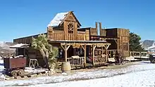 Pioneertown Mane Street Historic District |
May 26, 2020 (#100005220) |
Mane St. 34°09′25″N 116°29′49″W / 34.1570°N 116.4969°W |
Pioneertown | |
| 78 | Pipeline Corral | April 26, 2021 (#100004581) |
Near Lanfair Rd. in Mojave National Preserve Coordinates missing |
Goffs vicinity | ||
| 79 | Piute Dry Corral | April 26, 2021 (#100004582) |
10 miles (16 km) E. of Lanfair Rd. in Mojave National Preserve Coordinates missing |
Goffs vicinity | ||
| 80 | Piute Pass Archeological District | August 14, 1973 (#73000429) |
Address Restricted |
Needles | ||
| 81 | Thomas Place Corral | April 26, 2021 (#100004574) |
Near Cedar Canyon Rd. in Mojave National Preserve Coordinates missing |
Cima vicinity | ||
| 82 | Providence Townsite | August 16, 2016 (#16000522) |
10 miles (16 km) off Essex Rd. 34°58′54″N 115°30′26″W / 34.981766°N 115.507272°W |
Essex | ||
| 83 | John Rains House | 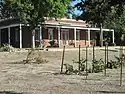 John Rains House |
April 24, 1973 (#73000428) |
7869 Vineyard Ave. 34°06′40″N 117°36′36″W / 34.111111°N 117.61°W |
Rancho Cucamonga | Entrance to the museum is now off Hemlock Street the address is 8810 Hemlock St. |
| 84 | Redlands Central Railway Company Car Barn | 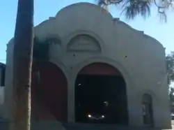 Redlands Central Railway Company Car Barn |
January 3, 1991 (#90002119) |
746 E. Citrus Ave. 34°03′24″N 117°10′29″W / 34.056667°N 117.174722°W |
Redlands | |
| 85 | Redlands Santa Fe Depot District | 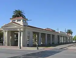 Redlands Santa Fe Depot District |
October 29, 1991 (#91001535) |
Roughly bounded by Stuart Ave., N. 5th St., Redlands Blvd., Eureka St. and the SFRR tracks 34°03′31″N 117°10′57″W / 34.058611°N 117.1825°W |
Redlands | |
| 86 | Rock Tank Corral | April 29, 2021 (#100004593) |
Near I-15 in Mojave National Preserve Coordinates missing |
Baker vicinity | ||
| 87 | Rodman Mountains Petroglyphs Archeological District | May 10, 1982 (#82002240) |
Address Restricted |
Barstow | ||
| 88 | Russian Village District | 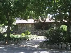 Russian Village District |
December 28, 1978 (#78000680) |
290-370 S. Mills Ave. and 480 Cucamonga Ave. 34°05′29″N 117°42′24″W / 34.091389°N 117.706667°W |
Montclair | |
| 89 | San Bernardino County Court House |  San Bernardino County Court House |
January 12, 1998 (#97001632) |
351 N. Arrowhead Ave. 34°06′20″N 117°17′26″W / 34.105556°N 117.290556°W |
San Bernardino | |
| 90 | Shady Point | 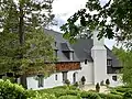 Shady Point |
October 5, 2009 (#09000804) |
778 Shelter Cove Dr. 34°15′46″N 117°11′00″W / 34.262647°N 117.183225°W |
Lake Arrowhead | |
| 91 | Smiley Park Historic District | Smiley Park Historic District |
December 29, 1994 (#94001487) |
Roughly bounded by Brookside Ave., Cajon St., Cypress Ave. and Buena Vista St. 34°03′03″N 117°10′56″W / 34.050833°N 117.182222°W |
Redlands | |
| 92 | Soda Springs Historic District |  Soda Springs Historic District |
November 8, 2022 (#100004814) |
4.8 miles (7.7 km) south of I 15, on Zzyzx Rd. 35°08′36″N 116°06′22″W / 35.1434°N 116.1061°W |
Baker vicinity | |
| 93 | Squaw Spring Archeological District | July 28, 1981 (#81000169) |
Address Restricted |
Red Mountain | ||
| 94 | Topock Maze Archeological Site | October 5, 1978 (#78000745) |
Address Restricted |
Needles | ||
| 95 | Upland Public Library | _courtesy_of_Upland_Public_Library.jpg.webp) Upland Public Library |
December 10, 1990 (#90001817) |
123 E. D St. 34°05′55″N 117°38′55″W / 34.098611°N 117.648611°W |
Upland | |
| 96 | US Post Office-Downtown Station | 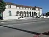 US Post Office-Downtown Station |
January 11, 1985 (#85000136) |
390 W. 5th St. 34°06′31″N 117°17′26″W / 34.108611°N 117.290556°W |
San Bernardino | |
| 97 | US Post Office-Redlands Main | 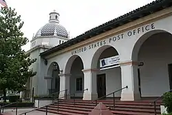 US Post Office-Redlands Main |
January 11, 1985 (#85000135) |
201 Brookside Ave. 34°03′18″N 117°11′05″W / 34.055°N 117.184722°W |
Redlands | |
| 98 | Vulcan Mine Historic District | July 15, 2019 (#100004180) |
5.28 miles (8.50 km) E. of Kelbaker Rd., on Vulcan Mine Rd. 34°55′18″N 115°34′15″W / 34.9216°N 115.5708°W |
Kelso vicinity | ||
| 99 | Wall Street Mill | 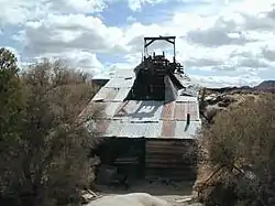 Wall Street Mill |
November 12, 1975 (#75000176) |
South of Twentynine Palms in Joshua Tree National Park 34°02′10″N 116°07′59″W / 34.036111°N 116.133056°W |
Twentynine Palms | |
| 100 | Henry Washington Survey Marker | .jpg.webp) Henry Washington Survey Marker |
May 12, 1975 (#75000459) |
South of Big Bear City in San Bernardino National Forest 34°07′13″N 116°55′46″W / 34.120278°N 116.929444°W |
Big Bear City | |
| 101 | Watson Well Corral | April 26, 2021 (#100004587) |
South of Cedar Canyon Rd. in Mojave National Preserve Coordinates missing |
Cima vicinity | ||
| 102 | Wigwam Village No. 7 | 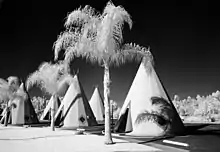 Wigwam Village No. 7 |
January 3, 2012 (#11000957) |
2728 Foothill Rd. 34°06′26″N 117°21′00″W / 34.107258°N 117.35°W |
San Bernardino | |
| 103 | Yorba-Slaughter Adobe | 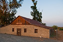 Yorba-Slaughter Adobe |
July 7, 1975 (#75000460) |
5.5 miles (8.9 km) south of Chino at 17127 Pomona Rincon Rd. 33°56′26″N 117°39′52″W / 33.940556°N 117.664444°W |
Chino |
See also
Wikimedia Commons has media related to National Register of Historic Places in San Bernardino County, California.
References
- ↑ The latitude and longitude information provided in this table was derived originally from the National Register Information System, which has been found to be fairly accurate for about 99% of listings. Some locations in this table may have been corrected to current GPS standards.
- ↑ National Park Service, United States Department of the Interior, "National Register of Historic Places: Weekly List Actions", retrieved January 12, 2024.
- ↑ Numbers represent an alphabetical ordering by significant words. Various colorings, defined here, differentiate National Historic Landmarks and historic districts from other NRHP buildings, structures, sites or objects.
- ↑ "National Register Information System". National Register of Historic Places. National Park Service. July 9, 2010.
- ↑ The eight-digit number below each date is the number assigned to each location in the National Register Information System database, which can be viewed by clicking the number.
- ↑ The coordinates for this site come from the Geographic Names Information System listing for Aikens Arch, one of the constituent sites in the district. The NRIS lists the site as "Address Restricted".
- ↑ Location derived from the Geographic Names Information System listing for Blackwater Well. The NRIS lists the address as "Address Restricted".
| Topics | |
|---|---|
| Lists by state |
|
| Lists by insular areas | |
| Lists by associated state | |
| Other areas | |
| Related | |
This article is issued from Wikipedia. The text is licensed under Creative Commons - Attribution - Sharealike. Additional terms may apply for the media files.