
This is a list of the National Register of Historic Places listings in Adams County, Pennsylvania.
This is intended to be a complete list of the properties and districts on the National Register of Historic Places in Adams County, Pennsylvania, United States. The locations of National Register properties and districts for which the latitude and longitude coordinates are included below, may be seen in a map.[1]
There are 35 properties and districts listed on the National Register in the county. One site is further designated as a National Historic Site and another is designated as a National Military Park. Another property was once listed but has been removed.
This National Park Service list is complete through NPS recent listings posted January 5, 2024.[2]
Current listings


Former listings
| [3] | Name on the Register | Image | Date listed | Date removed | Location | Municipality | Description |
|---|---|---|---|---|---|---|---|
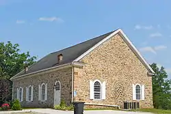
| 1 | Conewago Mass House | October 19, 1978 (#78002332) | January 11, 1996 | North of McSherrystown on Pennsylvania Route 476, Conewago Township |
McSherrystown | Destroyed by fire in August 1995. | |
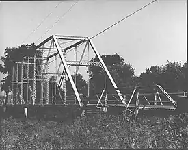
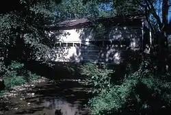
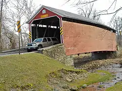
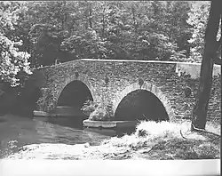
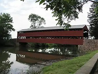
| 2 | Conewago Chapel Covered Bridge | August 26, 1980 (#80003398) | June 27, 1986 | Legislative Route 01060 |
McSherrystown | Destroyed by arsonist on June 14, 1985.[6] |
See also
References
- ↑ The latitude and longitude information provided in this table was derived originally from the National Register Information System, which has been found to be fairly accurate for about 99% of listings. Some locations in this table may have been corrected to current GPS standards.
- ↑ National Park Service, United States Department of the Interior, "National Register of Historic Places: Weekly List Actions", retrieved January 5, 2024.
- 1 2 Numbers represent an alphabetical ordering by significant words. Various colorings, defined here, differentiate National Historic Landmarks and historic districts from other NRHP buildings, structures, sites or objects.
- ↑ The eight-digit number below each date is the number assigned to each location in the National Register Information System database, which can be viewed by clicking the number.
- ↑ Location derived from its NRHP nomination form; the NRIS lists the site as "Address Restricted"
- ↑ "Arson fire destroys Blue Springs covered bridge". The Gettysburg Times. June 15, 1985. p. 1. Retrieved August 20, 2022 – via Newspapers.com.

Municipalities and communities of Adams County, Pennsylvania, United States | ||
|---|---|---|
| Boroughs | | |
| Townships | ||
| CDPs | ||
| Unincorporated communities | ||
| Ghost town | ||