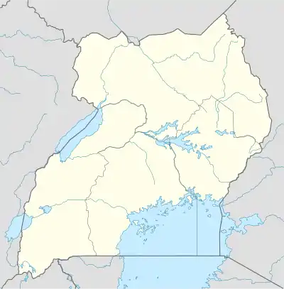
Nagojje | |
|---|---|
 Nagojje Location in Uganda | |
| Coordinates: 00°26′29″N 32°53′00″E / 0.44139°N 32.88333°E | |
| Country | |
| Region | Central Uganda |
| District | Mukono District |
| Elevation | 3,710 ft (1,130 m) |
Nagojje is a town in the Buganda Region of Uganda.[1] It is a municipality in Mukono District.[2]
Location
Nagojje is located in a rural area, approximately 13 kilometres (8 mi), by road, north-east of Namataba (which lies along the Kampala-Jinja Highway).[3] This is about 17 kilometres (11 mi), by road south-east of Nakifuma, where the sub-county headquarters are located.[4]
The town of Mukono, the location of the district headquarters, is located approximately 25 kilometres (16 mi), by road, southwest of Nagojje.[5] The coordinates of Nagojje are 0°26'29.0"N, 32°53'00.0"E (Latitude:0.441389; Longitude:32.883333).[6] Nagojje's average elevation is 1,130 metres (3,707 ft), above sea level.[7]
Points of interest
Nagojje is surrounded by a rural area where the main economic activity is agriculture. The main crop that is grown in the area is the cultivation of coffee. Both the Robusta and the more disease-resistant clonal variety are grown in the Nagojje neighborhood.[8]
See also
References
- ↑ Places in the World (6 December 2018). "Nagojje is a place in the region of Central Region in Uganda". Places in the World. Retrieved 6 December 2018.
- ↑ Geoview.info (6 December 2018). "Nagojje is a populated place and is located in Mukono District, Central Region, Uganda". Geoview.info. Retrieved 6 December 2018.
- ↑ Globefeed.com (6 December 2018). "Distance between Namataba, Mukono District, Central Region, UGA and Nagojje, Nakifuma, Mukono, UGA". Globefeed.com. Retrieved 6 December 2018.
- ↑ Globefeed.com (6 December 2018). "Distance between Nagojje, Nakifuma, Mukono, UGA and Nakifuma, Mukono, UGA". Globefeed.com. Retrieved 6 December 2018.
- ↑ Globefeed.com (6 December 2018). "Distance between Mukono, UGA and Nagojje, Nakifuma, Mukono, UGA". Globefeed.com. Retrieved 6 December 2018.
- ↑ Google (6 December 2018). "Location of Nagojje, Mukono District, Uganda" (Map). Google Maps. Google. Retrieved 6 December 2018.
- ↑ Elevationmap.net (6 December 2018). "Elevation of Nagojje, Mukono District, Uganda". Elevationmap.net. Retrieved 6 December 2018.
- ↑ Nuwagaba, Edwin (29 September 2010). "Farming: Nagojje abandons clonal for robusta coffee". Daily Monitor. Kampala. Retrieved 6 December 2018.
