Murliganj | |
|---|---|
Town | |
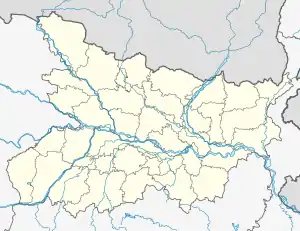 Murliganj Location in Bihar, India | |
| Coordinates: 25°54′N 86°59′E / 25.9°N 86.98°E | |
| Country | |
| State | Bihar |
| District | Madhepura |
| Elevation | 52 m (171 ft) |
| Population (2011)[1] | |
| • Total | 28,691 |
| Time zone | UTC+5:30 (IST) |
| PIN | 852122 |
| Lok Sabha constituency | Madhepura |
| Vidhan Sabha constituency | Bihariganj |
Murliganj is a town and a notified area in Madhepura district in the Indian state of Bihar. PIN code of Murliganj is 852122.[2]
Geography
Murliganj is located at 25°54′N 86°59′E / 25.9°N 86.98°E.[3] It has an average elevation of 52 m. It situated on the east boundary of Madhepura.
Demographics
As of 2001 India census,[4] Murliganj had a population of 22,921. Males constitute 53% of the population and females 47%. Murliganj has an average literacy rate of 45%, lower than the national average of 59.5%: male literacy is 53%, and female literacy is 37%. In Murliganj, 19% of the population is under 6 years of age.
References
- ↑ "Census of India Search details". censusindia.gov.in. Archived from the original on 18 May 2015. Retrieved 10 May 2015.
- ↑ "Murliganj Pin code". citypincode.in. Retrieved 11 March 2015.
- ↑ Falling Rain Genomics, Inc - Murliganj
- ↑ "Census of India 2001: Data from the 2001 Census, including cities, villages and towns (Provisional)". Census Commission of India. Archived from the original on 16 June 2004. Retrieved 1 November 2008.
This article is issued from Wikipedia. The text is licensed under Creative Commons - Attribution - Sharealike. Additional terms may apply for the media files.