Muraikh
مريخ | |
|---|---|
District | |
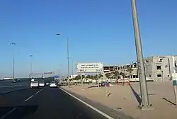
 Khalifa Bin Ahmed Street in Muraikh | |
 Muraikh | |
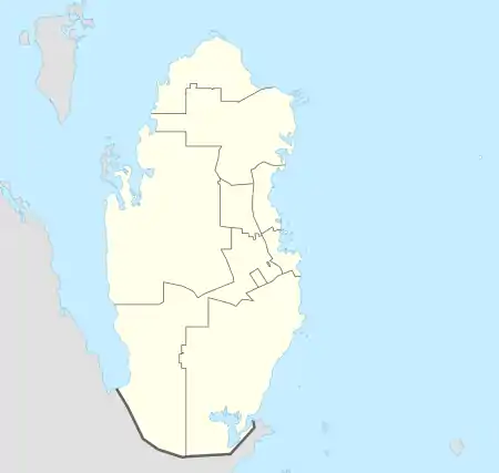
| Coordinates: 25°17′00″N 51°27′00″E / 25.28333°N 51.45000°E | |
| Country | |
| Municipality | Al Rayyan |
| Zone | Zone 54 |
| District no. | 78 |
| Area | |
| • Total | 3.4 km2 (1.3 sq mi) |
| Elevation | 23 m (75 ft) |
Muraikh (Arabic: مريخ) is a district of Al Rayyan City in the municipality of Al Rayyan in Qatar.[3]
Etymology
The district derives its name from "markh" (Leptadenia pyrotechnica), the local term used for a tree that grows abundantly in the area.[4]
History
In 1908, J.G. Lorimer documented Muraikh in the Gazetteer of the Persian Gulf, giving its location as "9 miles west by south of Dohah". He mentioned the presence of a masonry well, 2 fathoms deep, which yielded good water.[5]
Administration
When free elections of the Central Municipal Council first took place in Qatar during 1999,[6] Muraikh was designated the constituency seat of constituency no. 16.[7] It would remain constituency seat in the next three consecutive elections until the fifth municipal elections in 2015, when it was made part of constituency no. 5.[8] In the inaugural municipal elections in 1999, Nasser Fallah Al Dosari won the elections, receiving 40.4%, or 201 votes. Trailing behind Al Dosari was Ali Salem Al Suwaidi, who attained 34.5%, or 172 votes.[7] Salem Mohammed Al Nabat won the 2002 elections.[9] In the third municipal elections in 2007, Mohammed Salem Al Qamra was elected constituency representative.[10] Al Qamra successfully retained his seat in the 2011 elections.[11]
Landmarks
Education
The Dawhat Al Khair Centre for Quran Learning and Science is positioned inside the district.[12]
The following schools are located in Muraikh:
| Name of School | Curriculum | Grade | Genders | Ref |
|---|---|---|---|---|
| Al-Mujtama Girls School | Independent | Kindergarten – Secondary | Female-only | [14] |
| Apple Tree Nursery Aspire Branch | British | Kindergarten | Both | [15] |
| Omar Bin Al Khattab Primary First | Independent | Primary | Male-only | [16] |
| Palestinian School for Boys | Palestinian | Kindergarten – Secondary | Male-only | [17] |
References
- ↑ "District Area Map". Ministry of Development Planning and Statistics. Retrieved 12 February 2019.
- ↑ "Muraikh, Zone 54, Qatar on the Elevation Map". elevationmap.net. Retrieved 3 January 2019.
- ↑ "2015 Population census" (PDF). Ministry of Development Planning and Statistics. April 2015. Retrieved 1 July 2018.
- ↑ "Dalila Services". Ministry of Municipality and Environment. Retrieved 6 January 2019.
- ↑ "'Gazetteer of the Persian Gulf. Vol. II. Geographical and Statistical. J G Lorimer. 1908' [1523] (1638/2084)". Qatar Digital Library. Retrieved 6 July 2018. This article incorporates text from this source, which is in the public domain.
- ↑ "Central Municipal Council". Government Communications Office of Qatar. Retrieved 14 August 2018.
- 1 2 "إنتخابات الدورة الأولى" (in Arabic). Central Municipal Council. Retrieved 14 August 2018.
- ↑ "مقـار الدوائـر" (in Arabic). Ministry of Interior (Qatar). Archived from the original on 14 August 2018. Retrieved 14 August 2018.
- ↑ "الدورة الثانية" (in Arabic). Central Municipal Council. Retrieved 14 August 2018.
- ↑ "إنتخابات الدورة الثالثة" (in Arabic). Central Municipal Council. Retrieved 14 August 2018.
- ↑ "رابعاً: إنتخابات الدورة الرابعة كشف بأسماء السادة المرشحين الفائزين في عضوية انتخابات المجلس البلدي المركزي (الدورة الرابعة - 2011م)" (in Arabic). Central Municipal Council. Retrieved 14 August 2018.
- 1 2 3 4 "GIS Portal". Ministry of Municipality and Environment. Retrieved 1 July 2018.
- ↑ "Qatar Driving Learning Institute". dirqtr.net. Retrieved 1 July 2018.
- ↑ "Al Mujtama Girls School". Schools in Qatar. Retrieved 1 July 2018.
- ↑ "Apple Tree Nursery Aspire Branch – Doha". Schools in Qatar. Retrieved 1 July 2018.
- ↑ "Omar Bin Al Khattab Primary First". Schools in Qatar. Retrieved 1 July 2018.
- ↑ "Palestinian School – Boys". Schools in Qatar. Retrieved 1 July 2018.