Mount Pleasant Municipal Airport | |||||||||||||||
|---|---|---|---|---|---|---|---|---|---|---|---|---|---|---|---|
| Summary | |||||||||||||||
| Airport type | Public | ||||||||||||||
| Owner | City of Mt. Pleasant | ||||||||||||||
| Location | Mount Pleasant, Michigan | ||||||||||||||
| Elevation AMSL | 755 ft / 230 m | ||||||||||||||
| Coordinates | 43°37′18″N 084°44′15″W / 43.62167°N 84.73750°W | ||||||||||||||
| Map | |||||||||||||||
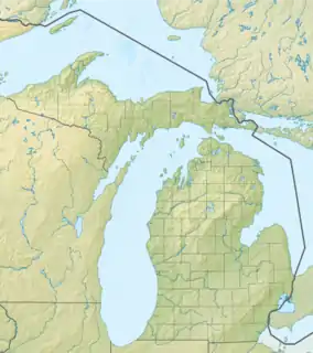
 MOP Location of airport in Michigan  MOP MOP (the United States) | |||||||||||||||
| Runways | |||||||||||||||
| |||||||||||||||
| Statistics (2020) | |||||||||||||||
| |||||||||||||||
Mount Pleasant Municipal Airport (IATA: MOP, ICAO: KMOP, FAA LID: MOP) is a city-owned public-use airport located two miles (3 km) northeast of the central business district of Mount Pleasant, a city in Isabella County, Michigan, United States.[1] The airport became active in 1940. It serves general aviation for Mount Pleasant and the surrounding area. It is included in the Federal Aviation Administration (FAA) National Plan of Integrated Airport Systems for 2017–2021, in which it is categorized as a local general aviation facility.[2]
The airport is home to a chapter of the experimental aircraft association. It holds regular airshows to showcase antique, homebuilt, and classic cars and aircraft.[3]
Facilities and aircraft
Mount Pleasant Municipal Airport covers an area of 344 acres (139 ha) which contains two runways:[1][4]
- Runway 09/27: 5,000 x 100 ft (1,524 x 30 m); surface: asphalt
- Runway 05/23: 2,500 x 160 ft (762 x 49 m); surface: turf
The airport has a fixed-base operator that sells fuel – both avgas and jet fuel – and offers amenities such as a conference room and crew lounge, snooze rooms, and more.[5]
For the 12-month period ending December 31, 2020, the airport had 10,220 aircraft operations, an average of 22 per day. This included 99% general aviation and 1% military. At the time, there are 17 aircraft based at this airport: 16 airplanes, including 15 single-engine and 1 multi-engine, and 1 jet airplane.[1][4]
See also
References
- 1 2 3 4 FAA Airport Form 5010 for MOP PDF, effective 2017-01-05
- ↑ "List of NPIAS Airports" (PDF). FAA.gov. Federal Aviation Administration. 21 October 2016. Retrieved 25 November 2016.
- ↑ "Mount Pleasant Municipal Airport (KMOP), Isabella County, Michigan: Planes, cars showcased at "Wings and Wheels" event". Kathryn's Report. Retrieved February 10, 2023.
- 1 2 "AirNav: KMOP - Mount Pleasant Municipal Airport". www.airnav.com. Retrieved 2023-02-10.
- ↑ "Mt. Pleasant Municipal Airport FBO Info & Fuel Prices at Mount Pleasant Muni (KMOP)". FlightAware. Retrieved 2023-02-10.
External links
- Mount Pleasant Municipal Airport at city website
- FAA Airport Contact (Mount Pleasant Municipal)
- Resources for this airport:
- FAA airport information for MOP
- AirNav airport information for KMOP
- ASN accident history for MOP
- FlightAware airport information and live flight tracker
- NOAA/NWS weather observations: current, past three days
- SkyVector aeronautical chart, Terminal Procedures