Montpensier | |
|---|---|
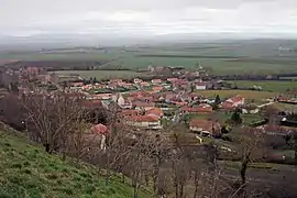 A general view of Montpensier | |
 Coat of arms | |
Location of Montpensier | |
 Montpensier 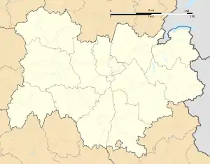 Montpensier | |
| Coordinates: 46°02′10″N 3°13′12″E / 46.036°N 3.220°E | |
| Country | France |
| Region | Auvergne-Rhône-Alpes |
| Department | Puy-de-Dôme |
| Arrondissement | Riom |
| Canton | Aigueperse |
| Intercommunality | CC Plaine Limagne |
| Government | |
| • Mayor (2020–2026) | David Despax[1] |
| Area 1 | 7.24 km2 (2.80 sq mi) |
| Population | 466 |
| • Density | 64/km2 (170/sq mi) |
| Time zone | UTC+01:00 (CET) |
| • Summer (DST) | UTC+02:00 (CEST) |
| INSEE/Postal code | 63240 /63260 |
| Elevation | 346–436 m (1,135–1,430 ft) (avg. 362 m or 1,188 ft) |
| 1 French Land Register data, which excludes lakes, ponds, glaciers > 1 km2 (0.386 sq mi or 247 acres) and river estuaries. | |
Montpensier (French pronunciation: [mɔ̃pɑ̃sje]; Occitan: Monpansèir) is a commune in the Puy-de-Dôme département in Auvergne region of central France.[3]
See also
References
- ↑ "Répertoire national des élus: les maires". data.gouv.fr, Plateforme ouverte des données publiques françaises (in French). 2 December 2020.
- ↑ "Populations légales 2021". The National Institute of Statistics and Economic Studies. 28 December 2023.
- ↑ INSEE commune file
Wikimedia Commons has media related to Montpensier.
This article is issued from Wikipedia. The text is licensed under Creative Commons - Attribution - Sharealike. Additional terms may apply for the media files.