Miskin
| |
|---|---|
 | |
 Miskin Location within Rhondda Cynon Taf | |
| OS grid reference | ST 052 985 |
| Principal area | |
| Preserved county | |
| Country | Wales |
| Sovereign state | United Kingdom |
| Post town | MOUNTAIN ASH |
| Postcode district | CF45 |
| Dialling code | 01443 |
| Police | South Wales |
| Fire | South Wales |
| Ambulance | Welsh |
| UK Parliament | |
| Senedd Cymru – Welsh Parliament | |
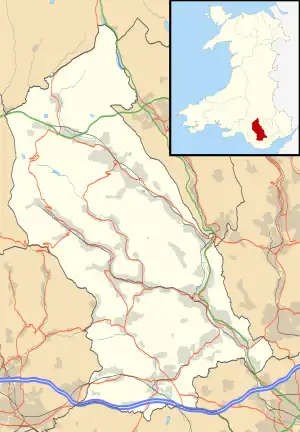
Miskin (Welsh: Meisgyn) is a village and district of the town of Mountain Ash within the Cynon Valley in Rhondda Cynon Taf, Wales.
The Miskin district is part of the community of Penrhiwceiber and, for the purposes of local and national governance, is part of the electoral ward of Penrhiwceiber, along with the district of Perthcelyn.
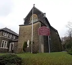
The former St Teilo's church was built c.1890 but since demolished and a meeting room, Miskin Hall, built on its site.[1] As of 2018, Miskin Hall was empty and for sale.[2]
Geography
Miskin is located south of Darranlas, north of Penrhiwceiber, and is the location of Miskin Primary School.
References
External links
- "Geograph: Photos of Miskin Mountain Ash". Geograph. Retrieved 29 March 2016.
This article is issued from Wikipedia. The text is licensed under Creative Commons - Attribution - Sharealike. Additional terms may apply for the media files.
