Madimbo Corridor | |
|---|---|
 Madimbo Corridor  Madimbo Corridor | |
| Coordinates: 22°20′S 30°50′E / 22.333°S 30.833°E | |
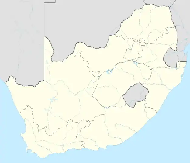
| Country | |
| Province | Limpopo |
| District | Vhembe |
| Municipality | Musina |
| Established | 1969 |
| Area | |
| • Total | 45,000 ha (111,000 acres) |
| Time zone | UTC+2 (SAST) |
The Madimbo Corridor, is a northern military base in the Limpopo Province that borders Zimbabwe in South Africa, and is contiguous with the Matshakatini Nature Reserve.[2] It is controlled by the South African National Defence Force and used as a military training zone[3] and a cordon sanitaire.[4]
History
In the 19th century, local residents began to encounter other groups of people in Africa, mainly commercial hunters. For a time, the hunters and settlers were able to coexist through trades of ivory and skin. However, these relations began to deteriorate with the increase of sport hunting and the introduction of land policies in the late 1890s.[5]
In 1969, The base was established after the forced removal of villages in the area.[6] During this time, the base served under the South African Defence Force as one of the country's protective barriers from attacks in neighboring countries.[7] Additionally, in 1992, the corridor established the Matshakatini Nature Reserve, sharing borders with the area.[8]
Beginning in 1994, at the end of South Africa's apartheid government, actions were taken to move relocated villages back to the corridor.
Climate
The Madimbo Corridor experiences an arid to semi-arid climate, with extended dry seasons and shorter wet periods.[9] Its annual maximum temperatures range from 38.1 °C (100.6 °F) to 44 °C (111 °F).[10] Its annual rainfall averages to 450 mm (18 in) per year,[11] with maximum precipitation of 460 mm (18 in) annually.[12]
Agriculture
The Madimbo Corridor uses a semi-arid irrigation scheme.[13]
Notes
- ↑ Whande 2007, p. 9.
- ↑ Shehab, May (May 2011). "Tourism-Led Development in South Africa: a case study of the Makuleke partnership with Wilderness Saaris" (PDF). University of the Witwatersrand: 114. OCLC 5857550503. Retrieved December 30, 2023.
- ↑ Whande, Webster; Suich, Helen (2009). "Transfrontier Conservation Initiatives in Southern Africa: Observations from the Great Limpopo Transfrontier Conservation Area" (PDF). Evolution and Innovation in Wildlife Conservation. Earthscan: 384. ISBN 978-1-84407-634-5. OCLC 228374313. Retrieved December 31, 2023.
- ↑ Turner, Robin L. (April 26, 2004). "Communities, Wildlife Conservation, and Tourism-based Development: Can Community-based Nature Tourism Live Up to Its Promise?". Breslauer Symposium on Natural Resource Issues in Africa. University of California, Berkeley: 11. OCLC 1367698862. Retrieved December 31, 2023.

- ↑ Whande 2009, pp. 79–80.
- ↑ Whande 2007, pp. 7–8.
- ↑ Whande 2009, pp. 90.
- ↑ Whande 2009, pp. 91.
- ↑ Mavhungu et al. 2021, p. 110.
- ↑ Mavhungu et al. 2021, pp. 109.
- ↑ Whande 2009, p. 68.
- ↑ Mavhungu et al. 2021, p. 108.
- ↑ Mavhungu, T. J.; Nesamvuni, A. E.; Tshikolomo, K. A.; Mpandeli, N. S.; Van Niekerk, J. (March 9, 2022). "Productivity and profitability of sweet potato (ipomoea batatas l.), dry bean (Phaseolus Vulgaris) and maize (Zea mays l.) as selected field crops in irrigated smallholder agricultural enterprises (ISAEs) in Vhembe District, Limpopo Province, South Africa" (PDF). Technium Social Sciences Journal. 29: 683–699. doi:10.47577/tssj.v29i1.5932. ISSN 2668-7798. OCLC 1145548118. Retrieved December 30, 2023.
References
- Mavhungu, T. J.; Nesamvuni, A. E.; Tshikolomo, K. A.; Raphulu, T.; Van Niekerk, J. A.; Mpandeli, N. S.; Nesamvuni, A. E. (December 9, 2021). "Characterization of women and youth smallholder agricultural entrepreneur's in rural irrigation schemes in Vhembe district, South Africa" (PDF). South African Journal of Agricultural Extension. 49 (3): 104–122. doi:10.17159/2413-3221/2021/v49n3a12848. eISSN 2413-3221. ISSN 0301-603X. OCLC 85810704. Retrieved January 1, 2024.
- Whande, Webster (August 2007). "Trans-boundary natural resources management in southern Africa: Local historical and livelihood realities within the Great Limpopo Trans-frontier Conservation Area" (PDF). Programme for Land and Agarian Studies. University of the Western Cape. ISBN 978-1-86808-647-4. OCLC 1073812977. Retrieved December 31, 2023.
- Whande, Webster (2009). "Framing Biodiversity Conservation Discourses in South Africa: Emerging Realities and Conflicting Agendas within the Great Limpopo Transfrontier Conservation Area" (PDF). University of the Western Cape. OCLC 659717270. Archived (PDF) from the original on December 27, 2023. Retrieved December 31, 2023.