
Aerial view of the Istanbul metropolitan area at night

The Hagia Sophia in Fatih, Istanbul's historic center

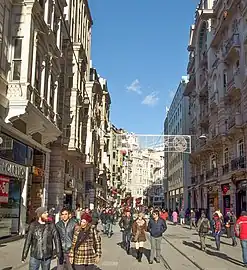
Nişantaşı shopping district in Istanbul
.jpeg.webp)
Bosphorus Bridge and skyline of the Istanbul Central Business District
The list of urban centers in Istanbul lists the major clusters of retail, office, government, retail and dense residential buildings within the city limits of Istanbul, including areas of the historic city center, Fatih, as well as edge cities built outside the historic core.
Important "edge cities", i.e. corridors and nodes of business and shopping centers and of tall residential buildings, include the Istanbul Central Business District in and around Şisli; the E-5/D-100 highway corridor along the north side of the old airport, and on the Asian side, Kozyatağı–Ataşehir, Altunizade, Kavacik and Ümraniye.[1]
European side
Historic city center areas
Fatih
Beyoğlu district (historic Pera)

Galata Tower and part of Beyoğlu district
İstiklal Avenue, originally the "Grand Rue de Péra", pedestrian shopping street of Beyoğlu, formerly Pera

Istanbul Central Business District
- Büyükdere Avenue runs through Beşiktaş, Şişli and Sarıyer districts, lined with residential and office towers and shopping complexes
Beşiktaş district
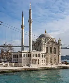
Ortaköy Mosque and the Bosphorus Bridge
Sarıyer district
Şişli district

Among Istanbul's many malls, Kanyon is noted for its dramatic architecture.
- Bomonti/Şişli Merkez (original center of Şişli)
- Esentepe including Zincirlikuyu and the Zorlu Center
- Fulya
- Levent including the Metrocity, Kanyon, Özdilekpark and Istanbul Sapphire complexes
- Nişantaşı
- Otim
- Zorlu Center
Other areas on the European side
Bakırköy district
- Ataköy
- E-5/D-100 highway corridor along the north side of the old airport
- Yeşilköy (San Stefano)
Bahçelievler district
- Bahçelievler
- E-5/D-100 highway corridor along the north side of the old airport
Esenler district
- Giyimkent ("Clothing City")
- Tekstilkent ("Textile City")
Eyüp district
Asian side
Ataşehir district
Beykoz district
Kadıköy district
Maltepe district
Ümraniye district
Üsküdar district
Related lists
References
- ↑ property2021. "Istanbul Office Market General Overview" (PDF). Propin: 3, 9.
{{cite journal}}: CS1 maint: numeric names: authors list (link)
This article is issued from Wikipedia. The text is licensed under Creative Commons - Attribution - Sharealike. Additional terms may apply for the media files.