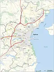
Municipal map

Statistics Denmark defines towns or cities as areas with more than 200 residents in a continuous settlement with no more than 200 meters between residential structures. In 2016 there were 20 such areas in Aarhus Municipality, the largest being the city of Aarhus with some 260.000 inhabitants while some 50.000 people lived in urban areas elsewhere in the municipality. In 2013 Beder and Malling were officially counted as a single conurbation for the first time.[1] Towns in the municipality are generally considered satellites of Aarhus.

Population by year[1]

Name2010201120122013201420152016201720182019202020212022Coords
Aarhus Municipality30665031095631454531909432389332624633063933568434042134533234998335275135523856°09′N 10°12′E / 56.150°N 10.200°E / 56.150; 10.200
Aarhus24291424970925221325601825975426157026471626902227307727708628053428291028527356°09′N 10°12′E / 56.150°N 10.200°E / 56.150; 10.200
Lystrup1002710363103801037610362103411037810436104771042510419103921027356°14′15.4″N 10°14′10.8″E / 56.237611°N 10.236333°E / 56.237611; 10.236333
Beder-Malling000813181948325836583878452859788989034904556°02′58.3″N 10°11′59.6″E / 56.049528°N 10.199889°E / 56.049528; 10.199889
Løgten620763346687696770617335770478948003819785418619865956°16′04.2″N 10°18′29.0″E / 56.267833°N 10.308056°E / 56.267833; 10.308056
Mårslet437944814530477248104877488149055007504350365014500456°04′07.3″N 10°09′44.8″E / 56.068694°N 10.162444°E / 56.068694; 10.162444
Solbjerg313931443270344635053551364637653973421844664550424056°02′28.1″N 10°05′23.4″E / 56.041139°N 10.089833°E / 56.041139; 10.089833
Harlev350835633648368836913718370737593755378538843983399056°08′42.4″N 9°59′49.9″E / 56.145111°N 9.997194°E / 56.145111; 9.997194
Hjortshøj286728762982304732983463356135623634366937143654359056°14′54.1″N 10°16′11.1″E / 56.248361°N 10.269750°E / 56.248361; 10.269750
Sabro247425012640274128072825292829642978322533003309333056°12′41.7″N 10°02′12.5″E / 56.211583°N 10.036806°E / 56.211583; 10.036806
Trige270127382748279928472864286928782858281030963193319156°15′04.9″N 10°08′36.4″E / 56.251361°N 10.143444°E / 56.251361; 10.143444
Elev9329861014101011101188121513071352145815391569166556°14′22.9″N 10°11′51.7″E / 56.239694°N 10.197694°E / 56.239694; 10.197694
Lisbjerg789812807811839838857846994105710291030106356°13′17.0″N 10°09′58.0″E / 56.221389°N 10.166111°E / 56.221389; 10.166111
Spørring9279469539369659769869941020102010081026105256°17′51.4″N 10°08′52.5″E / 56.297611°N 10.147917°E / 56.297611; 10.147917
Hårup75877576776374976380681180782381481085756°17′11.1″N 10°13′04.1″E / 56.286417°N 10.217806°E / 56.286417; 10.217806
Studstrup89089188387985385485185784987384283882756°15′28.6″N 10°20′30.7″E / 56.257944°N 10.341861°E / 56.257944; 10.341861
Mundelstrup43044146439938639639540539738740039941256°11′51.8″N 10°03′51.1″E / 56.197722°N 10.064194°E / 56.197722; 10.064194
Mejlby32033944843644743245444142543140941040956°18′03.1″N 10°12′44.8″E / 56.300861°N 10.212444°E / 56.300861; 10.212444
Ormslev30431132732432934934034433935135435735356°07′31.8″N 10°03′35.0″E / 56.125500°N 10.059722°E / 56.125500; 10.059722
Borum36435635532932633032130931530530330830056°11′16.5″N 10°00′45.0″E / 56.187917°N 10.012500°E / 56.187917; 10.012500
Todbjerg227<200<200<200<200<200204201204200056°16′04.1″N 10°12′27.1″E / 56.267806°N 10.207528°E / 56.267806; 10.207528
Beder433243504372**Beder-Malling since 2013
Malling346235383694**Beder-Malling since 2013
Stavtrup3729*Part of Aarhus since 2011

References

  1. 1 2 "BY1: Folketal 1. januar efter byområde, alder og køn" (in Danish). Danmarks Statistik. Retrieved 16 August 2015.
This article is issued from Wikipedia. The text is licensed under Creative Commons - Attribution - Sharealike. Additional terms may apply for the media files.