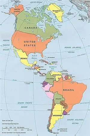

This list of rivers of the Americas by coastline includes the major coastal rivers of the Americas arranged by country. A link to a map of rivers with known coordinates is listed at right. The ocean coasts are demarcated as follows:
- Arctic Ocean coast (including Hudson Bay) from Cape Prince of Wales east to Cape Chidley
- Atlantic Ocean coast from Cape Chidley south to Cape Virgins
- Pacific Ocean coast from Cape Prince of Wales south to Cape Virgins
- Endorheic basin coast (drainage basins not reaching oceans)
This is a counterpart to the primarily alphabetical List of rivers of the Americas and other lists of rivers of countries, although only rivers which reach the ocean are included here, not tributaries.
Arctic Ocean coast
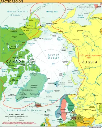
In the Americas, only the United States, Canada, and Greenland have rivers on the Arctic Ocean coast. Greenland is surrounded by the Barents Sea (part of the Arctic Ocean), the Greenland Sea (often described as part of the Arctic Ocean), Baffin Bay to the west (marginal sea of the Arctic Ocean), the Labrador Sea to the south (part of the Arctic Ocean), and directly to the Arctic Ocean to the north. The following is a list of rivers flowing into the Arctic Ocean. The province and country where the mouth is located are included.[1]
Atlantic Ocean coast
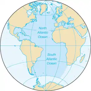
The Atlantic Ocean has irregular coasts indented by numerous bays, gulfs and seas. These include the Baltic Sea, Black Sea, Caribbean Sea, Davis Strait, Denmark Strait, part of the Drake Passage, Gulf of Mexico, Labrador Sea, Mediterranean Sea, North Sea, Norwegian Sea, almost all of the Scotia Sea, and other tributary water bodies.[18] Including these marginal seas the coast line of the Atlantic measures 111,866 km (69,510 mi) compared to 135,663 km (84,297 mi) for the Pacific.[18][19]
The rivers in the following sections flow into the Atlantic Ocean, unless indicated otherwise. The rivers of Cuba and several other countries flow into the Caribbean Sea which connects to the Atlantic Ocean. Some rivers also flow into the Gulf of Mexico before the water reaches the main Atlantic Ocean. A few of the major, notable rivers flowing into the Caribbean and Gulf of Mexico are included below. These lists contain rivers with Wikipedia articles and a few other well-documented rivers.
Argentina, Atlantic Ocean coast
Bahamas, Caribbean Sea, Atlantic Ocean coast
While there are many tidal creeks in The Bahamas, the Goose River is the only river (24°21′N 78°06′W / 24.350°N 78.100°W). Its mouth is on the Caribbean Sea.
Barbados, Caribbean Sea, Atlantic Ocean coast
The following rivers in Barbados flow to the Atlantic Ocean.[20]
- Bruce Vale River, Saint Andrew Parish, 13°14′59″N 59°33′29″W / 13.24959°N 59.558028°W
- Joes River, Saint Joseph Parish, 13°13′00″N 59°32′00″W / 13.216667°N 59.533333°W
- Long Pond River, Saint Andrew Parish, 13°15′06″N 59°33′20″W / 13.251537°N 59.55563°W
The following rivers in Barbados flow to the Caribbean Sea.[20]
Belize, Caribbean Sea, Atlantic Ocean coast
All coastal rivers in Belize drain to the Caribbean Sea before going into the Atlantic Ocean.
Brazil, Atlantic Ocean coast
Canada, Atlantic Ocean coast
Canadian coastal river basins flow towards either the Arctic Ocean, Atlantic Ocean, or Pacific Ocean. The major Canadian rivers with their mouth on the Atlantic Ocean coast are included in the list below. The Province where the mouth is located is also given.[21]
- Bald Head River, Newfoundland and Labrador, 47°19′23″N 52°44′32″W / 47.32306°N 52.74222°W
- Barrington River, Nova Scotia, 43°34′3.3″N 65°34′42.7″W / 43.567583°N 65.578528°W
- LaHave River, Nova Scotia, 44°22′2.1″N 64°28′47.1″W / 44.367250°N 64.479750°W
- Mersey River, Nova Scotia, 44°2′59.1″N 64°44′20.8″W / 44.049750°N 64.739111°W
- Saint John, New Brunswick, Bay of Fundy45°16′N 66°4′W / 45.267°N 66.067°W
- St. Lawrence River, Quebec, 49°30′N 64°30′W / 49.500°N 64.500°W
- St. Mary's River, Nova Scotia, 45°6′19.4″N 61°57′54.7″W / 45.105389°N 61.965194°W
Colombia, Caribbean Sea, Atlantic Ocean coast
Colombian rivers with their mouth on the Caribbean Sea, Atlantic Ocean coast include:
- Magdalena River, Colombia, Caribbean Sea, 11°7′0″N 74°51′0″W / 11.11667°N 74.85000°W
Costa Rica, Atlantic Ocean coast
All Costa Rican drainage basins flow to either the Caribbean Sea or the Pacific Ocean.
Cuba, Caribbean Sea, Atlantic Ocean coast
All Cuban coastal rivers have their mouth on the Caribbean Sea, including the following major river:
Dominican Republic, Caribbean Sea, Atlantic Ocean coast
The following rivers of the Dominican Republic have their mouth on the Atlantic Ocean:
French Guiana, Atlantic Ocean coast
Rivers of French Guiana where the mouth is on the Atlantic Ocean coast include the following:[22]
- Approuague, 4°41′01″N 51°57′41″W / 4.6836°N 51.9613°W
- Counamama (near Iracoubo), 5°32′42″N 53°17′25″W / 5.545033445086926°N 53.29027278971801°W
- Kourou, 5°9′10″N 52°37′45″W / 5.15278°N 52.62917°W
- Mahury, 4°52′09″N 52°14′08″W / 4.8693°N 52.2355°W
- Maroni, 5°44′45″N 53°58′06″W / 5.745793169255944°N 53.96842690321619°W
- Mana, 5°43′44″N 53°50′17″W / 5.7289°N 53.8381°W
- Oyapock, 04°14′08″N 51°36′53″W / 4.23556°N 51.61472°W
- Rivière de Cayenne, 4°55′23″N 52°20′56″W / 4.923°N 52.3489°W
- Sinnamary, 5°26′14″N 52°59′47″W / 5.4373°N 52.9964°W
Guyana, Atlantic Ocean coast
Rivers of Guyana where the mouth is on the Atlantic Ocean coast include the following:
- Abary River, 6°33′N 57°44′W / 6.550°N 57.733°W
- Berbice River, 6°17′N 57°32′W / 6.283°N 57.533°W
- Courantyne River, 5°57′N 57°06′W / 5.950°N 57.100°W[23]
- Demerara River, 6°48′44″N 58°10′12″W / 6.8121°N 58.1701°W[23]
- Essequibo River, 7°02′N 58°27′W / 7.033°N 58.450°W
- Mahaica River, 6°43′N 57°55′W / 6.717°N 57.917°W
- Mahaicony River, 6°34′N 57°48′W / 6.567°N 57.800°W
- Moruka River, 7°40′08″N 58°46′55″W / 7.669°N 58.782°W
- Pomeroon River, 7°37′N 58°45′W / 7.617°N 58.750°W
- Waini River, 8°23′25″N 59°50′14″W / 8.390186°N 59.837208°W
Haiti, Caribbean Sea, Atlantic Ocean coast
Coastal rivers of Haiti have their mouths on the Caribbean Sea, including:
- Artibonite River, Caribbean Sea, 19°15′00″N 72°47′00″W / 19.25°N 72.783333°W
Honduras, Caribbean Sea, Atlantic Ocean coast
Coastal rivers of Honduras flow into either the Caribbean Sea or Pacific Ocean.
Mexico, Atlantic Ocean coast
Coastal rivers of Mexico include Pacific Ocean coastal rivers and the following river with its mouth on the Gulf of Mexico.
- Rio Grande, United States, Mexico, Gulf of Mexico, 25°57′22″N 97°8′43″W / 25.95611°N 97.14528°W
Nicaragua, Caribbean Sea, Atlantic Ocean coast
Coastal rivers of Nicaragua with their mouth on the Caribbean Sea, Atlantic Ocean include:
- Coco River, 15°00′N 83°08′W / 15.000°N 83.133°W
- Escondido River, 12°05′12″N 83°44′57″W / 12.0868°N 83.7492°W
- Indio River, 10°56′31″N 83°43′11″W / 10.941835°N 83.71965°W
- Kukalaya River, 13°39′08″N 83°37′11″W / 13.652204°N 83.619741°W
- Kukra River, 11°54′00″N 83°49′00″W / 11.9°N 83.816667°W
- Kurinwás River, 12°47′33″N 83°39′18″W / 12.792533°N 83.654905°W
- Layasiksa River, 13°38′56″N 83°36′54″W / 13.648853°N 83.615039°W
- Maíz River, 11°17′34″N 83°52′28″W / 11.292745°N 83.874307°W
- Prinzapolka River, 13°24′21″N 83°34′02″W / 13.405799°N 83.567305°W
- Punta Gorda River, 11°30′32″N 83°46′26″W / 11.509°N 83.774°W
- Río Grande de Matagalpa, 12°54′N 83°32′W / 12.900°N 83.533°W
- San Juan River, 10°56′23″N 83°41′54″W / 10.93972°N 83.69833°W
- Ulang River, 14°27′00″N 83°14′00″W / 14.45°N 83.233333°W
- Wawa River, 14°13′38″N 83°34′43″W / 14.22722°N 83.57861°W
- Wawasang River, 12°33′15″N 83°44′47″W / 12.554153°N 83.746336°W
Panama, Caribbean Sea, Atlantic Ocean coast
Coastal rivers in Panama have their mouth on either the Caribbean Sea in the Atlantic or the Pacific Ocean. Some of the rivers with their mouth on the Caribbean Sea include:
Suriname, Atlantic Ocean coast
Coastal rivers of Suriname where the mouth is on the Atlantic Ocean coast include:[24]
- Coppename River, 5°48′00″N 55°55′00″W / 5.8°N 55.916667°W
- Courantyne River, 5°57′18″N 57°04′46″W / 5.955109°N 57.079415°W
- Maroni River, 5°44′45″N 53°58′06″W / 5.745793169255944°N 53.96842690321619°W
- Nickerie River, 5°57′28″N 56°59′21″W / 5.95764°N 56.989051°W
- Saramacca River, 5°51′00″N 55°53′00″W / 5.85°N 55.883333°W
- Suriname River, 5°55′37″N 55°09′37″W / 5.926998°N 55.160384°W
United States, Atlantic Ocean coast
The U.S. coastal rivers where the mouth is on the Atlantic Ocean coast include:[25]
Uruguay, Atlantic Ocean coast
Coastal rivers of Uruguay where the mouth is on the Atlantic Ocean coast include:
- Chuí Stream, Uruguay and Brazil, 33°44′37″S 53°22′09″W / 33.74365°S 53.369039°W
- Río de la Plata, Uruguay, 35°40′S 55°47′W / 35.667°S 55.783°W
- Uruguay River, Uruguay and Argentina, 34°12′S 58°18′W / 34.200°S 58.300°W
Venezuela, Atlantic Ocean coast
Coastal rivers of Venezuela have their mouth on either the Atlantic Ocean or the Caribbean Sea. The Orinoco River flows into the Delta Amacuro at its mouth. The Delta empties into the Gulf of Paría and the Atlantic Ocean. Venezuelan rivers with their mouth on the Atlantic Ocean coast include:
Pacific Ocean coast
Coastal rivers in the following sections by country have their mouth on the Pacific Ocean coast.
Canada, Pacific Ocean coast
Canadian rivers flowing into the Pacific Ocean include the following:[36]
- Fraser River, British Columbia, 49°10′40″N 123°12′45″W / 49.17778°N 123.21250°W
- Skeena River, British Columbia, 54°8′15″N 130°5′40″W / 54.13750°N 130.09444°W
Chile, Pacific Ocean coast
The coastal rivers (Río) in Chile that have their mouth on the Pacific Ocean include:
- Aconcagua River, 32°54′54″S 71°30′30″W / 32.91500°S 71.50833°W
- Bío-Bío River, 36°48′50″S 73°10′14″W / 36.81389°S 73.17056°W
- Cautín River, 38°45′12″S 72°58′50″W / 38.7533°S 72.9806°W
- Elqui River, 29°53′40″S 71°16′30″W / 29.89444°S 71.27500°W
- Itata River, 36°23′04″S 72°52′07″W / 36.3844704519714°S 72.86857972808235°W
- Loa River, 21°25′48″S 70°03′27″W / 21.43°S 70.0576°W
- Maipo River, 33°36′40″S 71°37′50″W / 33.61111°S 71.63056°W
- Maule River, 35°19′00″S 72°24′30″W / 35.31667°S 72.40833°W
- Maullín River, 41°35′49″S 73°39′31″W / 41.59701151086293°S 73.6585566862965°W
- Palena River, 43°46′04″S 72°58′33″W / 43.76778°S 72.97583°W
- Reñihue River, 42°26′30″S 72°46′34″W / 42.4417250961045°S 72.7759754002504°W
- Río Bueno River, 40°14′41″S 73°42′50″W / 40.244597°S 73.713889°W
- Toltén River, 39°15′04″S 73°13′24″W / 39.25118808647522°S 73.22333427026518°W
- Valdivia River, 39°52′44″S 73°23′05″W / 39.878852°S 73.384824°W
- Yelcho River, 42°57′22″S 72°45′03″W / 42.9561°S 72.7508°W
Colombia, Pacific Ocean Coast
.svg.png.webp)
Coastal rivers in Colombia flow into the Pacific Ocean or Caribbean Sea. Rivers flowing into the Pacific Ocean include the following:
- Anchicayá River, 3°32′00″N 76°52′03″W / 3.53333°N 76.86750°W
- Baudó River, 4°58′03″N 77°20′02″W / 4.96759°N 77.333961°W
- Dagua River, 3°51′41″N 77°03′55″W / 3.861382°N 77.065176°W
- Guapi River, 2°38′33″N 77°54′41″W / 2.642375°N 77.911384°W
- Iscuandé River, 2°37′12″N 78°03′57″W / 2.619951°N 78.065831°W
- Mira River (Colombia and Ecuador), 1°36′00″N 79°01′00″W / 1.6°N 79.016667°W
- Naya River, 3°18′30″N 77°29′11″W / 3.308349°N 77.486502°W
- Patía River, 2°15′36″N 78°40′47″W / 2.2599°N 78.6798°W
- Tapaje River, 2°38′42″N 78°06′51″W / 2.644981°N 78.114258°W
- San Juan River, 4°02′42″N 77°26′29″W / 4.04500°N 77.44139°W
- San Juan de Micay River, 3°11′51″N 77°30′31″W / 3.197401°N 77.508713°W
- Sanquianga River, 2°39′00″N 78°19′00″W / 2.65°N 78.316667°W
- Yurumanguí River, 3°24′49″N 77°21′26″W / 3.413673°N 77.35716°W
Costa Rica, Pacific Ocean Coast
- Abangares River, 10°08′37″N 85°04′37″W / 10.143537°N 85.076946°W
- Aranjuez River, 9°59′09″N 84°49′07″W / 9.985888°N 84.818593°W
- Barranca River, 9°57′32″N 84°44′15″W / 9.95893°N 84.737562°W
- Coto Colorado River, 8°32′55″N 83°08′20″W / 8.5485°N 83.1389°W
- Río Ceibo, 9°06′13″N 83°23′07″W / 9.103648°N 83.385286°W[37][38]
- Chacuaco River[37]
- Claro River (Costa Rica), 8°27′55″N 83°35′30″W / 8.465302°N 83.591601°W[37][39]
- Colón River[37]
- Conte River, 8°37′29″N 83°25′39″W / 8.624723°N 83.427611°W[37][40]
- Diamante River (Costa Rica)[37]
- Guacimal River, 10°01′32″N 84°53′57″W / 10.025659°N 84.899071°W
- Jaba River (Costa Rica), 8°53′15″N 83°01′47″W / 8.887416°N 83.029631°W[37][41]
- Jesús María River, 9°51′49″N 84°41′50″W / 9.8637°N 84.697201°W
- Lagarto River, 10°03′23″N 84°56′30″W / 10.05633°N 84.941751°W
- Limón River (Costa Rica)[37]
- Naranjo River (Costa Rica), 10°47′46″N 85°40′48″W / 10.796082310322847°N 85.68004124440162°W
- Nosara River, 9°57′59″N 85°40′38″W / 9.966388°N 85.677208°W
- La Palma River, 10°10′00″N 85°05′00″W / 10.166667°N 85.083333°W[37][42]
- Negro River (Costa Rica)[37]
- Pirris River, 9°29′31″N 84°19′59″W / 9.49207°N 84.332972°W
- Rincón River, 8°41′14″N 83°28′44″W / 8.687086°N 83.478794°W[37][43]
- Riyito River (Costa Rica)[37]
- Savegre River, 9°20′48″N 84°01′53″W / 9.34664°N 84.031285°W
- Sierpe River, 8°49′N 83°34′W / 8.817°N 83.567°W
- Síngrí River, 8°59′05″N 83°07′03″W / 8.984811°N 83.117382°W[37][44]
- Tamarindo River, Costa Rica, 10°18′26″N 85°50′25″W / 10.307177°N 85.840249°W
- Tárcoles River, 9°47′11″N 84°38′28″W / 9.786315°N 84.641175°W
- Tempisque River, Gulf of Nicoya, 10°9′20″N 85°13′12″W / 10.15556°N 85.22000°W
- Térraba River, 9°01′56″N 83°37′36″W / 9.032256°N 83.626742°W
- Tigre River (Costa Rica), 8°34′03″N 83°19′36″W / 8.567612°N 83.326666°W[37][45]
- Volcán River (Costa Rica), 9°07′48″N 83°24′47″W / 9.129907°N 83.412927°W[37][46]
Ecuador, Pacific Ocean Coast
- Arenillas River, 3°24′40″S 80°01′44″W / 3.4112°S 80.028763°W
- Balao River, 2°52′47″S 79°50′45″W / 2.879652°S 79.84589°W
- Cañar River, 2°39′28″S 79°45′57″W / 2.657855°S 79.765953°W
- Cayapas River, 1°13′50″N 79°02′43″W / 1.230555°N 79.045237°W
- Coaque River, 0°01′00″N 80°06′00″W / 0.016667°N 80.1°W
- Chone River, 0°35′14″S 080°25′07″W / 0.58722°S 80.41861°W
- Cojimies River, 0°15′43″N 79°56′37″W / .261809°N 79.943712°W
- Esmeraldas River, 0°54′14″N 79°39′27″W / 0.9040°N 79.6575°W
- Guayas River, Gulf of Guayaquil, 2°39′05″S 79°54′33″W / 2.651358°S 79.909052°W
- Jama River, 0°09′49″S 80°15′59″W / .163731°S 80.266418°W
- Jipijapa River, 1°21′05″S 80°44′04″W / 1.35152°S 80.734576°W
- Jubones River, 3°10′18″S 79°55′36″W / 3.171733°S 79.926692°W
- Mira River (Ecuador and Colombia border), 1°36′00″N 79°01′00″W / 1.6°N 79.016667°W
- Muisne River, 0°37′42″N 80°02′31″W / 0.628220°N 80.041822°W
- Portoviejo River, 0°47′58″S 80°31′22″W / .799438°S 80.522643°W
- Zarumilla River (Peru and Ecuador border), 3°26′27″S 80°13′19″W / 3.4408°S 80.2219°W
El Salvador, Pacific Ocean Coast
- Banderas River, 13°32′N 89°43′W / 13.533°N 89.717°W
- Cara Sucia River, 13°45′37″N 90°02′10″W / 13.760278°N 90.036111°W
- Comalapa River, 13°25′00″N 89°10′00″W / 13.416667°N 89.166667°W
- Copinula River, 13°37′57″N 89°50′36″W / 13.632617°N 89.843458°W
- Goascorán River, 13°24′38″N 87°49′08″W / 13.41056°N 87.81889°W
- Río Grande de San Miguel, 13°14′00″N 88°22′00″W / 13.2333333°N 88.3666667°W
- El Guayabo River, 13°16′00″N 88°50′01″W / 13.266617°N 88.833736°W
- Jalponga River, 13°22′00″N 88°57′00″W / 13.366667°N 88.95°W
- Jiboa River, 13°21′32″N 89°02′16″W / 13.358889°N 89.037778°W
- Lempa River, 13°15′17″N 88°49′38″W / 13.25472°N 88.82722°W
- El Molino River, 13°15′47″N 88°27′00″W / 13.262973°N 88.449974°W
- Paz River, 13°46′16″N 90°10′57″W / 13.77111°N 90.18250°W
- El Potrero River,
- Pululuya River, 13°33′N 89°42′W / 13.550°N 89.700°W
- Sensunapan River, 13°35′54″N 89°50′15″W / 13.598333°N 89.8375°W
- Sirama River, 13°27′34″N 87°47′52″W / 13.459444°N 87.797778°W
Guatemala, Pacific Ocean Coast
The coastal rivers in Guatemala with their mouth on the Pacific Ocean coast include:[47]
- Acomé River, 13°55′02″N 91°05′18″W / 13.9171°N 91.0883°W
- Achiguate River, 13°54′55″N 90°54′29″W / 13.915364°N 90.908003°W
- Coyolate River, 13°57′14″N 91°18′41″W / 13.953976°N 91.311493°W
- Icán River, 14°07′30″N 91°39′55″W / 14.125006°N 91.665201°W
- Lempa River, 13°15′17″N 88°49′38″W / 13.25472°N 88.82722°W
- Los Esclavos River, 13°50′20″N 90°19′46″W / 13.83889°N 90.32944°W
- Madre Vieja River, 14°00′14″N 91°25′49″W / 14.003866°N 91.430283°W
- María Linda River, 13°56′32″N 90°42′31″W / 13.942148°N 90.708489°W
- Nahualate River, 14°02′45″N 91°32′18″W / 14.045877°N 91.538343°W
- Naranjo River, 14°30′31″N 92°11′07″W / 14.508563°N 92.185335°W
- Ocosito River, 14°26′09″N 92°05′37″W / 14.43580°N 92.09369°W
- Paso Hondo River, 14°43′06″N 92°05′50″W / 14.718449°N 92.09734°W
- Paz River, 13°46′16″N 90°10′57″W / 13.77111°N 90.18250°W
- Samalá River, 14°11′31″N 91°47′08″W / 14.191934°N 91.785450°W
- Suchiate River (Guatemala and Mexico), 14°31′53″N 92°13′41″W / 14.531466°N 92.228125°W
Honduras, Pacific Ocean Coast
- Choluteca River, 13°05′29″N 87°22′24″W / 13.0914°N 87.3733°W
- Goascorán River, 13°24′38″N 87°49′08″W / 13.41056°N 87.81889°W
- Lempa River, 13°15′17″N 88°49′38″W / 13.25472°N 88.82722°W
- Nacaome River, 13°25′09″N 87°35′25″W / 13.419167°N 87.590278°W
- Río Negro, 13°02′00″N 87°08′00″W / 13.033333°N 87.133333°W
Mexico, Pacific Ocean Coast

Rivers of Mexico that have their mouth on the Pacific Ocean coast include the following. The river's name, as well as Mexican State and coordinates where the mouth of the river is located are listed where known.
Nicaragua, Pacific Ocean Coast
- Río Brito, 11°20′39″N 85°58′45″W / 11.3443°N 85.9793°W
- Rio Casares
- Río Escalante, Nicaragua, 11°31′09″N 86°10′20″W / 11.519144°N 86.172192°W
- Estero Real, Chinandega, 12°55′14″N 87°21′47″W / 12.920578°N 87.363149°W
- Río Negro, 13°02′00″N 87°08′00″W / 13.033333°N 87.133333°W
- Río el Tamarindo, León, 12°12′47″N 86°45′46″W / 12.213093°N 86.762798°W
- Río Tecolapa, Nicaragua, 11°43′16″N 86°26′29″W / 11.721116°N 86.441431°W
Panama, Pacific Ocean Coast
The mouth of the following rivers in Panama are at the Pacific Ocean:[22]
- Rio Anton, 8°18′04″N 80°15′46″W / 8.301089786439775°N 80.2627301296432°W
- Bahia de Parita, 8°21′32″N 80°27′07″W / 8.358779222570277°N 80.45196980434453°W
- Rio Cabra, 9°01′16″N 79°21′08″W / 9.021107°N 79.352351°W
- Rio Caimito, 8°52′33″N 79°42′13″W / 8.875777073671623°N 79.70362827055281°W
- Rio Cate, 7°43′09″N 81°14′51″W / 7.719163°N 81.247426°W
- Rio Chame, 8°33′38″N 79°50′22″W / 8.560674294368944°N 79.8393317525227°W
- Rio Chepo (Bayano River), 8°59′53″N 79°06′49″W / 8.9980°N 79.1136°W
- Rio Chiriquí Viejo, 8°19′39″N 82°42′07″W / 8.3275°N 82.7019°W
- Rio Chorcha, 8°17′24″N 82°17′10″W / 8.289979831867829°N 82.28623646945857°W
- Rio Colorado, 8°18′45″N 82°46′03″W / 8.31254806691923°N 82.76736777881712°W
- Rio Congo, 8°24′58″N 78°22′08″W / 8.416080451025929°N 78.36884419298751°W
- Rio Corotú, 8°45′22″N 78°42′49″W / 8.756215°N 78.713636°W
- Rio Duablo, 8°19′47″N 82°41′14″W / 8.329753352897917°N 82.68709449463277°W
- Estero de Ajo, 8°20′27″N 82°08′51″W / 8.340797°N 82.147507°W
- Rio Farallon, 8°21′00″N 80°08′37″W / 8.350091563795969°N 80.14359442982067°W
- Rio Fonseca, 8°12′27″N 82°00′15″W / 8.20744084288675°N 82.00418080816212°W
- Rio Grande, 9°01′N 79°37′W / 9.017°N 79.617°W
- Rio Guanábano, 8°14′37″N 82°52′23″W / 8.243724844157482°N 82.8731589489876°W
- Rio Jaqué, 7°30′00″N 78°03′00″W / 7.50000°N 78.05000°W
- Rio La Villa, 7°59′47″N 80°23′15″W / 7.996448°N 80.387549°W
- Las Vueltas
- Rio Lovaina, 7°56′37″N 81°36′58″W / 7.943693°N 81.61622°W
- Rio Mariato, 7°37′02″N 80°59′13″W / 7.617120284773962°N 80.98697737012957°W
- Rio Pacora, 9°01′18″N 79°16′47″W / 9.021794°N 79.279721°W
- Rio Palo Blanco, 8°17′56″N 82°48′33″W / 8.29897856822852°N 82.80908735216481°W
- Palo Seco, 7°36′30″N 80°58′34″W / 7.608328°N 80.975982°W
- Rio Pavo, 7°21′30″N 80°54′00″W / 7.358320169159046°N 80.89994743115152°W
- Rio Platanal, 8°19′06″N 78°11′19″W / 8.318434°N 78.188722°W
- Puerto Pocrí (tidal creek), 7°42′00″N 80°07′00″W / 7.7°N 80.116667°W
- Rio Rabo de Puerco, 8°16′36″N 82°51′24″W / 8.276563°N 82.856767°W
- Rio Sabanas, 8°25′05″N 78°05′17″W / 8.418141°N 78.088027°W
- Rio Sambú, 8°04′37″N 78°18′08″W / 8.076808°N 78.302333°W
- Rio San Bártolo, 8°17′02″N 82°50′51″W / 8.283819°N 82.847401°W
- Rio San Pablo, 7°51′13″N 81°11′01″W / 7.853525°N 81.183529°W
- Rio San Felix, 8°09′51″N 81°50′39″W / 8.16415°N 81.844201°W
- Rio San Juan, 8°11′52″N 81°58′05″W / 8.197876484075204°N 81.96808394031667°W
- Rio San Pedro, 8°49′31″N 81°32′39″W / 8.825288°N 81.544142°W
- Rio Santa Maria, 8°05′21″N 80°29′07″W / 8.089165°N 80.485287°W
- Rio Santiago, 8°10′52″N 81°45′40″W / 8.181179399026748°N 81.76115675496375°W
- Rio Suay, 7°44′52″N 81°02′23″W / 7.747694944408176°N 81.039825794059°W
- Rio Tabasara, 8°01′39″N 81°41′51″W / 8.027415182791582°N 81.69743203757884°W
- Rio Tuira, 8°19′10″N 78°18′31″W / 8.3194°N 78.3086°W
- Rio Varadero, 7°17′13″N 80°55′27″W / 7.286941845139123°N 80.92408219039564°W
Peru, Pacific Ocean Coast
The following coastal rivers in Peru have their mouth on the Pacific Ocean Coast:[48]
- Acarí River, 15°39′34″S 74°38′33″W / 15.659427°S 74.642565°W
- Atico, 16°03′16″S 73°37′04″W / 16.054359°S 73.617655°W
- Cañete River, 13°07′46″S 76°24′06″W / 13.129319°S 76.401557°W
- Caplina River, 18°14′00″S 70°33′00″W / 18.233333°S 70.55°W
- Caravelí River, 16°03′40″S 73°16′25″W / 16.061208°S 73.273474°W
- Casma River, 9°26′58″S 78°22′57″W / 9.449444°S 78.382375°W
- Chamán River, 7°12′15″S 79°39′58″W / 7.204134°S 79.66605°W
- Chancay River (Lambayeque), 11°36′53″S 77°15′00″W / 11.61475606870047°S 77.2500620460815°W
- Chancay River (Huaral), 11°36′40″S 77°14′46″W / 11.611246°S 77.246028°W
- Chao River, 8°36′01″S 78°42′58″W / 8.600344°S 78.716202°W
- Chaparra River, 15°55′18″S 74°07′21″W / 15.92171°S 74.122372°W
- Chicama River, 7°56′21″S 79°16′59″W / 7.939058°S 79.282924°W
- Chillón River, 11°56′24″S 77°08′19″W / 11.9400°S 77.1386°W
- Chira River, 4°54′S 81°08′W / 4.900°S 81.133°W
- Colca River, 16°37′52″S 72°45′51″W / 16.63111°S 72.76417°W
- Culebras River, 9°56′14″S 78°13′32″W / 9.937239°S 78.225599°W
- Fortaleza River, 10°38′54″S 77°51′39″W / 10.6482°S 77.8609°W
- Grande River (Rio Nazca), 14°59′43″S 75°27′16″W / 14.995339080430885°S 75.45436522863399°W
- Huaura River, 11°05′05″S 77°37′43″W / 11.084672°S 77.628743°W
- Huarmey River, 10°05′40″S 78°10′00″W / 10.094336°S 78.166739°W
- Ica River, 14°52′15″S 75°33′43″W / 14.870886°S 75.561981°W
- Rio Indio Muerto or Chala, 15°48′00″S 74°14′00″W / 15.8°S 74.233333°W
- Jequetepeque River, 7°19′56″S 79°35′29″W / 7.3322°S 79.5914°W
- Lacramarca River, 8°53′12″S 78°18′57″W / 8.886723°S 78.315818°W
- Rio Locumba, 17°55′03″S 70°57′53″W / 17.917497°S 70.964736°W
- Lurín River, 12°16′30″S 76°54′13″W / 12.2750°S 76.9036°W
- Mala River, 12°40′27″S 76°39′26″W / 12.674185°S 76.657131°W
- Moche River, 8°09′40″S 79°02′11″W / 8.16111°S 79.036298°W
- Motupe River, 06°31′27″S 080°07′16″W / 6.52417°S 80.12111°W
- Nepeña River, 9°13′08″S 78°22′06″W / 9.218811°S 78.368386°W
- Ocoña River, 16°27′07″S 73°06′43″W / 16.4519°S 73.1119°W
- Olmos River, 6°11′16″S 79°55′54″W / 6.187706°S 79.931622°W
- Omas River, 12°45′17″S 76°29′25″W / 12.754681°S 76.490148°W
- Osmore River or Moquegua or Ilo, 17°43′0″S 71°20′0″W / 17.71667°S 71.33333°W
- Pativilca River, 10°44′15″S 77°47′32″W / 10.737489°S 77.792198°W
- Pisco River, 13°40′36″S 76°12′52″W / 13.676796°S 76.214482°W
- Piura River, 5°46′20″S 80°52′07″W / 5.77222°S 80.86861°W
- Rímac River, 11°56′50″S 76°42′29″W / 11.94730°S 76.70792°W
- Sama River, 18°09′50″S 70°40′26″W / 18.163878°S 70.674001°W
- Rio San Juan
- Santa River, 8°57′57″S 78°38′05″W / 8.965844°S 78.634712°W
- Supe River, 10°50′50″S 77°42′45″W / 10.847244°S 77.712372°W
- Tambo River
- Quebrada Topara, 13°19′23″S 76°14′33″W / 13.323155°S 76.242633°W
- Tumbes River, 3°30′S 80°27′W / 3.500°S 80.450°W
- Virú River, 8°29′05″S 78°52′33″W / 8.484689°S 78.875937°W
- Vitor River, 16°37′13″S 72°18′13″W / 16.620271°S 72.303564°W
- Yauca River, 15°41′52″S 74°32′16″W / 15.69775°S 74.537863°W
- Zaña River, 7°05′10″S 79°43′05″W / 7.08602°S 79.71794°W
- Zarumilla River, 3°26′27″S 80°13′19″W / 3.4408°S 80.2219°W
United States, Pacific Ocean coast
The following coastal rivers of the United States have their mouth on the Pacific Ocean:[49]
Endorheic basins

There are Endorheic basins in several regions of the Americas. Rivers in these basins do not reach the oceans. The largest endorheic basin is the Great Basin (209,162 sq mi (541,730 km2)) in North America. There are also several endorheic basins in South America, including the Altiplano Basin (59,528 sq mi (154,180 km2)).[51]
See also
References
- 1 2 3 "Rivers". The Atlas of Canada. Natural Resources Canada. Archived from the original on 2007-02-02. Retrieved 2011-09-16.
- ↑ "Chesterfield Inlet". CGNDB. Canadian Government. Retrieved July 10, 2021.
- ↑ "Dawson Inlet". CGNDB. Canadian Government. Retrieved July 10, 2021.
- ↑ "Maguse Lake". The Columbia Gazetteer of North America. bartleby.com. 2000. Archived from the original on 2001-11-13. Retrieved 2008-12-04.
- ↑ "Tha-anne River". Canadian Geographical Names Database. Retrieved July 10, 2021.
- ↑ "Thlewiaza River". Canadian Geographical Names Database. October 6, 2016. Retrieved July 10, 2021.
- ↑ "Nanook River". CGNDB. Canadian Government. Retrieved July 10, 2021.
- ↑ "Caribou River". Canadian Geographical Names Database. Retrieved July 10, 2021.
- ↑ "Canada Drainage Basins". The National Atlas of Canada, 5th edition. Natural Resources Canada. 1985. Retrieved 24 November 2010.
- ↑ "North Knife". CGNDB. Canadian Government. Retrieved July 10, 2021.
- ↑ "South Knife River". CGNDB. Canadian Government. Retrieved July 10, 2021.
- ↑ "Churchill River". CGNDB. Canadian Government. Retrieved July 10, 2021.
- ↑ U.S. Geological Survey Geographic Names Information System: Hulahula River
- ↑ U.S. Geological Survey Geographic Names Information System: Sadlerochit River
- ↑ U.S. Geological Survey Geographic Names Information System: Shaviovik River
- ↑ U.S. Geological Survey Geographic Names Information System: Ikpikpuk River
- ↑ U.S. Geological Survey Geographic Names Information System: Topagoruk River
- 1 2 "Atlantic Ocean". CIA World Factbook. 27 June 2016. Retrieved 2 October 2016.
- ↑ "Pacific Ocean". CIA World Factbook. 1 June 2016. Retrieved 2 October 2016.
- 1 2 "GEONet Names Server". National Geospatial-Intelligence Agency. Retrieved June 25, 2021., GEOnet Names Server
- ↑ Coordinates and locations references are given in the article on each river.
- 1 2 Coordinates from WikiPedia article, GeoNames, or Google search
- 1 2 Harrison, John Burchmore; Fowler, Frank; Anderson, Charles Wilgress (1908). The Geology of the Goldfields of British Guiana. Dulau & Company. pp. 11–15.
- ↑ GeoNames search for each river
- ↑ Coordinates and locations are taken from either the referenced WikiPedia river article or Geographic Names Information System when there is no article.
- ↑ U.S. Geological Survey Geographic Names Information System: Fort George River
- ↑ U.S. Geological Survey Geographic Names Information System: Stranahan River
- ↑ U.S. Geological Survey Geographic Names Information System: Kiawah River
- ↑ U.S. Geological Survey Geographic Names Information System: Coosaw River
- ↑ U.S. Geological Survey Geographic Names Information System: Morgan River
- ↑ U.S. Geological Survey Geographic Names Information System: Story River
- ↑ U.S. Geological Survey Geographic Names Information System: Beaufort River
- ↑ U.S. Geological Survey Geographic Names Information System: May River
- ↑ U.S. Geological Survey Geographic Names Information System: New River
- ↑ U.S. Geological Survey Geographic Names Information System: Wright River
- ↑ "Atlas of Canada". Princeton University. Retrieved July 12, 2021.
- 1 2 3 4 5 6 7 8 9 10 11 12 13 14 15 Case area in Costa Rica: The Terraba River basin Archived 2016-03-04 at the Wayback Machine LiveDiverse, p. 33. Retrieved: 2012-11-05.
- ↑ "Rio Ciebo". GeoNames. Retrieved July 24, 2021.
- ↑ "Rio Claro". GeoNames. Retrieved July 24, 2021.
- ↑ "Rio Conte". GeoNames. Retrieved July 24, 2021.
- ↑ "Rio Jaba". GeoNames. Retrieved July 24, 2021.
- ↑ "Rio La Palma". GeoNames. Retrieved July 24, 2021.
- ↑ "Rio Rincón". GeoNames. Retrieved July 24, 2021.
- ↑ "Rio Síngrí". GeoNames. Retrieved July 24, 2021.
- ↑ "Rio Tigre". GeoNames. Retrieved July 24, 2021.
- ↑ "Rio Volcán". GeoNames. Retrieved July 24, 2021.
- ↑ Coordinates from Wikipedia article or GeoNames
- ↑ Coordinates from WikiPedia article or GeoNames search
- ↑ Unless otherwise noted, the coordinates come from the United States Geological Survey Geographic Names Information System database
- ↑ U.S. Geological Survey Geographic Names Information System: Kalaloch Creek
- ↑ "Salton Sea: California's Everglades" (PDF). Redlands Institute. p. 6. Retrieved 2015-08-02.