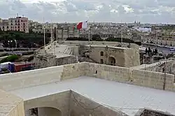
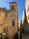
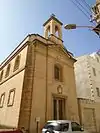
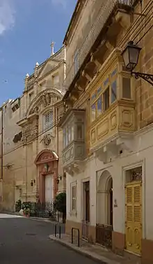
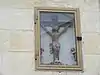
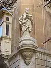
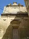
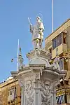
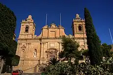
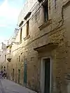
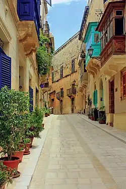
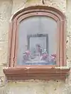
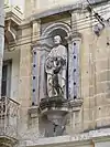
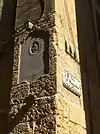
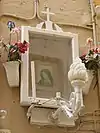
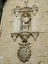
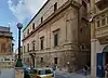
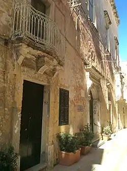
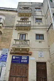
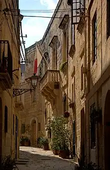
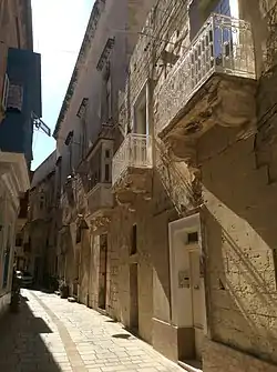
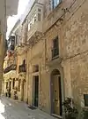
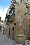
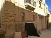
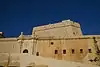
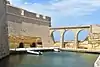
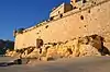
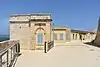
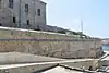
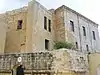
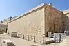
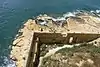
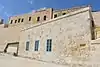
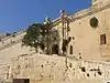
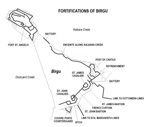
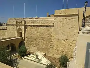
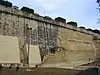
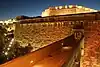
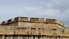
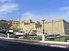
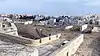
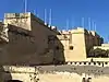
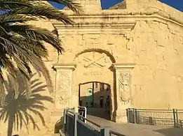
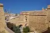
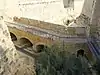
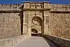
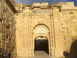
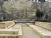
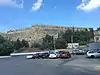
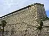
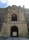
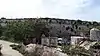
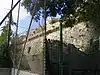
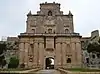
This is a list of monuments in Birgu, Malta, which are listed on the National Inventory of the Cultural Property of the Maltese Islands.[1][2][3][4]
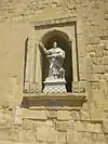
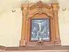
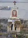
List

Name of objectLocationCoordinatesIDPhotoUpload
Couvre Porte BarracksTriq it-8 ta' Dicembru35°53′08″N 14°31′21″E / 35.885417°N 14.522583°E / 35.885417; 14.522583 (Couvre Porte Barracks)00049Couvre Porte Barracks
Upload Photo
Niche of the Madonna of Mount CarmelTriq il-Karmnu / Triq San Lawrenz35°53′19″N 14°31′14″E / 35.888667°N 14.520639°E / 35.888667; 14.520639 (Niche of the Madonna of Mount Carmel)00705Niche of the Madonna of Mount Carmel
Upload Photo
Church of the Madonna of MonserratTriq il-Madonna ta' Monserrat35°53′21″N 14°31′14″E / 35.889123°N 14.520585°E / 35.889123; 14.520585 (Church of the Madonna of Monserrat)00706Church of the Madonna of Monserrat
Upload Photo
Monastery of Saint ScholastikaTriq Santa Skolastika35°53′20″N 14°31′20″E / 35.888948°N 14.522308°E / 35.888948; 14.522308 (Monastery of Saint Scholastika)00707Monastery of Saint Scholastika
Upload Photo
Niche of the Crucified ChristMisrah ir-Rebha / Triq La Vallette35°53′18″N 14°31′19″E / 35.888257°N 14.522016°E / 35.888257; 14.522016 (Niche of the Crucified Christ)00708Niche of the Crucified Christ
Upload Photo
Niche of St. Philip NeriTriq San Filippu / Triq Patri Indri Vella35°53′18″N 14°31′18″E / 35.888362°N 14.521732°E / 35.888362; 14.521732 (Niche of St. Philip Neri)00709Niche of St. Philip Neri
Upload Photo
Church of the Madonna of the Guardian AngelsTriq San Filippu35°53′19″N 14°31′18″E / 35.888720°N 14.521731°E / 35.888720; 14.521731 (Church of the Madonna of the Guardian Angels)00710Church of the Madonna of the Guardian Angels
Upload Photo
Statue of St. LawrenceMisrah ir-Rebha35°53′17″N 14°31′20″E / 35.887921°N 14.522105°E / 35.887921; 14.522105 (Statue of St. Lawrence)00711Statue of St. Lawrence
Upload Photo
Oratory of the Fraternity of St. JosephZuntier35°53′16″N 14°31′18″E / 35.887647°N 14.521804°E / 35.887647; 14.521804 (Oratory of the Fraternity of St. Joseph)00712Oratory of the Fraternity of St. Joseph
Upload Photo
Oratory of the Fraternity of the CrucifixZuntier35°53′16″N 14°31′17″E / 35.887667°N 14.521509°E / 35.887667; 14.521509 (Oratory of the Fraternity of the Crucifix)00713Oratory of the Fraternity of the Crucifix
Upload Photo
Parish Church of St. Lawrence MartyrTriq San Lawrenz35°53′14″N 14°31′17″E / 35.887332°N 14.521497°E / 35.887332; 14.521497 (Parish Church of St. Lawrence Martyr)00714Parish Church of St. Lawrence Martyr
Upload Photo
Church of the AnnunciationTriq il-Mina l-Kbira35°53′13″N 14°31′20″E / 35.886954°N 14.522290°E / 35.886954; 14.522290 (Church of the Annunciation)00715Church of the Annunciation
Upload Photo
Houses of the Conventual ChaplainsTriq Papa Alessandru VII35°53′14″N 14°31′23″E / 35.887315°N 14.522924°E / 35.887315; 14.522924 (Houses of the Conventual Chaplains)00716Houses of the Conventual Chaplains
Upload Photo
Palace of the BishopTriq il-Palazz ta' L-Isqof35°53′14″N 14°31′24″E / 35.887275°N 14.523416°E / 35.887275; 14.523416 (Palace of the Bishop)00717Palace of the Bishop
Upload Photo
Niche of St. Lawrence15 Triq il-Kwartier35°53′17″N 14°31′26″E / 35.887949°N 14.523830°E / 35.887949; 14.523830 (Niche of St. Lawrence)00718Niche of St. Lawrence
Upload Photo
Niche of St JosephTriq Gilormu Cassar / Triq Hilda Tabone35°53′18″N 14°31′24″E / 35.888412°N 14.523381°E / 35.888412; 14.523381 (Niche of St Joseph)00719Niche of St Joseph
Upload Photo
Niche of St. LawrenceTriq Hilda Tabone / Triq il-Majjistral35°53′18″N 14°31′21″E / 35.888420°N 14.522592°E / 35.888420; 14.522592 (Niche of St. Lawrence)00720Niche of St. Lawrence
Upload Photo
Niche of the Madonna of SorrowsTriq il-Majjistral35°53′17″N 14°31′22″E / 35.887987°N 14.522814°E / 35.887987; 14.522814 (Niche of the Madonna of Sorrows)00721Niche of the Madonna of Sorrows
Upload Photo
Niche of the Madonna of the RosaryTriq il-Majjistral / Triq Pacifiku Scicluna35°53′16″N 14°31′23″E / 35.887691°N 14.523100°E / 35.887691; 14.523100 (Niche of the Madonna of the Rosary)00722Niche of the Madonna of the Rosary
Upload Photo
Niche of St. DominicTriq P. Boffa35°53′10″N 14°31′22″E / 35.886110°N 14.522901°E / 35.886110; 14.522901 (Niche of St. Dominic)00723Niche of St. Dominic
Upload Photo
Niche of the Madonna of SorrowsTaht il-Mina ta' Provence35°53′09″N 14°31′22″E / 35.885957°N 14.522741°E / 35.885957; 14.522741 (Niche of the Madonna of Sorrows)00724Niche of the Madonna of Sorrows
Upload Photo
Niche of the Crucified ChristCouvre Porte35°53′08″N 14°31′21″E / 35.885439°N 14.522386°E / 35.885439; 14.522386 (Niche of the Crucified Christ)00725Niche of the Crucified Christ
Upload Photo
Niche of the Face of ChristTriq 8-ta'Dicembru (ditch)35°53′08″N 14°31′20″E / 35.885471°N 14.522198°E / 35.885471; 14.522198 (Niche of the Face of Christ)00726Niche of the Face of Christ
Upload Photo
Inquisitor's PalaceTriq il-Mina l-Kbira35°53′14″N 14°31′21″E / 35.887234°N 14.522497°E / 35.887234; 14.522497 (Inquisitor's Palace)01157Inquisitor's Palace
Upload Photo
Auberge de France24-27 Triq Hilda Tabone35°53′19″N 14°31′22″E / 35.888523°N 14.522834°E / 35.888523; 14.522834 (Auberge de France)01158Auberge de France
Upload Photo
Auberge d' Allemagne7a/7b Misrah ir-Rebha35°53′17″N 14°31′20″E / 35.888110°N 14.522243°E / 35.888110; 14.522243 (Auberge d' Allemagne)01159Auberge d' Allemagne
Upload Photo
Auberge d' Angleterre40-42 Triq il-Majjistral35°53′18″N 14°31′21″E / 35.888219°N 14.522601°E / 35.888219; 14.522601 (Auberge d' Angleterre)01160Auberge d' Angleterre
Upload Photo
Auberge d' Aragon28-30 Triq Hilda Tabone35°53′19″N 14°31′23″E / 35.888485°N 14.522989°E / 35.888485; 14.522989 (Auberge d' Aragon)01161Auberge d' Aragon
Upload Photo
Auberge d' Auvergne et Provence21-23 Triq Hilda Tabone35°53′19″N 14°31′22″E / 35.888494°N 14.522707°E / 35.888494; 14.522707 (Auberge d' Auvergne et Provence)01162Auberge d' Auvergne et Provence
Upload Photo
Auberge de Castille et Portugal (leon)57-59 Triq Hilda Tabone / Triq Gilormu Cassar35°53′18″N 14°31′24″E / 35.888417°N 14.523435°E / 35.888417; 14.523435 (Auberge de Castille et Portugal (leon))01163Auberge de Castille et Portugal (leon)
Upload Photo
Auberge d'Italie1 Triq San Lawrenz35°53′26″N 14°31′11″E / 35.890553°N 14.519701°E / 35.890553; 14.519701 (Auberge d'Italie)01164Auberge d'Italie
Upload Photo
Fort St AngeloXatt il-Forn35°53′33″N 14°31′05″E / 35.892481°N 14.518078°E / 35.892481; 14.518078 (Fort St Angelo)01479Fort St Angelo
Upload Photo
D' Homedes Bastion - Fort St AngeloSant'Anglu35°53′27″N 14°31′09″E / 35.890943°N 14.519097°E / 35.890943; 14.519097 (D' Homedes Bastion - Fort St Angelo)01480D' Homedes Bastion - Fort St Angelo
Upload Photo
Cavalier - Fort St AngeloSant'Anglu35°53′30″N 14°31′08″E / 35.891593°N 14.519017°E / 35.891593; 14.519017 (Cavalier - Fort St Angelo)01481Cavalier - Fort St Angelo
Upload Photo
Curtain wall adjoining D'Homedes Bastion - Fort St AngeloSant'Anglu35°53′29″N 14°31′07″E / 35.891518°N 14.518637°E / 35.891518; 14.518637 (Curtain wall adjoining D'Homedes Bastion - Fort St Angelo)01482Curtain wall adjoining D'Homedes Bastion - Fort St Angelo
Upload Photo
Main Gateway - Fort St AngeloSant'Anglu35°53′29″N 14°31′07″E / 35.891476°N 14.518551°E / 35.891476; 14.518551 (Main Gateway - Fort St Angelo)01483Main Gateway - Fort St Angelo
Upload Photo
Rampart adjoining D'Homedes bastion and overlooking Moat - Fort St AngeloSant'Anglu35°53′29″N 14°31′10″E / 35.891274°N 14.519345°E / 35.891274; 14.519345 (Rampart adjoining D'Homedes bastion and overlooking Moat - Fort St Angelo)01484Rampart adjoining D'Homedes bastion and overlooking Moat - Fort St Angelo
Upload Photo
Main enciente along No 2 battery - Fort St AngeloSant'Anglu35°53′32″N 14°31′01″E / 35.892226°N 14.517050°E / 35.892226; 14.517050 (Main enciente along No 2 battery - Fort St Angelo)01485Main enciente along No 2 battery - Fort St Angelo
Upload Photo
Sea-level (no 1) battery - Fort St AngeloSant'Anglu35°53′34″N 14°31′06″E / 35.892884°N 14.518292°E / 35.892884; 14.518292 (Sea-level (no 1) battery - Fort St Angelo)01486Sea-level (no 1) battery - Fort St Angelo
Upload Photo
No. 2. Battery - Fort St AngeloSant'Anglu5°53′34″N 14°31′05″E / 5.892760°N 14.518003°E / 5.892760; 14.518003 (No. 2. Battery - Fort St Angelo)01487No. 2. Battery - Fort St Angelo
Upload Photo
No. 3 Battery - Fort St AngeloSant'Anglu35°53′33″N 14°31′04″E / 35.892578°N 14.51774°E / 35.892578; 14.51774 (No. 3 Battery - Fort St Angelo)01488No. 3 Battery - Fort St Angelo
Upload Photo
No. 4 Battery - Fort St AngeloSant'Anglu35°53′33″N 14°31′04″E / 35.892488°N 14.517685°E / 35.892488; 14.517685 (No. 4 Battery - Fort St Angelo)01489No. 4 Battery - Fort St Angelo
Upload Photo
Castral enclosure - Fort St AngeloSant'Anglu35°53′33″N 14°31′05″E / 35.892411°N 14.518178°E / 35.892411; 14.518178 (Castral enclosure - Fort St Angelo)01490Castral enclosure - Fort St Angelo
Upload Photo
Barbican - Fort St AngeloSant'Anglu35°53′31″N 14°31′06″E / 35.891845°N 14.518218°E / 35.891845; 14.518218 (Barbican - Fort St Angelo)01491Barbican - Fort St Angelo
Upload Photo
De Guiral Battery - Fort St AngeloSant'Anglu35°53′32″N 14°31′01″E / 35.892311°N 14.516898°E / 35.892311; 14.516898 (De Guiral Battery - Fort St Angelo)01492De Guiral Battery - Fort St Angelo
Upload Photo
Gunpowder Magazine - Fort St AngeloSant'Anglu35°53′31″N 14°31′05″E / 35.891990°N 14.517925°E / 35.891990; 14.517925 (Gunpowder Magazine - Fort St Angelo)01493Gunpowder Magazine - Fort St Angelo
Upload Photo
Sea-filled Moat - Fort St AngeloXatt Sant'Anglu35°53′28″N 14°31′10″E / 35.890982°N 14.519452°E / 35.890982; 14.519452 (Sea-filled Moat - Fort St Angelo)01494Sea-filled Moat - Fort St Angelo
Upload Photo
Entrance ramp - Fort St AngeloXatt Sant'Anglu35°53′29″N 14°31′07″E / 35.891387°N 14.518514°E / 35.891387; 14.518514 (Entrance ramp - Fort St Angelo)01495Entrance ramp - Fort St Angelo
Upload Photo
BirguBirgu35°53′17″N 14°31′19″E / 35.888089°N 14.522039°E / 35.888089; 14.522039 (Birgu)01507Birgu
Upload Photo
St John BastionTriq il-Mina l-Kbira35°53′09″N 14°31′22″E / 35.885840°N 14.522777°E / 35.885840; 14.522777 (St John Bastion)01508St John Bastion
Upload Photo
St John CavalierTriq Torri ta' San Gwann35°53′10″N 14°31′22″E / 35.886211°N 14.522904°E / 35.886211; 14.522904 (St John Cavalier)01509St John Cavalier
Upload Photo
French CurtainTriq Torri ta' San Gwann35°53′12″N 14°31′25″E / 35.886719°N 14.523519°E / 35.886719; 14.523519 (French Curtain)01510French Curtain
Upload Photo
St James BastionTriq Torri ta' San Gwann35°53′13″N 14°31′28″E / 35.887024°N 14.524354°E / 35.887024; 14.524354 (St James Bastion)01511St James Bastion
Upload Photo
St James CavalierTriq Torri ta' San Gwann35°53′14″N 14°31′27″E / 35.887217°N 14.524125°E / 35.887217; 14.524125 (St James Cavalier)01512St James Cavalier
Upload Photo
Post of CastileTriq il-Foss35°53′17″N 14°31′29″E / 35.888107°N 14.524674°E / 35.888107; 14.524674 (Post of Castile)01513Post of Castile
Upload Photo
Hornwork of the Post of CastileKalkara Creek35°53′18″N 14°31′30″E / 35.888279°N 14.524982°E / 35.888279; 14.524982 (Hornwork of the Post of Castile)01514Hornwork of the Post of Castile
Upload Photo
Retrenchment of the Post of CastileFoss tas-Sur35°53′16″N 14°31′29″E / 35.887909°N 14.524625°E / 35.887909; 14.524625 (Retrenchment of the Post of Castile)01515Retrenchment of the Post of Castile
Upload Photo
Enceinte along Kalkara sideil-Manderagg, Santa Skolastika35°53′21″N 14°31′21″E / 35.889254°N 14.522558°E / 35.889254; 14.522558 (Enceinte along Kalkara side)01516Enceinte along Kalkara side
Upload Photo
Short stretch of stepped curtain wall leading down to Birgu CreekTelghet II - Vittmi Tal-Polvrista35°53′09″N 14°31′20″E / 35.885800°N 14.522120°E / 35.885800; 14.522120 (Short stretch of stepped curtain wall leading down to Birgu Creek)01517Short stretch of stepped curtain wall leading down to Birgu Creek
Upload Photo
Couvre Porte CounterguardTriq 8-ta'Dicembru35°53′07″N 14°31′21″E / 35.885240°N 14.522617°E / 35.885240; 14.522617 (Couvre Porte Counterguard)01518Couvre Porte Counterguard
Upload Photo
Couvre Porte GateTriq 8-ta'Dicembru35°53′08″N 14°31′21″E / 35.885429°N 14.522377°E / 35.885429; 14.522377 (Couvre Porte Gate)01519Couvre Porte Gate
Upload Photo
Covertwayil-Foss35°53′09″N 14°31′25″E / 35.885870°N 14.523505°E / 35.885870; 14.523505 (Covertway)01520Covertway
Upload Photo
Main Ditchil-Foss35°53′12″N 14°31′26″E / 35.886563°N 14.523818°E / 35.886563; 14.523818 (Main Ditch)01521Main Ditch
Upload Photo
Battery of Ditchil-Foss35°53′15″N 14°31′29″E / 35.887453°N 14.524779°E / 35.887453; 14.524779 (Battery of Ditch)01522Battery of Ditch
Upload Photo
Advanced GateSaint John Bastiona35°53′09″N 14°31′21″E / 35.885751°N 14.522574°E / 35.885751; 14.522574 (Advanced Gate)01523Advanced Gate
Upload Photo
Main GateSaint John Bastion35°53′09″N 14°31′22″E / 35.885953°N 14.522737°E / 35.885953; 14.522737 (Main Gate)01524Main Gate
Upload Photo
Remains of Caponierditch35°53′11″N 14°31′26″E / 35.886484°N 14.523756°E / 35.886484; 14.523756 (Remains of Caponier)01525Remains of Caponier
Upload Photo
Cottonera LinesCottonera35°52′38″N 14°31′30″E / 35.877318°N 14.525085°E / 35.877318; 14.525085 (Cottonera Lines)01544Cottonera Lines
Upload Photo
St Laurence Demi-bastion - Cottonera Linesil-Mandragg35°53′12″N 14°31′33″E / 35.886717°N 14.525761°E / 35.886717; 14.525761 (St Laurence Demi-bastion - Cottonera Lines)01545St Laurence Demi-bastion - Cottonera Lines
Upload Photo
San Salvatore Curtain - Cottonera LinesTriq Santa Liberata35°53′10″N 14°31′35″E / 35.886171°N 14.526329°E / 35.886171; 14.526329 (San Salvatore Curtain - Cottonera Lines)01546San Salvatore Curtain - Cottonera Lines
Upload Photo
San Salvatore Gate - Cottonera LinesTriq Santa Liberata35°53′10″N 14°31′36″E / 35.886130°N 14.526558°E / 35.886130; 14.526558 (San Salvatore Gate - Cottonera Lines)01547San Salvatore Gate - Cottonera Lines
Upload Photo
San Salvatore Bastion - Cottonera LinesTriq Santa Liberata35°53′11″N 14°31′42″E / 35.886256°N 14.528348°E / 35.886256; 14.528348 (San Salvatore Bastion - Cottonera Lines)01548San Salvatore Bastion - Cottonera Lines
Upload Photo
Fort San Salvatore - Cottonera LinesSan Salvatore Bastion35°53′10″N 14°31′40″E / 35.886153°N 14.527708°E / 35.886153; 14.527708 (Fort San Salvatore - Cottonera Lines)01549Fort San Salvatore - Cottonera Lines
Upload Photo
St Louis Curtain - Cottonera LinesTriq San Dwardu35°53′05″N 14°31′45″E / 35.884806°N 14.529224°E / 35.884806; 14.529224 (St Louis Curtain - Cottonera Lines)01550St Louis Curtain - Cottonera Lines
Upload Photo
St Louis Gate - Cottonera LinesTriq San Dwardu35°53′06″N 14°31′45″E / 35.884956°N 14.529031°E / 35.884956; 14.529031 (St Louis Gate - Cottonera Lines)01551
Upload Photo
St Louis Bastion - Cottonera LinesTriq San Dwardu35°53′03″N 14°31′50″E / 35.884158°N 14.530510°E / 35.884158; 14.530510 (St Louis Bastion - Cottonera Lines)01552St Louis Bastion - Cottonera Lines
Upload Photo
St James Curtain - Cottonera LinesTriq San Dwardu35°52′59″N 14°31′48″E / 35.882986°N 14.529993°E / 35.882986; 14.529993 (St James Curtain - Cottonera Lines)01553St James Curtain - Cottonera Lines
Upload Photo
St James Gate - Cottonera LinesTriq San Dwardu35°52′58″N 14°31′48″E / 35.882736°N 14.530001°E / 35.882736; 14.530001 (St James Gate - Cottonera Lines)01554St James Gate - Cottonera Lines
Upload Photo
St James Bastion - Cottonera LinesTriq San Dwardu35°52′53″N 14°31′51″E / 35.881336°N 14.530707°E / 35.881336; 14.530707 (St James Bastion - Cottonera Lines)01555St James Bastion - Cottonera Lines
Upload Photo
Notre Dame de la Grace Curtain - Cottonera LinesTriq il-Kottonera35°52′48″N 14°31′45″E / 35.880000°N 14.529139°E / 35.880000; 14.529139 (Notre Dame de la Grace Curtain - Cottonera Lines)01556Notre Dame de la Grace Curtain - Cottonera Lines
Upload Photo
Notre Dame de la Grace Gate - Cottonera LinesTriq il-Kottonera35°52′49″N 14°31′45″E / 35.880370°N 14.529285°E / 35.880370; 14.529285 (Notre Dame de la Grace Gate - Cottonera Lines)01557Notre Dame de la Grace Gate - Cottonera Lines
Upload Photo
Notre Dame de la Grace Bastion - Cottonera LinesTriq il-Kottonera35°52′44″N 14°31′45″E / 35.878890°N 14.529189°E / 35.878890; 14.529189 (Notre Dame de la Grace Bastion - Cottonera Lines)01558Notre Dame de la Grace Bastion - Cottonera Lines
Upload Photo
Chapel of the Nativity of the MadonnaSant'Anglu35°53′31″N 14°31′06″E / 35.891933°N 14.518310°E / 35.891933; 14.518310 (Chapel of the Nativity of the Madonna)01805Chapel of the Nativity of the Madonna
Upload Photo

References

  1. "National Inventory Register". National Inventory of the Cultural Property of the Maltese Islands. 27 August 2012. Archived from the original on 12 September 2016.
  2. "Superintendence of Cultural Property". National Inventory of the Cultural Property of the Maltese Islands. Archived from the original on 26 October 2016.
  3. "Superintendence of Cultural Property". National Inventory of the Cultural Property of the Maltese Islands. 27 September 2013. Archived from the original on 13 February 2017.
  4. Terribile, Tony (2000). Niċeċ u Statwi fit-Toroq Maltin. Malta: Publikazzjoni Indipendenza (PIN). ISBN 9789990941784. OCLC 48920678.
This article is issued from Wikipedia. The text is licensed under Creative Commons - Attribution - Sharealike. Additional terms may apply for the media files.