The Ramsar Convention on Wetlands of International Importance Especially as Waterfowl Habitat is an international treaty for the conservation and sustainable use of wetlands.[1] Adopted in 1971, it entered into force in 1975 and as of May 2022 had 172 contracting parties.[1] Greece acceded on 21 December 1975 and has ten Ramsar sites as of May 2022, with a total surface area of 1,635 square kilometres (631 sq mi).[2]
Ramsar sites
| Name | Region | Area | Designated | Image | National Park status | Coords. |
|---|---|---|---|---|---|---|
| Amvrakikos gulf | Epirus | 23,649 hectares (91.31 sq mi) | 1975 | 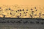 | Amvrakikos Wetlands National Park | 39°06′N 20°55′E / 39.100°N 20.917°E |
| Artificial Lake Kerkini | Central Macedonia | 10,996 hectares (42.46 sq mi) | 1975 | 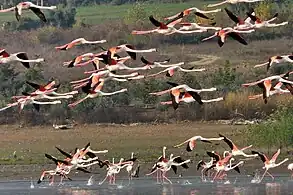 | Lake Kerkini National Park | 41°13′N 23°08′E / 41.217°N 23.133°E |
| Axios, Loudias, Aliakmon Delta | Central Macedonia | 11,808 hectares (45.59 sq mi) | 1975 | 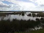 | Axios-Loudias-Aliakmonas National Park | 40°30′N 22°43′E / 40.500°N 22.717°E |
| Evros Delta | Eastern Macedonia and Thrace | 9,267 hectares (35.78 sq mi) | 1975 | 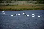 | Evros Delta National Park | 40°50′N 26°04′E / 40.833°N 26.067°E |
| Kotychi lagoons | Western Greece | 6,302 hectares (24.33 sq mi) | 1975 | .jpg.webp) | Kotychi-Strofylia Wetlands National Park | 38°01′N 21°17′E / 38.017°N 21.283°E |
| Lake Mikri Prespa | Western Macedonia | 5,078 hectares (19.61 sq mi) | 1975 | 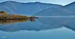 | Prespa National Forest | 40°46′N 21°05′E / 40.767°N 21.083°E |
| Lakes Volvi & Koronia | Central Macedonia | 16,388 hectares (63.27 sq mi) | 1975 | .jpg.webp) | National Park of Koronia and Volvi Lakes | 40°41′N 23°20′E / 40.683°N 23.333°E |
| Lake Vistonis, Porto Lagos, Lake Ismaris & adjoining lagoons | Eastern Macedonia and Thrace | 24,396 hectares (94.19 sq mi) | 1975 |  | National Park of East Macedonia-Thrace | 41°03′N 25°11′E / 41.050°N 25.183°E |
| Messolonghi lagoons | Western Greece | 33,687 hectares (130.07 sq mi) | 1975 | 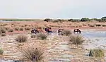 | National Park of Messolonghi-Aitoliko lagoons, lower reaches and estuaries of Acheloos and Evinos rivers, and Echinades islands | 38°20′N 21°15′E / 38.333°N 21.250°E |
| Nestos delta & adjoining lagoons | Eastern Macedonia and Thrace | 21,930 hectares (84.7 sq mi) | 1975 |  | National Park of East Macedonia-Thrace | 40°54′N 24°47′E / 40.900°N 24.783°E |
See also
References
- 1 2 "Ramsar". Ramsar. Retrieved 14 May 2022.
- ↑ "Country Profiles: Greece". Ramsar. Retrieved 14 May 2022.
External links
Wikimedia Commons has media related to Ramsar sites in Greece.
This article is issued from Wikipedia. The text is licensed under Creative Commons - Attribution - Sharealike. Additional terms may apply for the media files.