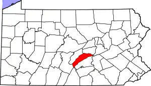
Location of Juniata County in Pennsylvania
This is a list of the Pennsylvania state historical markers in Juniata County.
This is intended to be a complete list of the official state historical markers placed in Juniata County, Pennsylvania by the Pennsylvania Historical and Museum Commission (PHMC). The locations of the historical markers, as well as the latitude and longitude coordinates as provided by the PHMC's database, are included below when available. There are five historical markers located in Juniata County.[1]
Historical markers
| Marker title | Image | Date dedicated | Location | Marker type | Topics |
|---|---|---|---|---|---|
| Fort Bigham | April 1, 1947 | SR 3001 (old U.S. 22 & 322), .8 mile NW of Mexico 40°32′48″N 77°21′59″W / 40.5467°N 77.36633°W |
Roadside | Forts, French & Indian War, Military, Native American | |
| Juniata County | June 27, 1982 | County Courthouse, Mifflintown 40°34′13″N 77°33′47″W / 40.5702°N 77.56293°W |
City | Government & Politics, Government & Politics 19th Century, Transportation | |
| Patterson's Fort | April 1, 1947 | Wm. Penn Hwy. (SR 3001 / old US 22/322), near Gill Rd. (Rt. 382), .1 mile E of Mexico 40°32′09″N 77°21′03″W / 40.5359°N 77.35072°W |
Roadside | French & Indian War, Military, Native American | |
| Tuscarora Academy | 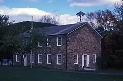 |
March 20, 1968 | At site, SR 3017 (former LR 34005), Academia |
Roadside | Education, Religion |
| Tuscarora Path | April 1, 1947 | Wm. Penn Hwy. (SR 3002 / old US 22/322) near Henry Crossroad Rd. (PA 75), .9 mile NW of Mexico 40°32′51″N 77°22′05″W / 40.54757°N 77.36793°W |
Roadside | Native American, Paths & Trails, Transportation |
See also
References
- ↑ "PHMC Historical Markers Search" (Searchable database). Pennsylvania Historical and Museum Commission. Commonwealth of Pennsylvania. Retrieved 2010-07-19.
External links
Municipalities and communities of Juniata County, Pennsylvania, United States | ||
|---|---|---|
| Boroughs | | |
| Townships | ||
| CDPs | ||
| Unincorporated communities | ||
| Footnotes | ‡This populated place also has portions in an adjacent county or counties. | |

This article is issued from Wikipedia. The text is licensed under Creative Commons - Attribution - Sharealike. Additional terms may apply for the media files.