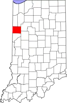
Location of Benton County in Indiana
This is a list of the Indiana state historical markers in Benton County.
This is intended to be a complete list of the official state historical markers placed in Benton County, Indiana, United States by the Indiana Historical Bureau. The locations of the historical markers and their latitude and longitude coordinates are included below when available, along with their names, years of placement, and topics as recorded by the Historical Bureau. There are 3 historical markers located in Benton County.[1]
Historical markers
| Marker title | Image | Year placed | Location | Topics |
|---|---|---|---|---|
| New Purchase Boundary (Treaty of St. Mary's)[2] |  |
1966 | State Road 18, 2.5 miles west of its junction with U.S. Route 52 in Fowler and 0.5 miles east of U.S. Route 41 40°37′20″N 87°22′20″W / 40.62222°N 87.37222°W |
Early Settlement and Exploration, American Indian/Native American, Government Institutions |
| Benton County Courthouse[3] | 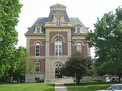 |
1995 | 705 E. Sixth Street at the eastern entrance of the courthouse in Fowler 40°37′2″N 87°18′56″W / 40.61722°N 87.31556°W |
Buildings and Architecture, Government Institutions |
| Dan Patch[4] |  |
1999 | 203 S. Michigan Road, near the intersection of State Roads 55 and 352 on the eastern edge of Oxford 40°31′10″N 87°14′42.5″W / 40.51944°N 87.245139°W |
Sports |
See also
References
- ↑ "Indiana Historical Markers by County". State of Indiana. Retrieved 2012-03-15.
- ↑ New Purchase Boundary (Treaty of St. Mary's), Indiana Historical Bureau, n.d. Accessed 2012-03-14.
- ↑ Benton County Courthouse, Indiana Historical Bureau, n.d. Accessed 2012-03-14.
- ↑ Dan Patch, Indiana Historical Bureau, n.d. Accessed 2012-03-14.
External links
Municipalities and communities of Benton County, Indiana, United States | ||
|---|---|---|
| Towns | Map of Indiana highlighting Benton County | |
| Townships | ||
| CDPs | ||
| Other communities |
| |
| Ghost towns | ||
| Footnotes | ‡This populated place also has portions in an adjacent county or counties | |
This article is issued from Wikipedia. The text is licensed under Creative Commons - Attribution - Sharealike. Additional terms may apply for the media files.