Ličartovce | |
|---|---|
Municipality | |
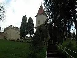 Church of Saint Martin | |
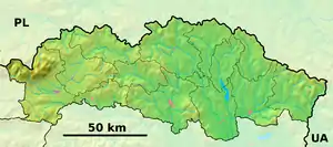 Ličartovce Location of Ličartovce in the Prešov Region 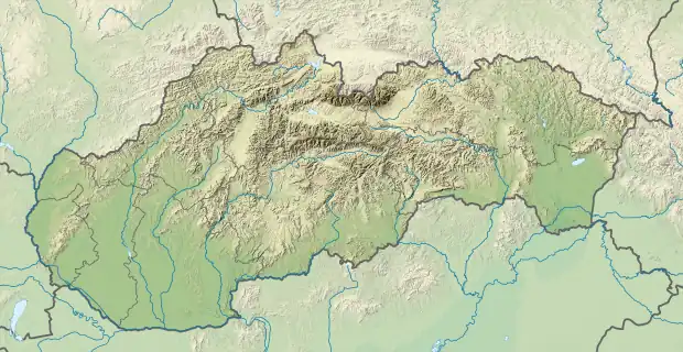 Ličartovce Location of Ličartovce in Slovakia | |
| Coordinates: 48°52′30″N 21°14′51″E / 48.87500°N 21.24750°E | |
| Country | Slovakia |
| Region | Prešov |
| District | Prešov |
| First mentioned | 1249 |
| Government | |
| • Mayor | Pavol Jurko |
| Area | |
| • Total | 8.29 km2 (3.20 sq mi) |
| Elevation | 282 m (925 ft) |
| Population (31 December 2021) | |
| • Total | 949 |
| • Density | 110/km2 (300/sq mi) |
| Time zone | UTC+1 (CET) |
| • Summer (DST) | UTC+2 (CEST) |
| Postal code | 082 03 (Lemešany) |
| Area code | 421-51 |
| Car plate | PO |
| Website | www |
Ličartovce is a village and municipality in Prešov District in the Prešov Region of eastern Slovakia.
History
In historical records the village was first mentioned in 1249.
Geography
The municipality lies at an altitude of 243 metres and covers an area of 8.28 km2 (3.20 sq mi) (2020-06-30/-07-01).[1]
References
- ↑ "Statistic of Slovak places by Dušan Kreheľ – Export". Retrieved 2021-07-05.
External links
 Media related to Ličartovce at Wikimedia Commons
- Official website

- https://web.archive.org/web/20070427022352/http://www.statistics.sk/mosmis/eng/run.html
- https://web.archive.org/web/20070913225916/http://www.licartovce.ocu.sk/
This article is issued from Wikipedia. The text is licensed under Creative Commons - Attribution - Sharealike. Additional terms may apply for the media files.