Lewoleba | |
|---|---|
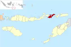
 Location of Lembata in East Nusa Tenggara Province | |
 Lewoleba | |
| Coordinates: 8°23′S 123°24′E / 8.383°S 123.400°E | |
| Country | Indonesia |
| Region | Lesser Sunda Islands |
| Province | East Nusa Tenggara |
| Regency | Lembata |
Lewoleba is a town and also the capital of the Lembata Regency, East Nusa Tenggara province of Indonesia. It is located in Nubatukan District on Lembata Island.[1]
Transportation
The town is served by Wonopito Airport.
Climate
Lewoleba has a tropical savanna climate (Aw) with long dry season and short wet season.
| Climate data for Lewoleba | |||||||||||||
|---|---|---|---|---|---|---|---|---|---|---|---|---|---|
| Month | Jan | Feb | Mar | Apr | May | Jun | Jul | Aug | Sep | Oct | Nov | Dec | Year |
| Mean daily maximum °C (°F) | 30.1 (86.2) |
29.8 (85.6) |
30.2 (86.4) |
31.0 (87.8) |
31.2 (88.2) |
30.7 (87.3) |
30.3 (86.5) |
30.4 (86.7) |
30.7 (87.3) |
31.2 (88.2) |
31.5 (88.7) |
30.6 (87.1) |
30.6 (87.2) |
| Daily mean °C (°F) | 26.8 (80.2) |
26.5 (79.7) |
26.5 (79.7) |
26.8 (80.2) |
26.9 (80.4) |
26.3 (79.3) |
25.5 (77.9) |
25.4 (77.7) |
25.8 (78.4) |
26.6 (79.9) |
27.7 (81.9) |
27.2 (81.0) |
26.5 (79.7) |
| Mean daily minimum °C (°F) | 23.6 (74.5) |
23.2 (73.8) |
22.9 (73.2) |
22.7 (72.9) |
22.6 (72.7) |
21.9 (71.4) |
20.8 (69.4) |
20.5 (68.9) |
20.9 (69.6) |
22.1 (71.8) |
23.9 (75.0) |
23.9 (75.0) |
22.4 (72.4) |
| Average rainfall mm (inches) | 251 (9.9) |
219 (8.6) |
198 (7.8) |
98 (3.9) |
45 (1.8) |
28 (1.1) |
15 (0.6) |
5 (0.2) |
4 (0.2) |
28 (1.1) |
91 (3.6) |
176 (6.9) |
1,158 (45.7) |
| Source: Climate-Data.org[2] | |||||||||||||
References
- ↑ "Lembata | Profil Lembata | Data Lembata". Archived from the original on 16 January 2013. Retrieved 5 January 2013.
- ↑ "Climate: Lewoleba". Climate-Data.org. Retrieved 18 November 2020.
This article is issued from Wikipedia. The text is licensed under Creative Commons - Attribution - Sharealike. Additional terms may apply for the media files.