Le Mayet-de-Montagne | |
|---|---|
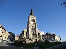 The church in Le Mayet-de-Montagne | |
 Coat of arms | |
Location of Le Mayet-de-Montagne | |
 Le Mayet-de-Montagne 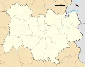 Le Mayet-de-Montagne | |
| Coordinates: 46°04′18″N 3°40′03″E / 46.0717°N 3.6675°E | |
| Country | France |
| Region | Auvergne-Rhône-Alpes |
| Department | Allier |
| Arrondissement | Vichy |
| Canton | Lapalisse |
| Intercommunality | CA Vichy Communauté |
| Government | |
| • Mayor (2020–2026) | Jean-Pierre Raymond[1] |
| Area 1 | 29.03 km2 (11.21 sq mi) |
| Population | 1,387 |
| • Density | 48/km2 (120/sq mi) |
| Time zone | UTC+01:00 (CET) |
| • Summer (DST) | UTC+02:00 (CEST) |
| INSEE/Postal code | 03165 /03250 |
| Elevation | 415–880 m (1,362–2,887 ft) (avg. 543 m or 1,781 ft) |
| 1 French Land Register data, which excludes lakes, ponds, glaciers > 1 km2 (0.386 sq mi or 247 acres) and river estuaries. | |
Le Mayet-de-Montagne (French pronunciation: [lə majɛ də mɔ̃taɲ]; Occitan: Lo Maiet de Montanha) is a commune in the Allier department in central France.
Geography
Le Mayet-de-Montagne is situated 16.6 miles south of Vichy in the north part of the Massif Central. It is situated at an altitude of around 1,800 feet.
History
In 1334, le Mayet de Montagne belonged to Auvergne. The counts of Auvergne considered Le Mayet to be of great strategic value, and they held onto the town until 1589, when Henri IV decided to alter the borders of Bourbonnais to include Le Mayet.
Le Mayet became the chef-lieu of its eponymous canton in 1790.
Population
| Year | Pop. | ±% |
|---|---|---|
| 1962 | 1,577 | — |
| 1968 | 1,694 | +7.4% |
| 1975 | 1,761 | +4.0% |
| 1982 | 1,664 | −5.5% |
| 1990 | 1,609 | −3.3% |
| 1999 | 1,598 | −0.7% |
| 2008 | 1,537 | −3.8% |
| 2012 | 1,519 | −1.2% |
| Source: INSEE (1968–2012) | ||

Old view of the church and square
See also
References
- ↑ "Répertoire national des élus: les maires" (in French). data.gouv.fr, Plateforme ouverte des données publiques françaises. 13 September 2022.
- ↑ "Populations légales 2021". The National Institute of Statistics and Economic Studies. 28 December 2023.
Wikimedia Commons has media related to Le Mayet-de-Montagne.
This article is issued from Wikipedia. The text is licensed under Creative Commons - Attribution - Sharealike. Additional terms may apply for the media files.