Lalgola | |
|---|---|
census town | |
 Lalgola Location in West Bengal, India | |
| Coordinates: 24°25′N 88°15′E / 24.42°N 88.25°E | |
| Country | |
| State | West Bengal |
| District | Murshidabad |
| Government | |
| • Type | Panchayat |
| Area | |
| • Total | 134 km2 (52 sq mi) |
| Elevation | 23 m (75 ft) |
| Population (2001) | |
| • Total | 267,563 |
| • Density | 2,000/km2 (5,200/sq mi) |
| Languages | |
| • Official | Bengali, English |
| Time zone | UTC+5:30 (IST) |
| PIN | 742148 |
| Sex ratio | 955 ♀ / 1000 ♂ |
| Lok Sabha constituency | Jangipur |
| Vidhan Sabha constituency | Lalgola |
| Website | murshidabad |
Lalgola is a census town in the Lalgola CD block in the Lalbag subdivision of Murshidabad district, West Bengal. It is situated about 225 kilometres (140 mi) north of Kolkata, near the head of the Ganges delta. It is a terminal railway station on the Ranaghat-Lalgola branch line. The distance between Lalgola railway station and Krishnapur railway station is one of the shortest distance between two railway stations in India (1.7 km). It is also a border checkpoint but presently non functional due to some unknown reasons.
Backdrop
Lalgola is a trading hub situated near Bangladesh-India border surrounded by a number of large and small lakes (dighis).It was a settlement which came into existence after the Permanent Settlement in Bengal in 1793 by the Bhumihar Brahmin (Kaushik Gotra of kusaunjhiya Clan) Zamindar employed by the British East India Company. It was one of the prominent businesses hubs in then Murshidabad. Mainly agricultural products were collected and exported to different corner of the country. The remnant of the Palaces, called Rajbari, is still present. In one of these palaces Lalgola Open Air Correctional Home is established. It is the only one open air correctional home in West Bengal which runs here since 1986. The Lalgola Palace had been gifted to the government by Maharaja Jogendra Narayan Rai.
Geography
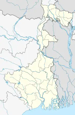
M: municipal town, CT: census town, R: rural/ urban centre, H: historical place
Owing to space constraints in the small map, the actual locations in a larger map may vary slightly
Location
Lalgola is located at 24°25′N 88°15′E / 24.42°N 88.25°E.[1] It is located near the Padma River, which is the principal distributary of the Ganges, and which forms the border between India and Bangladesh in this area; thus Bangladesh bounds the town on the north and east. The average elevation is about 23 metres (75 ft)
The climate is similar to the rest of Gangetic West Bengal. The maximum temperature during the summer is about 45 °C (113 °F); the minimum during the winter is between 8 and 10 °C (46 and 50 °F).
Border checkpoint
Lalgola is a border checkpoint on the Bangladesh-India border. On the other side is Godagiri, across the Padma.[2][3]
Area overview
While the Lalbag subdivision is spread across both the natural physiographic regions of the district, Rarh and Bagri, the Domkal subdivision occupies the north-eastern corner of Bagri. In the map alongside, the Ganges/ Padma River flows along the northern portion. The border with Bangladesh can be seen in the north and the east. Murshidabad district shares with Bangladesh a porous international border which is notoriously crime prone (partly shown in this map). The Ganges has a tendency to change course frequently, causing severe erosion, mostly along the southern bank.[4][5][6][7] The historic city of Murshidabad, a centre of major tourist attraction, is located in this area. In 1717, when Murshid Quli Khan became Subahdar, he made Murshidabad the capital of Subah Bangla (then Bengal, Bihar and Odisha).[8] The entire area is overwhelmingly rural with over 90% of the population living in the rural areas.[9]
Note: The map alongside presents some of the notable locations in the subdivisions. All places marked in the map are linked in the larger full screen map.
Civic administration
Police station
Lalgola police station has jurisdiction over Lalgola CD block.[10]
CD block HQ
The headquarters of Lalgola CD block are located at Lalgola.[11]
Open Air Jail
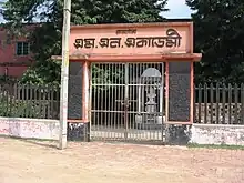
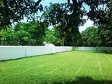
Probably, the most special thing about Lalgola is that, the first 'Open Air Jail', officially Lalgola Open Air Correctional Home, was founded here in the year 1987. For this purpose Sri Birendra Narayan Roy, popularly known as Biren Roy, descendants of Lalgola Raj family and erstwhile king of Lalgola, gifted their residential palace to the Government. Royal residence made way first for female lunatic convicts and later, from 1987, the open-air correctional home. Open Air Correctional Home is a relatively new and revolutionary concept. Situated over 100 acres (0.40 km2) of land and mango garden containing about 1000 mango trees, this Open Air Jail is a correction home for the prisoners. Convicts sentenced to imprisonment for a period of 7 years or more and such of them as have already served 2/3 of their sentence and have maintained all along a good jail record are eligible for transfer to the open jail after thorough screening and personal interview by a board constituted for such selection. Surprisingly, inmates get freedom to go out during day time (06:00 hrs to 20:00 hrs). They have their own source of income in the forms of cultivation, goods shops (given by the Prison Authority), Private Tuition. They even get quarters for their families.
Demographics
According to the 2011 Census of India, Lalgola had a total population of 31,698, of which 16,147 (51%) were males and 15,551 (49%) were females. Population in the age range 0–6 years was 4,290. The total number of literate persons in Lalgola was 19,797 (72.23% of the population over 6 years).[12]
Economy
As a trading town and transit point for farm products, Lalgola is visited daily by hundreds of people from the surrounding villages.
Education
Lalgola College was established in 2006 and began offering courses in the 2007–08 academic year, under the University of Kalyani.

The Lalgola Mahesh Narayan Academy provides education up to class XII. It was established in 1914 by Maharaja Jogendra Narayan Ray, the Maharaja of Lalgola, in memory of his foster father.
The Lalgola Rahmatullah High Madrasah was established in 1919. It was also patronized by Maharaja. Initially it was affiliated with Dhaka Board. It is now affiliated to West Bengal Board of Madrasa Education .
Other schools include Sekhalipur High School (H.S), Sailaja Memorial Girls' High School and Laskarpur High School (HS) Al Mahadus Salafi10th standard Bengali Medium School privately organised, for Muslims and Shree Padmaprava Digamber Jain Vidyalaya English Medium School, Synergy Mission School, Ramkrishna Vidyapith; and Chamapara Primary School.
A public library, the Lalgola Mahesh Narayan Academy Town Library, was established in 1913.
Keeping in mind the value of advanced education, 4 new colleges have started in lalgola. (BMTTI) Belayat Munsi Teachers Training College (D.Ed and B.Ed) courses degree, Abdus Sattar Memorial College of Education, Madan Mohan Roy Teachers Training College, The Agnibina College of Education (D.Ed)
Culture
Almost all major and minor Hindu and Muslim festivals are celebrated here. A popular Bengali proverb is baro mase tero parbon, translated as thirteen festivals in twelve months.
One of the main festivals is the Hindu Durga Puja, when pandals (ceremonial structures) are constructed throughout the town.

The Muslim Eid ul-Fitr and Eid al-Adha is also celebrated here. A number of local festivals are also held, including the local Flower Show and Exhibition, held every January since 1986 and also a Local Football event called Lalgola Challenge Cup which is organised by the local voluntary organization.
Healthcare
There is one hospital in the town, Krishnapur Primary Health Centre. A number of local and visiting doctors are also available for consultation. A local voluntary organisation, Lalgola Sanjeeban, works in health-related fields.
See also
References
- ↑ Falling Rain Genomics, Inc - Lalgola
- ↑ "Bangladesh - Getting there and around". Lonely Planet. Retrieved 6 March 2013.
- ↑ "Notification No. 63/94-Cus. (N.T.) dtd 21/11/1994 with amendments - Land Customs Stations and Routes for import and export of goods by land or inland water ways". Archived from the original on 28 January 2012. Retrieved 6 March 2013.
- ↑ "Types and sources of floods in Murshidabad, West Bengal" (PDF). Swati Mollah. Indian Journal of Applied Research, February 2013. Archived from the original (PDF) on 20 August 2017. Retrieved 15 August 2017.
- ↑ "District Census Handbook: Murshidabad, Series 20 Part XII A" (PDF). Physiography, Page 13. Directorate of Census Operations, West Bengal, 2011. Retrieved 24 July 2017.
- ↑ "Murshidabad". Geography. Murshidabad district authorities. Retrieved 24 July 2017.
- ↑ "Child labour, illness & lost childhoods, India's tobacco industry". Edge of Humanity Magazine, 27 December 2020. Retrieved 13 July 2021.
- ↑ "District Gazeteer" (PDF). (in Bengali) Chapter 3: History. Murshidabad District Administration. Retrieved 12 September 2017.
- ↑ "District Census Handbook, Murshidabad, Series 20, Part XII B" (PDF). District Primary Census Abstract page 26. Directorate of Census Operations West Bengal. Retrieved 2 July 2021.
- ↑ "District Statistical Handbook 2014 Murshidabad". Table 2.1. Department of Statistics and Programme Implementation, Government of West Bengal. Archived from the original on 29 July 2017. Retrieved 17 May 2017.
- ↑ "District Census Handbook: Murshidabad, Series 20 Part XII A" (PDF). Map of Murshidabad with CD Block HQs and Police Stations (on the fourth page). Directorate of Census Operations, West Bengal, 2011. Retrieved 27 August 2017.
- ↑ "C.D. Block Wise Primary Census Abstract Data(PCA)". West Bengal – District-wise CD Blocks. Registrar General and Census Commissioner, India. Retrieved 27 August 2017.
