| Päijänne | |
|---|---|
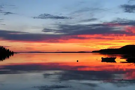 Päijänne and Päijätsalo | |
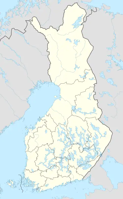 Päijänne | |
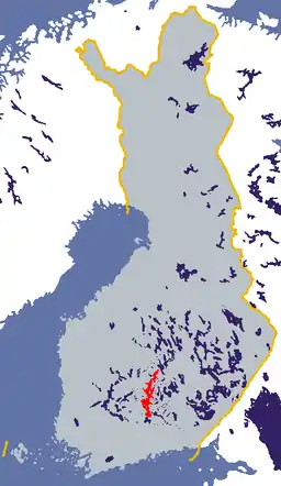 | |
| Coordinates | 61°35′N 025°30′E / 61.583°N 25.500°E |
| Primary outflows | Kymi River |
| Basin countries | Finland |
| Max. length | 120 km (75 mi) |
| Surface area | 1,070–1,082.89 km2 (413.13–418.11 sq mi)[1][2] |
| Average depth | 16.2–18 m (53–59 ft)[1] |
| Max. depth | 95.3 m (313 ft)[1] |
| Water volume | 18.1 km3 (4.3 cu mi)[1] |
| Residence time | 2.5 years |
| Surface elevation | 78.3 m (257 ft)[2] |
| Islands | 1886 (Virmailansaari, Salonsaari, Judinsalo, Onkisalo, Paatsalo, Muuratsalo, Haukkasalo, Vuoritsalo, Mustassalo, Edessalo, Taivassalo) |
| Settlements | Asikkala, Jyväskylä, Korpilahti, Kuhmoinen, Luhanka, Muurame, Padasjoki, Sysmä |
| References | [2][1] |
Lake Päijänne (Finnish pronunciation: [ˈpæi̯jænːe]) is the second largest lake in Finland (1,080 km2 (266,874 acres)). The lake drains into the Gulf of Finland via the Kymi River. The major islands are from north to south Vuoritsalo, Muuratsalo, Onkisalo, Judinsalo, Edessalo, Taivassalo, Haukkasalo, Vehkasalo, Mustassalo, Virmailansaari and Salonsaari. The largest island is Virmailansaari. The word saari means an island. Salo once meant a great island, nowadays it means a great forest area.
The largest city on the shores of Päijänne is Jyväskylä in the North. The city of Lahti is connected to Päijänne through Lake Vesijärvi and Vääksy canal.
An underground aqueduct, Päijänne Water Tunnel, connects the lake to Vantaa, providing the Greater Helsinki area with water. The deepest point in any lake in Finland is located in Päijänne (95.3 m or 313 ft).
The name of Lake Päijänne comes possibly from a Pre-Finno-Ugric substrate language.[3]
Transportation
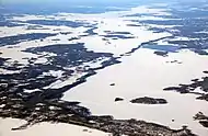
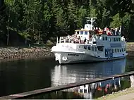
Päijänne is a famous boating, canoeing and sailing attraction. The 119 kilometres (74 mi) long lake is connected by canals to Lake Keitele, Lake Vesijärvi and to Lake Ruotsalainen. Length of the open waterway for ships is 380 kilometres (240 mi). Construction of canals connecting Päijänne to the Baltic Sea has been discussed for decades. Nevertheless, the plan is still to be materialized.
Until the 1940s Lake Päijänne was a major transportation channel in the Central Finland. Numerous ships transported passengers and freight between the villages and cities on the shores of Päijänne. Nowadays, passenger transportation is rather a tourist attraction on the lakelands than the fastest way connecting the cities and villages. One of the most popular passenger transportation routes in summertime is between the cities of Lahti and Jyväskylä.
| Name | Built | Passengers | Length | Width | Speed | Home harbour |
|---|---|---|---|---|---|---|
| M/S Aino | 1922 | 90 | 17,20 m | 4,10 m | 11 knots | Lahti[4] |
| M/S Elbatar | 1984 | 90 | 16,08 m | 4,78 m | 11 knots | Padasjoki[5] |
| M/S Charlotte | Padasjoki | |||||
| M/S Happy Days | Lahti | |||||
| M/S Hilja | 1902 | 60 | Jyväskylä, charter ferry[6] | |||
| M/S Jenni-Maria II | 1970 | 30 | 15,30 m | 3,80 m | 15 knots | Sysmä |
| M/S Katrilli | 80 | Jyväskylä, charter ferry[7] | ||||
| M/S Kymppi | 77 | Jyväskylä, charter ferry[7] | ||||
| S/S Laitiala | 1903 | 130 | 26,7 m | 6,64 m | Lahti, charter ferry[4] | |
| M/S Meininki | 1970 | 30 | Jyväskylä, charter ferry[8] | |||
| M/S Minni | Jyväskylä | |||||
| M/S Päijänne | 50 | 20 m | 5 m | Jyväskylä, charter ferry[9] | ||
| M/S Rhea | 43 m | 8,2 m | Jyväskylä[10] | |||
| M/S Rosetta | Lahti, charter ferry[11] | |||||
| M/S Ruotsalainen | 22,10 m | 5,32 m | Asikkala | |||
| M/S Salome | 18,90 m | 4,35 m | Lahti, charter ferry | |||
| M/S Suometar | 199 | Jyväskylä[7] | ||||
| M/S Suomen Neito | 199 | Jyväskylä[7] | ||||
| M/S Suomen Suvi | 1993 | 199 | Jyväskylä[7] | |||
| S/S Suomi | 1906 | 199 | 31,60 m | 2,13 m | Jyväskylä[7][12] | |
| M/S Terhi | 199 | Heinola | ||||
| M/S Tuulikki II | 170 | Jämsä[13] | ||||
| M/S Tuulikki III | 80 | Jämsä[13] | ||||
| M/S Wellamo | 1990 | 190 | Lahti[4] |
Tourism
There are 16,000 cottages on the shores of Päijänne. Most of the cottages are private owned and have a separate sauna cottage.[14]
In addition to cottage tourism Päijänne attracts fishing, sailing, canoeing, rowing, paddling, trekking, ice-skating, snow mobile and nature tourists. The National Parks of Päijänne and Leivonmäki alone has tens of thousands of visitors every year.
The Clear and Drinkable Lake Päijänne South Association won a Tourism and Environment award presented by the European Union Commission in 1995.[15]
National Parks
Päijänne National Park (Finnish: Päijänteen kansallispuisto) is a national park in the southern parts of Lake Päijänne. It consists of 50 unbuilt islands and parts of inhabited islands. The national park has been established in 1993 and has an area of 14 square kilometres (5.4 sq mi).[16]
Leivonmäki National Park is situated few kilometres North East from the Northern part of Lake Päijänne. It is one of the youngest national parks in Finland.
Cities and towns upon Lake Päijänne
From North to South
- Jyväskylä (at 62°14.5′N 025°44.5′E / 62.2417°N 25.7417°E)
- Säynätsalo (at 62°08.3′N 025°46.9′E / 62.1383°N 25.7817°E)
- Muurame (at 62°08′N 025°40.5′E / 62.133°N 25.6750°E)
- Toivakka (at 62°06′N 026°05′E / 62.100°N 26.083°E)
- Korpilahti (at 62°01′00″N 025°33′40″E / 62.01667°N 25.56111°E)
- Jämsä (at 61°52′N 025°11′E / 61.867°N 25.183°E)
- Luhanka (at 61°48′N 025°42′E / 61.800°N 25.700°E)
- Joutsa (at 61°44.5′N 026°07′E / 61.7417°N 26.117°E)
- Kuhmoinen (at 61°34′N 025°11′E / 61.567°N 25.183°E)
- Sysmä (at 61°30′N 025°41′E / 61.500°N 25.683°E)
- Padasjoki (at 61°21′N 025°16.5′E / 61.350°N 25.2750°E)
- Asikkala (at 61°10′20″N 025°32′50″E / 61.17222°N 25.54722°E)
Gallery
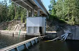 Kalkkinen canal
 Pulkkilanharju and Karisalmi Bridge in Asikkala
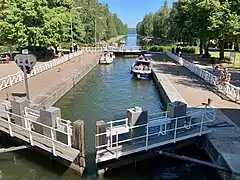 Vääksy canal between Päijänne and Lake Vesijärvi
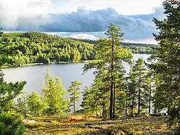 View from Hill Satasarvinen in Muuratsalo, Jyväskylä
 Kärkinen bridge in Korpilahti, Jyväskylä during the Päijännepurjehdus sailing competition
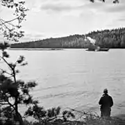 Tugboat pulling logs in Päijänne in 1930s
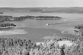 Päijänne from the Puolakanvuori hill in 1948
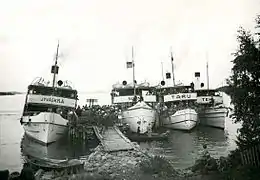 Passenger steam ships S/S Jyväskylä, S/S Suomi, S/S Taru and S/S Tehi in Pihlajakoski harbour, Kuhmoinen in 1938
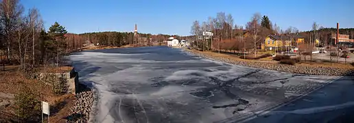 Vaajakoski canal in the Northern end of Lake Päijänne
See also
References
- 1 2 3 4 5 Seppälä, Matti (2005), The Physical Geography of Fennoscandia, Oxford University Press, p. 145, ISBN 978-0-19-924590-1
- 1 2 3 Päijänne. Järviwiki Web Service. Finnish Environment Institute. Retrieved 2014-03-07. (in English)
- ↑ "Saimaa".
- 1 2 3 "TIETOA LAIVOISTA::Lahden Järvimatkailu Oy". Lahdenjarvimatkailu.fi. Archived from the original on 10 January 2019. Retrieved 28 December 2017.
- ↑ "Sivut ovat siirtyneet". Archived from the original on 2009-07-09. Retrieved 2011-09-27.
- ↑ "Laivan tilat". Archived from the original on 2007-09-28. Retrieved 2011-09-27.
- 1 2 3 4 5 6 "PÄIJÄNNE RISTEILYT HILDEN OY: Laivat". Archived from the original on 2011-09-03. Retrieved 2011-09-27.
- ↑ "Merimeininki". Merimeininki.fi. Retrieved 28 December 2017.
- ↑ "M/S Päijänne". Mspaijanne.fi. Retrieved 28 December 2017.
- ↑ "Päijänneristeilyt Jyväskylässä - Risteilyt Jyväskylästä". Matkarhea.fi. Retrieved 28 December 2017.
- ↑ "Päijännettä pohjoiseen - Risteilyt". www.paijannettapohjoiseen.com. Archived from the original on 2 July 2007. Retrieved 15 January 2022.
- ↑ "Archived copy". www.elka.fi. Archived from the original on 26 June 2002. Retrieved 15 January 2022.
{{cite web}}: CS1 maint: archived copy as title (link) - 1 2 "Päijännematkat Koskinen, Jämsä". Paijannematkat.com. Retrieved 28 December 2017.
- ↑ Koskinen, Petri. "Täyttä mökkielämää". Talouselämä. Retrieved 28 December 2017.
- ↑ Etelä-Päijänne, Juotavan Hyvä. "Etelä-Päijänne - majoitus, ohjelmapalvelut ja ravintolat Järvi-Suomessa". Loma-paijanne.fi. Archived from the original on 13 February 2013. Retrieved 28 December 2017.
- ↑ "PÄIJÄNTEEN KANSALLISPUISTO" (in Finnish). visitpaijanne.fi. Retrieved 7 April 2020.
External links
 Media related to Päijänne at Wikimedia Commons