| Lake Lillinonah | |
|---|---|
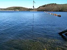 Lake Lillinonah near the Shepaug Dam, April 10, 2010 | |
 Lake Lillinonah  Lake Lillinonah | |
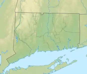
| Location | Fairfield, Litchfield and New Haven counties, Connecticut |
| Coordinates | 41°28′08″N 73°18′43″W / 41.469°N 73.312°W |
| Type | Reservoir |
| Managing agency | Lake Lillinonah Authority, CL&P |
| First flooded | September 27, 1955 |
| Max. length | 12 to 14 mi (19 to 23 km) |
| Surface area | 1,547 to 1,900 acres (626 to 769 ha) |
| Max. depth | 110 ft (34 m) |
| Shore length1 | 45 mi (72 km) |
| Surface elevation | 59 m (194 ft)[1] |
| References | [2] |
| 1 Shore length is not a well-defined measure. | |
Lake Lillinonah /ˌlɪlɪˈnoʊnə/ is a manmade lake located in Fairfield, Litchfield and New Haven counties of Western Connecticut, approximately 60 miles (97 km) northeast of New York City.[3] It is the second largest lake in Connecticut, smaller only than Candlewood Lake.[3] The lake is bordered by six towns: Brookfield, Bridgewater, Newtown, New Milford, Roxbury, and Southbury.[3] It was formed in 1955 by impoundment of the Housatonic River and the Shepaug River by the Shepaug Dam which was built by the Connecticut Light and Power Company.[3] Some of the most expensive real estate in the Greater Danbury area is located on the shores of the lake, in the towns of Brookfield, Bridgewater and Newtown.
References
Wikimedia Commons has media related to Lake Lillinonah.
Wikivoyage has a travel guide for Lake Lillinonah.
- ↑ U.S. Geological Survey Geographic Names Information System: Lake Lillinonah
- ↑ "About". Lake Lillinonah Authority. Retrieved 2012-06-08.
- 1 2 3 4 Jeffrey, Angie (2005-08-16). "Lake Lillinonah has colorful history". The News-Times. Retrieved 2012-03-26.
External links
This article is issued from Wikipedia. The text is licensed under Creative Commons - Attribution - Sharealike. Additional terms may apply for the media files.