Koclířov | |
|---|---|
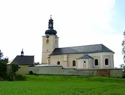 Church of Saints James the Great and Philomena | |
 Flag  Coat of arms | |
 Koclířov Location in the Czech Republic | |
| Coordinates: 49°45′59″N 16°32′24″E / 49.76639°N 16.54000°E | |
| Country | |
| Region | Pardubice |
| District | Svitavy |
| First mentioned | 1347 |
| Area | |
| • Total | 17.28 km2 (6.67 sq mi) |
| Elevation | 502 m (1,647 ft) |
| Population (2023-01-01)[1] | |
| • Total | 754 |
| • Density | 44/km2 (110/sq mi) |
| Time zone | UTC+1 (CET) |
| • Summer (DST) | UTC+2 (CEST) |
| Postal code | 569 11 |
| Website | www |
Koclířov is a municipality and village in Svitavy District in the Pardubice Region of the Czech Republic. It has about 800 inhabitants.
Koclířov lies approximately 6 kilometres (4 mi) east of Svitavy, 63 km (39 mi) south-east of Pardubice, and 157 km (98 mi) east of Prague.
Administrative parts
The village of Hřebeč is an administrative part of Koclířov.
References
Wikimedia Commons has media related to Koclířov.
This article is issued from Wikipedia. The text is licensed under Creative Commons - Attribution - Sharealike. Additional terms may apply for the media files.