| Kirgizjangal Pass (Kekeate Pass) (Heiqiazi Pass) | |
|---|---|
| Heika/Heiqia Pass | |
 Westbound view with the many hairpin turns | |
| Elevation | 4,909 m (16,106 ft) |
| Traversed by | |
| Location | Kargilik County and Hotan County in Xinjiang, China |
| Range | Kunlun Mountains |
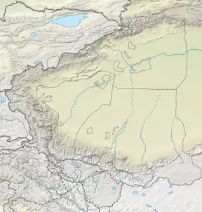
| Coordinates | 36°25′52″N 77°34′44″E / 36.431°N 77.579°E |
 Kirgizjangal Pass (Kekeate Pass) (Heiqiazi Pass) | |
| Kekeate Pass | |||||||
|---|---|---|---|---|---|---|---|
| Traditional Chinese | 柯克阿特達坂 | ||||||
| Simplified Chinese | 柯克阿特达坂 | ||||||
| |||||||
| Heiqiazi Daban | |||||||
| Traditional Chinese | 黑卡子達坂 | ||||||
| Simplified Chinese | 黑卡子达坂 | ||||||
| Literal meaning | Black hairpin pass | ||||||
| |||||||
| Heiqia Pass | |||||||
| Traditional Chinese | 黑恰達坂 | ||||||
| Simplified Chinese | 黑恰达坂 | ||||||
| |||||||
Kekeate Pass[1][2] (Chinese: 柯克阿特达坂; pinyin: Kēkèā'ěrtè Dábǎn), also refer to it as Heiqiazi Pass, Heika Pass or Heiqia Daban[hqz](Chinese: 黑卡子达坂; pinyin: Hēiqiǎzi Dábǎn; lit. 'black hairpin pass') is a mountain pass along the China National Highway 219 with numerous hairpin turns.[3] The mountain pass connects the Yarkand River valley to the west with the Karakash River valley to the east. Located at 309 kilometres (192 mi) from the northern terminus of the G219 highway,[4] it is between the village of Mazar in Kargilik County and the town of Xaidulla in Hotan County near the boundary of the two counties. Western sources often known it as as Kirgizjangal Pass,[5]
History
The name Kirgizjangal references the nearby historically infamous location of Kirghiz Jangal (Chinese: 黑黑子将杆/黑黑孜江干[6][hhz]), which literally means "Kirghiz jungle" or "Kirghiz thicket."[7] Located about 10 kilometres (6 mi) to the west, it was a location best avoided by caravan traders between the Indian subcontinent and Tarim Basin (southern Xinjiang). Prior to the Qing dynasty conquest of Xinjiang, the area was inhabited by Kirghiz nomads.[7] The Kirghiz from the region were known to be bandits. They would rob caravans and sell its crew into slavery in Badakhshan.[8] When the Qing dynasty first took control of the region in the late 1700s, they expelled the Kirghiz from the area.[7] However, when the Qing control of region weakened during the Taiping Rebellion and Dungan Revolt in 1850s-1870s, the Kirghiz returned.[8] This along with the economic impacts of those rebellions led to reduction in trade along the caravan route between the Indian subcontinent and Tarim Basin.[9]
There are numerous buildings in the area built to host highway maintenance squads, many of them are now abandoned.[4] In recent years, a few mining operations started to west of the mountain pass producing siderite iron ore and potentially copper.[10][11]
See also
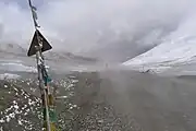
 Eastbound view partly concealed by dust of passing vehicle
_and_environs_1_-_French_Army_map.jpg.webp) French map where it is labelled as Koug-Art.
French map where it is labelled as Koug-Art.
Notes
- hqz - There are numerous variations in the Chinese name, and there are numerous permutations in transcription. In Chinese, the character 卡 is a heteronym with multiple pronunciations. The character 子 is a diminutive modifier in this context thus can be dropped. In addition, 达坂 meaning "mountain pass" is sometimes transcribed phonetically as "Daban".
- hhz - In Chinese, "黑黑子" is an archaic word for Kirghiz.[12]
References
- ↑ Institute of Glaciology and Geocryology (1992). Proceedings of the Symposium on Mountain Glaciology relating to Human Activity held at Lanzhou, Gansu Province, China, 26-30 August 1991. International Glaciological Society. p. 136. ISBN 978-0-946417-08-7.
Kekeate Pass
- ↑ Frank van Rijn (2007). De gouden capuchon (in German). Uitgeverij Elmar. p. 51. ISBN 978-90-389-1729-0.
Kekeate-La
- ↑ "Kirgizjangal Pass". dangerousroads.org. Retrieved 28 January 2020.
Kirgizjangal Pass ... The road to the summit is called 219 National Road, also known as Tibet-Xinjiang Highway. Construction of this road started in 1951, was completed in 1957 and fully paved with asphalt in 2013. ... It's a great climb with many switchbacks.
- 1 2 "骑行新藏线d5:黑恰道班k288 -黑恰达坂k309-赛图拉遗址k350-三十里营房k364" (in Chinese). 不止骑行川藏线攻略 (buzhiqixing.com). 9 March 2019. Archived from the original on 14 June 2021. Retrieved 28 January 2020.
黑恰达坂k309 ... K324路过废弃道班 ... K340处的道班也是废弃道班
- ↑ Stephen Lioy; Bradley Mayhew; Megan Eaves (1 May 2019). Lonely Planet Tibet. Lonely Planet Global Limited. p. 311. ISBN 978-1-78868-583-2.
The road turns east and climbs over the Kirgizjangal Pass (4930m) to the large village of Xaidulla (Sai Tula; 3700m)
- ↑ "黑黑子将杆 (桿)". 历史地名 (in Chinese). guoxuedashi.com. Archived from the original on 28 January 2020. Retrieved 28 January 2020.
在今新疆叶城县东南叶尔羌河东岸黑恰道班。清宣统 《新疆图志》 卷9: "可卡提达坂山口……又十里至黑黑子将杆,柴足草缺。"
- 1 2 3 Royal Asiatic Society of Great Britain and Ireland (1843). Journal of the Royal Asiatic Society. University Press. p. 299.
a placed called Kirghiz thicket, where are the remains of some ruined edifices, that tribe having been resident here before the country was subjected to China: being in the habit of plundering the Kafilas they were expelled. After passing Kirghiz Jangal ...
- 1 2 Hayward, G. W. (1870). "Journey from Leh to Yarkand and Kashgar, and Exploration of the Sources of the Yarkand River". Journal of the Royal Geographical Society of London. 40: 33. doi:10.2307/1798640. ISSN 0266-6235. JSTOR 1798640.
The Kirghiz of Sarikol and Pamir Khurd formerly frequented this pasture ground, used to commit many depredations on the caravans of the merchants trading between Leh and Yarkand. ... Their last great raid took place three years ago, when a band of 120 armed men attacked a large caravan ... their property was seized, and the merchants themselves were sold as slaves into Badakhshan.
- ↑ Report on the Trade and Resources of the Countries on the North-western Boundary of British India. Printed at the Government Press. 1862. p. 69.
the trade of Le has within the last fifteen years, considerably diminished. The civil war in China is one principal cause of the decline. ... the road between Le and Yarkand is not efficiently protected as formerly, and the Kirghiz robbers from Kunjad, in the winter frequently attack the armed caravans.
- ↑ YANG Jinzhong; CHEN Wei; WANG Hui (2017). "Delineation of iron formation in Wenquangou Group along Heiqia Pass in West Kunlun metallogenic belt". Remote Sensing for Land & Resources (in Chinese). 29 (3). doi:10.6046/gtzyyg.2017.03.28. Retrieved 27 January 2020.
- ↑ Qiao Gengbiao; Wang Ping; Wu Yuezhong; Du Wei; Li Shanglin; Chen Denghui; Zhao Xiaojian (2015). "Generality on Metallogenic Regularity of Karakorum Metallogenic Belt in Xinjiang". Journal of Jilin University (Earth Science Edition) (in Chinese). 45 (4). doi:10.13278/j.cnki.jjuese.201504111. Retrieved 27 January 2020.
黑黑孜江干菱铁矿 ... 黑黑孜江干铜矿点
- ↑ 李长林; 张小曼 (1 October 2010). 张西曼集. Beijing Book Co. Inc. p. 52. ISBN 978-7-5438-6846-5.
Kirghiz——汉之坚昆,唐之黠戛斯,现称:吉尔吉斯,黑黑子