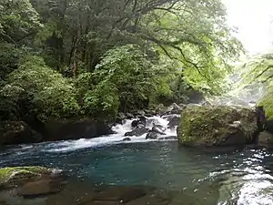
Rapids at Kikuchi River valley
The Kikuchi River (菊池川, Kikuchi-gawa) flows through the northern part of Kumamoto Prefecture, Kyūshū, Japan. The source of the river is Fukaba, Aso city near Mt. Aso at the height of 1041 metres[1] and flows west through the Kikuchi Valley. It turns south near Kikusui and empties into the Shimabara Bay in the Ariake sea. Land reclamation is taking place at its mouth.[2]
The river has a total length of 71 km. It begins at an elevation of 1041 meters and has a catchment area of 995 km2. The width of the river ranges from 24 metres to 72 metres and the current velocity and discharge varies greatly through the year, from 10 to 350 cubic metres per second.[3]
References
- ↑ Okamura, Maya; Minagawa, Tomoko (2016). "Historical and Physical Evaluation of Floodplain Habitats in The River Channel of the Kikuchi River" (PDF). 11th International Symposium on Ecohydraulics (ISE 2016). Engineers Australia: 91–98. ISBN 9780734053398. Archived from the original (PDF) on 2017-12-01. Retrieved 2017-11-22.
- ↑ Ohmoto, T., R. Hirakawa, and K. Watanabe. "Flow pattern and sediment transport in the Kikuchi River mouth." In 6th International Symposium on Environmental Hydraulics. 2010.
- ↑ Higa, Atsushi; Kasai, Fumie; Kawachi, Masanobu; Kumano, Shigeru; Sakayama, Hidetoshi; Miyashita, Mamoru; Watanabe, Makoto M. (2007-03-01). "Seasonality of gametophyte occurrence, maturation and fertilization of the freshwater red alga Thorea okadae (Thoreales, Rhodophyta) in the Kikuchi River, Japan". Phycologia. 46 (2): 160–167. doi:10.2216/05-39.1.
External links

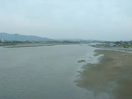
The river at Tamana, Kumamoto.
32°52′47″N 130°31′34″E / 32.879855°N 130.526028°E (mouth)
This article is issued from Wikipedia. The text is licensed under Creative Commons - Attribution - Sharealike. Additional terms may apply for the media files.