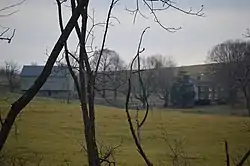
Kennedy–Lunsford Farm | |
 Distant view from the north | |
  | |
| Location | Approximately .5 mi. S of VA 606, near jct. with VA 604, 1194 Raphine Rd., Raphine, Virginia |
|---|---|
| Coordinates | 37°56′07″N 79°16′15″W / 37.93528°N 79.27083°W |
| Area | 161.7 acres (65.4 ha) |
| Built | c. 1775 |
| Architectural style | Georgian |
| NRHP reference No. | 96000592 (original) 99000140[1] (increase) |
| VLR No. | 081-0032 |
| Significant dates | |
| Added to NRHP | June 7, 1996 |
| Boundary increase | February 22, 1999 |
| Designated VLR | June 12, 2002[2] |
Kennedy–Lunsford Farm is a historic home, farm, and national historic district located near Lexington, Rockbridge County, Virginia. The district encompasses six contributing buildings. They are the main house (c. 1775), plus a large bank barn, a corn crib / machinery shed, a spring house, a chicken coop and a syrup house, all dating from the early-20th century. The main house is a two-story, three-bay, vernacular Georgian style stone dwelling with a gable roof and interior end chimneys. It has a single bay, gable roofed front porch and two-story rear frame ell.[3][4]
It was listed on the National Register of Historic Places in 1996.[1]
References
- 1 2 "National Register Information System". National Register of Historic Places. National Park Service. July 9, 2010.
- ↑ "Virginia Landmarks Register". Virginia Department of Historic Resources. Retrieved June 5, 2013.
- ↑ William T. Frazier and Lisa Marie Tucker (October 1995). "National Register of Historic Places Inventory/Nomination: Kennedy–Lunsford Farm" (PDF). Virginia Department of Historic Resources. and Accompanying photo
- ↑ Calder Loth (September 1998). "National Register of Historic Places Inventory/Nomination: Kennedy–Lunsford Farm" (PDF). Virginia Department of Historic Resources.
This article is issued from Wikipedia. The text is licensed under Creative Commons - Attribution - Sharealike. Additional terms may apply for the media files.

