Katthivakkam
ennore | |
|---|---|
Neighbourhood | |
 Katthivakkam Location in Chennai (North), Tamil Nadu, India Show map of Chennai Katthivakkam Katthivakkam (Tamil Nadu) Show map of Tamil Nadu Katthivakkam Katthivakkam (India) Show map of India | |
| Coordinates: 13°12′17″N 80°19′00″E / 13.204602°N 80.316740°E / 13.204602; 80.316740 | |
| Country | |
| State | Tamil Nadu |
| District | Chennai |
| Taluk | Tiruvottiyur |
| Metro | Chennai |
| Local body | Greater Chennai Corporation |
| Other neighbourhoods | Ennore, Periya Kuppam |
| Elevation | 13 m (43 ft) |
| Population (2011) | |
| • Total | 36,617 |
| Languages | |
| • Official | Tamil |
| Time zone | UTC+5:30 (IST) |
| PIN | 600057 |
| Vehicle registration | TN-18 |
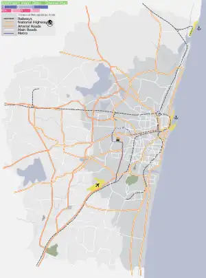
Katthivakkam is an residential and industrial area located in the northern part of Chennai. It is a part of zone 1 in Greater Chennai Corporation. It is under Thiruvottiyur taluk in Chennai district. It is a part of Thiruvottiyur(state assembly constituency) and Chennai North (Lok Sabha constituency). Formerly a town and a municipality of Thiruvallur district in the Indian state of Tamil Nadu, it has now been absorbed by Chennai city in September 2011 and within Chennai District limit since January 2018.[1] The neighbourhood is served by Katthivakkam railway station. As of 2011, the town had a population of 36,617.
Demographics
| Religious census | ||||
|---|---|---|---|---|
| Religion | Percent(%) | |||
| Hindus | 82.04% | |||
| Muslims | 8.86% | |||
| Christians | 8.53% | |||
| Sikhs | 0.06% | |||
| Buddhists | 0.01% | |||
| Jains | 0.02% | |||
| Other | 0.46% | |||
| No religion | 0.02% | |||
According to 2011 census, Kattivakkam had a population of 36,617 with a sex-ratio of 983 females for every 1,000 males, much above the national average of 929.[2] A total of 4,301 were under the age of six, constituting 2,194 males and 2,107 females. Scheduled Castes and Scheduled Tribes accounted for 15.62% and .37% of the population respectively. The average literacy of the town was 74.5%, compared to the national average of 72.99%.[2] The town had a total of : 9354 households. There were a total of 13,273 workers, comprising 17 cultivators, 49 main agricultural labourers, 201 in house hold industries, 10,613 other workers, 2,393 marginal workers, 4 marginal cultivators, 20 marginal agricultural labourers, 80 marginal workers in household industries and 2,289 other marginal workers.[3] As per the religious census of 2011, Kattivakkam had 82.04% Hindus, 8.86% Muslims, 8.53% Christians, 0.06% Sikhs, 0.01% Buddhists, 0.02% Jains, 0.46% following other religions and 0.02% following no religion or did not indicate any religious preference.[4]
Education
E.T.P.S. Matriculation School is managed by "Ennore Thermal Power Station" under State government.
References
- ↑ "Chennai District Doubles in Size".
- 1 2 "Census Info 2011 Final population totals". Office of The Registrar General and Census Commissioner, Ministry of Home Affairs, Government of India. 2013. Retrieved 26 January 2014.
- ↑ "Census Info 2011 Final population totals - Kattivakkam". Office of The Registrar General and Census Commissioner, Ministry of Home Affairs, Government of India. 2013. Retrieved 26 January 2014.
- ↑ "Population By Religious Community - Tamil Nadu" (XLS). Office of The Registrar General and Census Commissioner, Ministry of Home Affairs, Government of India. 2011. Retrieved 13 September 2015.
Neighbourhoods of Chennai (city) | |
|---|---|
|
| District headquarters |  | |
|---|---|---|
| Country | ||
| State | ||
| Region | ||
| Revenue divisions | ||
| Taluks | ||
| Revenue blocks | ||
| Municipal corporations | ||
| Municipalities | ||
| Special grade town panchayats | ||
| Town panchayats | ||
| History | ||
| Places of interest |
| |
| Universities |
| |
Municipalities of Tamil Nadu | |||||||||
|---|---|---|---|---|---|---|---|---|---|
| Corporations | |||||||||
| Municipalities |
| ||||||||