Ite | |
|---|---|
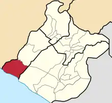 Location of Ite in the Jorge Basadre Province | |
| Coordinates: 17°31′27″S 70°34′32″W / 17.52417°S 70.57556°W | |
| Country | |
| Region | Tacna |
| Province | Jorge Basadre |
| Founded | June 12, 1961 |
| Capital | Ite |
| Government | |
| • Mayor | Pablo Ysaul Rivera Chavez |
| Area | |
| • Total | 848.34 km2 (327.55 sq mi) |
| Elevation | 175 m (574 ft) |
| Population | |
| • Total | 1,763 |
| • Density | 2.1/km2 (5.4/sq mi) |
| Time zone | UTC-5 (PET) |
| UBIGEO | 230303 |
Ite District is one of three districts of the province Jorge Basadre in Peru.[1]
Climate
| Climate data for Ite (elevation 160 m (520 ft), 1991–2020 normals) | |||||||||||||
|---|---|---|---|---|---|---|---|---|---|---|---|---|---|
| Month | Jan | Feb | Mar | Apr | May | Jun | Jul | Aug | Sep | Oct | Nov | Dec | Year |
| Mean daily maximum °C (°F) | 26.1 (79.0) |
26.8 (80.2) |
25.9 (78.6) |
23.8 (74.8) |
21.4 (70.5) |
19.4 (66.9) |
18.1 (64.6) |
18.0 (64.4) |
18.6 (65.5) |
20.2 (68.4) |
22.3 (72.1) |
24.3 (75.7) |
22.1 (71.7) |
| Mean daily minimum °C (°F) | 20.2 (68.4) |
20.6 (69.1) |
19.5 (67.1) |
17.5 (63.5) |
15.6 (60.1) |
14.0 (57.2) |
13.2 (55.8) |
13.0 (55.4) |
13.6 (56.5) |
15.0 (59.0) |
16.8 (62.2) |
18.6 (65.5) |
16.5 (61.7) |
| Average precipitation mm (inches) | 2.3 (0.09) |
0.1 (0.00) |
0.1 (0.00) |
0.1 (0.00) |
0.2 (0.01) |
0.7 (0.03) |
2.3 (0.09) |
1.9 (0.07) |
2.8 (0.11) |
1.1 (0.04) |
0.6 (0.02) |
0.5 (0.02) |
12.7 (0.48) |
| Source: National Meteorology and Hydrology Service of Peru[2] | |||||||||||||
References
- ↑ (in Spanish) Instituto Nacional de Estadística e Informática. Banco de Información Distrital Archived 2008-04-23 at the Wayback Machine. Retrieved April 11, 2008.
- ↑ "Normales Climaticás Estándares y Medias 1991-2020". National Meteorology and Hydrology Service of Peru. Archived from the original on 21 August 2023. Retrieved 6 November 2023.
| |
|---|---|
| Candarave | |
| Jorge Basadre | |
| Tacna | |
| Tarata | |
This article is issued from Wikipedia. The text is licensed under Creative Commons - Attribution - Sharealike. Additional terms may apply for the media files.