Itararé | |
|---|---|
| Municipality of Itararé | |
 Flag  Coat of arms | |
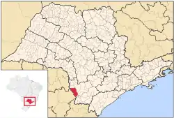 Location in São Paulo state | |
 Itararé Location in Brazil | |
| Coordinates: 24°6′45″S 49°19′54″W / 24.11250°S 49.33167°W | |
| Country | |
| Region | Southeast |
| State | |
| Area | |
| • Total | 1,004 km2 (388 sq mi) |
| Population (2020 [1]) | |
| • Total | 50,642 |
| • Density | 50/km2 (130/sq mi) |
| Time zone | UTC−3 (BRT) |
| Website | www |


Itararé is a municipality in the state of São Paulo in Brazil. The population is 50,642 (2020 est.) in an area of 1004 km².[2] Its elevation is of 740 metres (2,430 ft). This place's name comes from the Tupi language, and means "stone that the river has dug" because the Itararé River runs partly underground. Itataré became an independent municipality in 1893, when it was separated from Itapeva da Faxina.[3]
References
Capital: São Paulo | |||||||||||||||||||||
|  | ||||||||||||||||||||
|
| |||||||||||||||||||||
| |||||||||||||||||||||
| |||||||||||||||||||||
| |||||||||||||||||||||
| |||||||||||||||||||||
| |||||||||||||||||||||
| |||||||||||||||||||||
| |||||||||||||||||||||
| |||||||||||||||||||||
| |||||||||||||||||||||
| |||||||||||||||||||||
| |||||||||||||||||||||
This article is issued from Wikipedia. The text is licensed under Creative Commons - Attribution - Sharealike. Additional terms may apply for the media files.