IJzevoorde | |
|---|---|
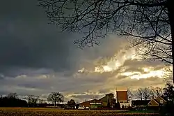 Sunset on IJzevoorde | |
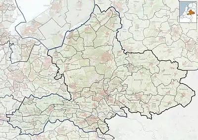 IJzevoorde Location in the province of Gelderland  IJzevoorde IJzevoorde (Netherlands) | |
| Coordinates: 51°58′29″N 6°21′28″E / 51.97472°N 6.35778°E | |
| Country | Netherlands |
| Province | Gelderland |
| Municipality | Doetinchem Bronckhorst |
| Area | |
| • Total | 4.10 km2 (1.58 sq mi) |
| Elevation | 14 m (46 ft) |
| Population (2021)[1] | |
| • Total | 265 |
| • Density | 65/km2 (170/sq mi) |
| Time zone | UTC+1 (CET) |
| • Summer (DST) | UTC+2 (CEST) |
| Postal code | 7004[1] |
| Dialing code | 0314 |
IJzevoorde is a hamlet in the municipalities of Doetinchem and Bronckhorst in the province of Gelderland in the east part of the Netherlands.[3]
Overview
It was first mentioned in 1235 as Ysenuort and means fordable place through the IJze.[4] The postal authorities have placed it under Doetinchem.[5] In 1840, it was home to 839 people.[3]
It includes a school, a kindergarten, a gym, a bar and a small stage. The school has about 60 students and there are a lot of farmers' children attending the school. IJzevoorde also has a small campground.
Close to IJzevoorde lies the Slangenburg Castle, referring to a little river called the Slinge.[3]
References
- 1 2 3 "Kerncijfers wijken en buurten 2021". Central Bureau of Statistics. Retrieved 21 March 2022.
Doetinchem part
- ↑ "Postcodetool for 7004AA". Actueel Hoogtebestand Nederland (in Dutch). Het Waterschapshuis. Retrieved 21 March 2022.
- 1 2 3 "IJzevoorde". Plaatsengids (in Dutch). Retrieved 21 March 2022.
- ↑ "IJzevoorde - (geografische naam)". Etymologiebank (in Dutch). Retrieved 21 March 2022.
- ↑ "Postcode 7004 in Doetinchem". Postcode bij adres (in Dutch). Retrieved 21 March 2022.
Wikimedia Commons has media related to IJzevoorde.
This article is issued from Wikipedia. The text is licensed under Creative Commons - Attribution - Sharealike. Additional terms may apply for the media files.