.jpg.webp)
Hundred of Wirreanda, 1896
The Hundred of Wirreanda is a cadastral unit of hundred in the County of Granville, South Australia.[1] The township of Cradock is at the hundred's centre.
The hundred is crossed from east to west by Wirreanda Creek.
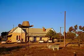
Cradock Hotel
Local government
The hundred was first locally governed by the District Council of Hawker, with Wirreanda ward electing one dedicated councillor.[2] In 1997 the hundred become a part of the Flinders Ranges Council with the amalgamation of Hawker and Kanyaka councils.[3]
See also
References
- ↑ "Placename Details: Hundred of Wirreanda". Property Location Browser. Government of South Australia. SA0027323. Archived from the original on 7 December 2015. Retrieved 30 October 2017.
-32.047410, 138.516450; Named By: Governor Musgrave; Date Named: 18/01/1877; Derivation of Name: Abna for a forest of knotty trees; Other Details: Area 92 square miles.
- ↑ Hosking, P. (1936). The Official civic record of South Australia : centenary year, 1936. Adelaide: Universal Publicity Company. p. 615.
- ↑ "Council". Flinders Ranges Council. Retrieved 2 December 2015.
32°02′49″S 138°30′58″E / 32.047°S 138.516°E
This article is issued from Wikipedia. The text is licensed under Creative Commons - Attribution - Sharealike. Additional terms may apply for the media files.