| Hlíðarfjall | |
|---|---|
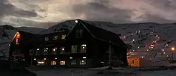 Hlíðarfjall lodge and ski slopes, Jan 2011 | |
| Highest point | |
| Elevation | 1,200 m (3,900 ft) |
| Coordinates | 65°38′55″N 18°15′57″W / 65.6487°N 18.2659°W |
| Geography | |
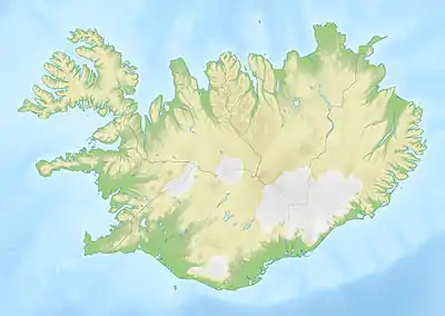 Hlíðarfjall Iceland | |
| Location | northern Iceland |
Akureyri, with Hlíðarfjall behind, viewed from the eastern shore of Eyjafjörður, morning November 2007
Hlíðarfjall (Icelandic pronunciation: [ˈl̥iːðarˌfjatl̥] ⓘ) is a mountain located west of the Icelandic town Akureyri in Eyjafjörður.[1] The former hotel no longer offers accommodation and is now mostly used for meetings.
Hlíðarfjall is generally considered to be named after Lögmannshlíð, a (formerly important) homestead and church site on the slopes of the mountain (the word hlíð having the meaning "slope").[2]
References
- ↑ "Hlíðarfjall Akureyri". Retrieved 2020-06-23.
- ↑ "Meaning of the name given on the (Icelandic) website of the Árni Magnússon Institute". arnastofnun.is. Archived from the original on 2009-02-25. Retrieved 2017-09-17.
This article is issued from Wikipedia. The text is licensed under Creative Commons - Attribution - Sharealike. Additional terms may apply for the media files.