| Hissaro-Alay | |
|---|---|
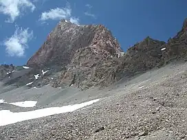
 Chimtarga peak | |
| Highest point | |
| Peak | Chimtarga |
| Elevation | 5,489 m (18,009 ft) |
| Dimensions | |
| Length | 900 km (560 mi) |
| Width | 80–150 km (50–93 mi) |
| Naming | |
| Native name | |
| Geography | |
| Country | Tajikistan, Uzbekistan and Kyrgyzstan |
| Range coordinates | 39°28′0″N 69°58′0″E / 39.46667°N 69.96667°E |
Hissaro-Alay is a mountain system in Central Asia, part of the Pamir-Alay.
Location
Hissaro-Alay is located west of the Pamirs, between the Fergana Valley in the north, the Karshi Steppe, the Tajik Depression and the Alay Valley in the south. The eastern part of the system is located on the territory of Kyrgyzstan, the middle - in Tajikistan and the western - in Uzbekistan. The length of Hissaro-Alai from west to east is about 900 km (560 mi), the width in the western part is up to 150 km (93 mi), and in the east up to 80 km (50 mi).
History
Neolithic cultures, such as Hissar have inhabited the Hissaro-Alay mountain area between 6-2 millennia BCE whose economy consisted of sheep and goat pastoralism.[1]
Ridges
source:[2]
| Name | Max. height (meters above sea level) | Length (km) | Glacier area (km2) |
|---|---|---|---|
| Turkestan range | 5621 | 340 | 600 |
| Gissarsky range | 4643 | 200 | 390 |
| Zerafshansky range | 5489 | 397 | 307 |
| Karatekinsky range | 3950 | 90 | 60 |
| Malguzar range | 2621 | 25 | 0 |
| Hobduntau Mountains | 1672 | 25 | 0 |
| Aktau Mountains | 500 | 15 | 0 |
| Karatau Mountains | 1108 | 50 | 0 |
| Nuratau range | 2165 | 170 | 0 |
| Etaktau range | 1993 | 87 | 0 |
| Karakchitau Mountains | 1103 | 22 | 0 |
| Koitas Mountains | 1905 | 52 | 0 |
| Natrantoo range | 3375 | 35 | 0 |
| Terektau range | 4454 | 80 | 0 |
| Baysun Tau range[3] | 4424 | 150 | 0 |
| Kugitangtau range | 3137 | 41 | 0 |
| Alaysky range | 5539 | 400 | 811 |
References
- ↑ Taylor, William T. T.; Pruvost, Mélanie; Posth, Cosimo; Rendu, William; Krajcarz, Maciej T.; Abdykanova, Aida; Brancaleoni, Greta; Spengler, Robert; Hermes, Taylor; Schiavinato, Stéphanie; Hodgins, Gregory (September 2021). "Evidence for early dispersal of domestic sheep into Central Asia". Nature Human Behaviour. 5 (9): 1169–1179. doi:10.1038/s41562-021-01083-y. ISSN 2397-3374. PMID 33833423. S2CID 233191571.
- ↑ "Горы Средней Азии". asiaxx.narod.ru. Retrieved 2022-04-24.
- ↑ "Baysun Tau: hight [sic] altitude caves and mountain chains of Uzbekistan". milesbeyond.it. Retrieved 2022-04-24.
This article is issued from Wikipedia. The text is licensed under Creative Commons - Attribution - Sharealike. Additional terms may apply for the media files.