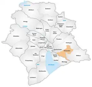
Map of the quarter of Hirslanden in Zürich

Hirslanden is a quarter in the district 7 in Zürich.
It was formerly a municipality of its own, having been incorporated into Zürich in 1893.
The quarter has a population of 6,859 distributed on an area of 2.2 km2 (0.85 sq mi).
Hirslanden is located on the western side of the Adlisberg.
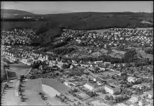
Aerial view (1953)
Wikimedia Commons has media related to Hirslanden.
47°21′52.72″N 8°33′58.62″E / 47.3646444°N 8.5662833°E
This article is issued from Wikipedia. The text is licensed under Creative Commons - Attribution - Sharealike. Additional terms may apply for the media files.