 | |
|---|---|
| ٣٥ طريق | |
| King's Highway طريق الملک | |
 | |
.JPG.webp) | |
| Route information | |
| Length | 384 km (239 mi) |
| Major junctions | |
| North end | Al-Wehda Dam, Irbid |
| Irbid, Irbid, En-Nu`aymeh, Suwaylih, Amman, Amman, (Towards Karak, Tafilah, Rajif, | |
| South end | Abu Al-Lasn, |
| Location | |
| Country | Jordan |
| Districts | Irbid Jerash Balqa Amman Madaba Karak Tafilah Ma'an |
| Highway system | |
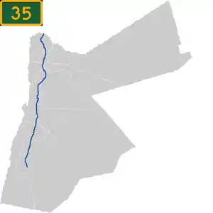
Highway 35, also known as the King's Highway, is a north–south highway in Jordan. It starts in at the Syrian border north of Irbid and leads to Highway 15 in the Ma'an Governorate.
History
The route of Highway 35 is over 5,000 years old. It runs over the ancient King's Highway.[1] This highway was first constructed by the Romans, and was part of the Via Nova Traiana.
Tourist attractions
This highway runs north–south from Irbid down to the Desert Highway in Ma'an Governorate.[2] The interesting hilly highway passes the castle of Kerak and Shobak and passes Wadi Musa, the city most close to the ruins of Petra.

Highway 35 in Jordan
References
- ↑ Vidal, Marta. "The King's Highway: The road that reveals Jordan's history". www.bbc.com. Retrieved 2023-10-03.
- ↑ Rodrigues, Daniel (2022-02-07). "A Photographer's View of Jordan's Many Splendors". The New York Times. ISSN 0362-4331. Retrieved 2023-10-03.
This article is issued from Wikipedia. The text is licensed under Creative Commons - Attribution - Sharealike. Additional terms may apply for the media files.