Hester, Louisiana | |
|---|---|
 Hester, Louisiana  Hester, Louisiana | |
| Coordinates: 30°01′40″N 90°46′16″W / 30.02778°N 90.77111°W | |
| Country | United States |
| State | Louisiana |
| Parish | St. James |
| Area | |
| • Total | 4.04 sq mi (10.47 km2) |
| • Land | 3.46 sq mi (8.96 km2) |
| • Water | 0.58 sq mi (1.50 km2) |
| Elevation | 7 ft (2 m) |
| Population (2020) | |
| • Total | 483 |
| • Density | 139.56/sq mi (53.89/km2) |
| Time zone | UTC-6 (Central (CST)) |
| • Summer (DST) | UTC-5 (CDT) |
| Area code | 225 |
| GNIS feature ID | 2583537[2] |
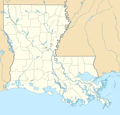
Hester is an unincorporated community and census-designated place in St. James Parish, Louisiana, United States. It was first listed as a CDP in the 2010 census with a population of 498.[3] The community is located along Louisiana Highway 44 on the east bank of the Mississippi River.
Geography
Hester is located at 30°01′40″N 90°46′16″W / 30.0276541°N 90.7710381°W.[2] According to the U.S. Census Bureau, the community has an area of 4.041 square miles (10.47 km2); 3.460 square miles (8.96 km2) of its area is land, and 0.581 square miles (1.50 km2) is water.[3]
Demographics
| Census | Pop. | Note | %± |
|---|---|---|---|
| 2010 | 498 | — | |
| 2020 | 483 | −3.0% | |
| U.S. Decennial Census[4] | |||
| Race / Ethnicity | Pop 2010[5] | Pop 2020[6] | % 2010 | % 2020 |
|---|---|---|---|---|
| White alone (NH) | 457 | 456 | 91.77% | 94.41% |
| Black or African American alone (NH) | 30 | 11 | 6.02% | 2.28% |
| Native American or Alaska Native alone (NH) | 1 | 1 | 0.20% | 0.21% |
| Asian alone (NH) | 1 | 0 | 0.20% | 0.00% |
| Pacific Islander alone (NH) | 0 | 0 | 0.00% | 0.00% |
| Some Other Race alone (NH) | 1 | 1 | 0.20% | 0.21% |
| Mixed Race/Multi-Racial (NH) | 6 | 5 | 1.20% | 1.04% |
| Hispanic or Latino (any race) | 2 | 9 | 0.40% | 1.86% |
| Total | 498 | 483 | 100.00% | 100.00% |
At the 2020 census, its population was 483, down from 498 in 2010.[3]
References
- ↑ "2020 U.S. Gazetteer Files". United States Census Bureau. Retrieved March 20, 2022.
- 1 2 "Hester Census Designated Place". Geographic Names Information System. United States Geological Survey, United States Department of the Interior.
- 1 2 3 "2010 Census Gazetteer Files - Places: Louisiana". U.S. Census Bureau. Retrieved January 1, 2017.
- ↑ "Census of Population and Housing". Census.gov. Retrieved June 4, 2016.
- ↑ "P2 HISPANIC OR LATINO, AND NOT HISPANIC OR LATINO BY RACE – 2010: DEC Redistricting Data (PL 94-171) – Hester CDP, Louisiana". United States Census Bureau.
- ↑ "P2 HISPANIC OR LATINO, AND NOT HISPANIC OR LATINO BY RACE - 2020: DEC Redistricting Data (PL 94-171) – Hester CDP, Louisiana". United States Census Bureau.
Municipalities and communities of St. James Parish, Louisiana, United States | ||
|---|---|---|
| Towns | 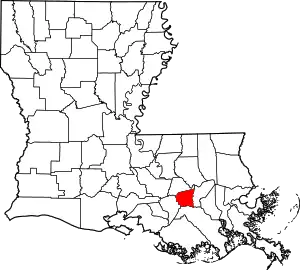 | |
| CDPs | ||
| Unincorporated community | ||
| Footnotes | ‡This populated place also has portions in an adjacent parish or parishes | |
This article is issued from Wikipedia. The text is licensed under Creative Commons - Attribution - Sharealike. Additional terms may apply for the media files.