Harrison Township | |
|---|---|
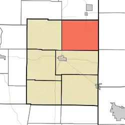 Location in Union County | |
| Coordinates: 39°41′16″N 84°51′58″W / 39.68778°N 84.86611°W | |
| Country | United States |
| State | Indiana |
| County | Union |
| Government | |
| • Type | Indiana township |
| Area | |
| • Total | 30.13 sq mi (78.0 km2) |
| • Land | 30.11 sq mi (78.0 km2) |
| • Water | 0.02 sq mi (0.05 km2) 0.07% |
| Elevation | 1,109 ft (338 m) |
| Population (2010) | |
| • Total | 416 |
| • Density | 13.8/sq mi (5.3/km2) |
| Time zone | UTC-5 (Eastern (EST)) |
| • Summer (DST) | UTC-4 (EDT) |
| ZIP codes | 47353, 47374 |
| Area code | 765 |
| GNIS feature ID | 453397 |
Harrison Township is one of six townships in Union County, Indiana, United States. As of the 2010 census, its population was 416 and it contained 182 housing units.[2]
Geography
According to the 2010 census, the township has a total area of 30.13 square miles (78.0 km2), of which 30.11 square miles (78.0 km2) (or 99.93%) is land and 0.02 square miles (0.052 km2) (or 0.07%) is water.[2]
Unincorporated towns
- Five Points at 39°42′43″N 84°51′07″W / 39.7119937°N 84.8519030°W
- Kitchel at 39°40′59″N 84°51′41″W / 39.6831051°N 84.8613475°W
- Witts Station at 39°42′44″N 84°51′42″W / 39.7122714°N 84.8616256°W
(This list is based on USGS data and may include former settlements.)
Cemeteries
The township contains these two cemeteries: Nutter and Railsback.
School districts
- Union County-College Corner Joint School District
Political districts
- Indiana's 6th congressional district
- State House District 55
- State Senate District 43
References
- United States Census Bureau 2007 TIGER/Line Shapefiles
- United States Board on Geographic Names (GNIS)
- IndianaMap
- ↑ "US Board on Geographic Names". United States Geological Survey. October 25, 2007. Retrieved May 9, 2017.
- 1 2 "Population, Housing Units, Area, and Density: 2010 - County -- County Subdivision and Place -- 2010 Census Summary File 1". United States Census. Archived from the original on February 12, 2020. Retrieved May 10, 2013.
External links
Places adjacent to Harrison Township, Union County, Indiana | |
|---|---|
Municipalities and communities of Union County, Indiana, United States | ||
|---|---|---|
| Towns | Map of Indiana highlighting Union County | |
| Townships | ||
| CDP | ||
| Other communities | ||
This article is issued from Wikipedia. The text is licensed under Creative Commons - Attribution - Sharealike. Additional terms may apply for the media files.