| Hanging Dog Creek Tributary to Hiawassee River | |
|---|---|
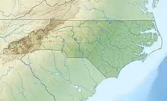 Location of Hanging Dog mouth  Hanging Dog Creek (the United States) | |
| Location | |
| Country | United States |
| State | North Carolina |
| County | Cherokee |
| Physical characteristics | |
| Source | Hyatt Creek divide |
| • location | Hanging Dog Gap |
| • coordinates | 35°12′48″N 083°58′03″W / 35.21333°N 83.96750°W[1] |
| • elevation | 3,450 ft (1,050 m)[2] |
| Mouth | Hiawassee River |
• location | Hiawassee Lake |
• coordinates | 35°06′22″N 084°04′33″W / 35.10611°N 84.07583°W[1] |
• elevation | 1,525 ft (465 m)[2] |
| Length | 14.57 mi (23.45 km)[3] |
| Basin size | 40.94 square miles (106.0 km2)[4] |
| Discharge | |
| • location | Hiawassee River |
| • average | 120.86 cu ft/s (3.422 m3/s) at mouth with Hiawassee River[4] |
| Basin features | |
| Progression | Hiawassee River → Tennessee River → Ohio River → Mississippi River → Gulf of Mexico |
| River system | Hiawassee River |
| Population | Swannanoa River → French Broad River → |
| Tributaries | |
| • left | Will Creek Augen Branch Grindstone Branch Davis Creek Cook Creek Dockery Creek |
| • right | Bear Creek Owl Creek Bates Creek |
| Bridges | Clearview Lane, Boiling Springs Road (x2), Woody Branch Road, Boiling Springs Road (x3), Running Deer Lane, Boiling Springs Road (x2), Hanging Dog Road, Tranquil Valley Lane, Ed Graves Road (x2), Ebenezer Road, McDonald Road, Haven Lane, Joe Brown Highway |
Hanging Dog Creek is a stream in the U.S. state of North Carolina.[5] It is a tributary to the Hiwassee River.
Some say the name Hanging Dog is a corruption of "Hanging Maw", a local Cherokee, while others believe the name stems from an incident when Indian's dog was "hung up" in river debris before being rescued.[6]
References
- 1 2 "GNIS Detail - Hanging Dog Creek". geonames.usgs.gov. US Geological Survey. Retrieved 29 August 2020.
- 1 2 "Hanging Dog Creek Topo Map in Cherokee". TopoZone. Locality, LLC. Retrieved 29 August 2020.
- ↑ "ArcGIS Web Application". epa.maps.arcgis.com. US EPA. Retrieved 29 August 2020.
- 1 2 "Hanging Dog Creek Watershed Report". US EPA Geoviewer. US EPA. Retrieved 29 August 2020.
- ↑ U.S. Geological Survey Geographic Names Information System: Hanging Dog Creek
- ↑ "Community Backstory". Cherokee County Chamber of Commerce. Archived from the original on 3 July 2019. Retrieved 3 July 2019.
This article is issued from Wikipedia. The text is licensed under Creative Commons - Attribution - Sharealike. Additional terms may apply for the media files.