| Høgstolen | |
|---|---|
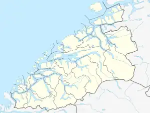
 Høgstolen Location of the mountain  Høgstolen Høgstolen (Norway) | |
| Highest point | |
| Elevation | 1,953 m (6,407 ft)[1][2] |
| Prominence | 200 m (660 ft)[2] |
| Coordinates | 62°11′57″N 7°41′02″E / 62.1993°N 7.6838°E[3] |
| Geography | |
| Location | Møre og Romsdal, Norway |
| Parent range | Tafjordfjella |
| Topo map | 1319 III Tafjord |
Høgstolen is a mountain in Møre og Romsdal county, Norway. The 1,953-metre (6,407 ft) tall mountain lies on the border of Rauma Municipality and Fjord Municipality in the Tafjordfjella mountain range, about 3 kilometres (1.9 mi) west of the border with Oppland county.[1]
Høgstolen lies within the Reinheimen National Park, between the mountains Puttegga and Karitind. The name is not unique to this mountain, as there are other (lower) mountains with the same name in Norway.[4]
See also
References
- 1 2 Lauritzen, Per Roger, ed. (2009). "Høgstolen". Norsk Fjelleksikon (in Norwegian). Arendal: Friluftsforlaget. ISBN 978-82-91-49547-7.
- 1 2 Røyne, Eivind (1985). Fjell i Norge over 1800 meter (in Norwegian). Oslo.
{{cite book}}: CS1 maint: location missing publisher (link) - ↑ "Høgstolen, Norddal (Møre og Romsdal)" (in Norwegian). yr.no. Retrieved 2019-07-06.
- ↑ "Geonames search in Norway". Retrieved 2019-07-06.
This article is issued from Wikipedia. The text is licensed under Creative Commons - Attribution - Sharealike. Additional terms may apply for the media files.