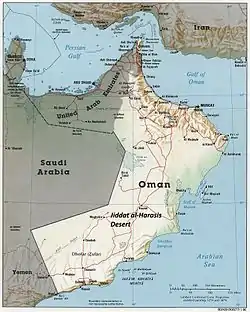
Location in Oman
The Gulf of Masirah (Arabic: بحر الحدري, romanized: Baḥr al-Ḥadrī, literally the "Lower Sea") is a gulf or sea between the Arabian Sea and the eastern coast of Oman south of the Masirah Island and north of Raʾs Madrakah.[1] In some maps, the Gulf of Masirah is labelled Khalīj Maṣīrah (Arabic: خليج مصيرة, literally the Masirah Bay), but in the official map of Oman, that is the name of the Masirah Channel.[2]
References
- ↑ Miles, Samuel Barrett (1919). The Countries and Tribes of the Persian Gulf. Vol. 2. London: Harrison and Sons. p. 488.
- ↑ "Map of the Sultanate of Oman" (PDF). Foreign Ministry of Oman. Archived from the original (PDF) on 2024-01-09. Retrieved 2024-01-06.
This article is issued from Wikipedia. The text is licensed under Creative Commons - Attribution - Sharealike. Additional terms may apply for the media files.