Goesdorf
Géisdref | |
|---|---|
 | |
 Coat of arms | |
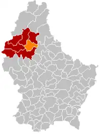 Map of Luxembourg with Goesdorf highlighted in orange, and the canton in dark red | |
| Coordinates: 49°55′00″N 5°58′00″E / 49.9167°N 5.9667°E | |
| Country | |
| Canton | Wiltz |
| Area | |
| • Total | 29.41 km2 (11.36 sq mi) |
| • Rank | 27th of 102 |
| Highest elevation | 498 m (1,634 ft) |
| • Rank | 19th of 102 |
| Lowest elevation | 233 m (764 ft) |
| • Rank | 44th of 102 |
| Population (2023) | |
| • Total | 1,664 |
| • Rank | 87th of 102 |
| • Density | 57/km2 (150/sq mi) |
| • Rank | 92nd of 102 |
| Time zone | UTC+1 (CET) |
| • Summer (DST) | UTC+2 (CEST) |
| LAU 2 | LU0000804 |
| Website | goesdorf.lu |
Goesdorf (German pronunciation: [ˈɡøːsˌdɔʁf]; Luxembourgish: Géisdref) is a commune and village in north-western Luxembourg. It is part of the canton of Wiltz.
As of 2005, the village of Goesdorf, which lies in the south of the commune, had a population of 238. Other towns within the commune include Buderscheid, Dahl, Nocher, and Nocher-Route.
Population
References
- ↑ "Population par canton et commune". statistiques.public.lu. Retrieved 11 January 2022.
External links
 Media related to Goesdorf at Wikimedia Commons
Places adjacent to Goesdorf | |
|---|---|

This article is issued from Wikipedia. The text is licensed under Creative Commons - Attribution - Sharealike. Additional terms may apply for the media files.