Goaltore | |
|---|---|
Village | |
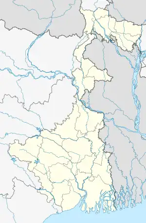
 Goaltore Location in West Bengal, India  Goaltore Goaltore (India) | |
| Coordinates: 22°42′30″N 87°10′17″E / 22.70842°N 87.17136°E | |
| Country | |
| State | West Bengal |
| District | Paschim Medinipur |
| Subdivision | Medinipur Sadar |
| Government | |
| • Body | Gram panchayat |
| Population (2011) | |
| • Total | 693 |
| Languages* | |
| • Official | Bengali, Santali, English |
| Time zone | UTC+5:30 (IST) |
| PIN | 721128 |
| ISO 3166 code | IN-WB |
| Vehicle registration | WB |
| Website | wb |
Goaltore, also spelled Goaltor, is a village in the Garhbeta II CD block in the Medinipur Sadar subdivision of the Paschim Medinipur district in West Bengal, India.
Geography
M: municipal city/ town, CT: census town, R: rural/ urban centre, H: historical/ religious centre, F: facilities
Owing to space constraints in the small map, the actual locations in a larger map may vary slightly
Location
Goaltore is located at 22°42′30″N 87°10′17″E / 22.70842°N 87.17136°E.
Area overview
There are large forested areas in the subdivision. The soil is predominantly lateritic.[1] Around 30% of the population of the district resides in this subdivision. 13.95% of the population of this subdivision lives in urban areas and 86.05% of the population lives in rural areas.[2]
Note: The map alongside presents some of the notable locations in the subdivision. All places marked in the map are linked in the larger full screen map.
Demographics
According to the 2011 Census of India, Goaltore had a total population of 693, of which 356 (51%) were males and 337 (49%) were females. There were 48 persons in the age range of 0–6 years. The total number of literate persons in Goaltore was 606 (93.95% of the population over 6 years).[3]
.*For language details see Garhbeta II#Language and religion
Civic administration
CD block HQ
The headquarters of Garhbeta II block are located at Goaltore.[4]
Police station
Goaltore police station has jurisdiction over parts of Garhbeta I, Garhbeta II, and Garhbeta III CD blocks.[5][6]
Economy
The West Bengal Government has offered 1,000 acres of land in Goaltore for industry.[7]
Transport
State Highway 4 (West Bengal) running from Jhalda (in Purulia district) to Digha (in Purba Medinipur district) passes through Goaltore.[8]
Education
The Santal Bidroha Sardha Satabarsiki Mahavidyalaya is a coeducational college at Goaltore, established in 2005. It offers honors courses in Bengali, Santali, Sanskrit, English, geography, history, political science, philosophy, mathematics, chemistry, nutrition and zoology.[9]
Healthcare
Kewakole Rural Hospital, with 30 beds, is located in Goaltore and is the major government medical facility in the Garhbeta II CD block.[10]
References
- ↑ "District Human Development Report Paschim Medinipur, 2011". page 7, 27. Department of Planning and Statistics, Government of West Bengal. Retrieved 10 September 2020.
- ↑ "District Statistical Handbook Paschim Medinipur, 2013". Table 2.2, 2.4 (a). Department of Planning and Statistics. Retrieved 10 September 2020.
- ↑ "CD block Wise Primary Census Abstract Data(PCA)". West Bengal – District-wise CD blocks. Registrar General and Census, India. Retrieved 5 September 2020.
- ↑ "District Census Handbook: Paschim Medinipur" (PDF). Map of Paschim Medinipur with CD Block HQs and Police Stations (on the fifth page). Directorate of Census Operations, West Bengal, 2011. Retrieved 20 November 2016.
- ↑ "District Statistical Handbook 2014 Paschim Medinipur". Tables 2.1, 2.2. Department of Planning and Statistics, Government of West Bengal. Retrieved 14 September 2020.
- ↑ "District at a Glance". Paschim Medinipur District Police. Archived from the original on 27 October 2016. Retrieved 27 October 2016.
- ↑ "Mamata Banerjee offers 1,000 acres of land for industry in Bengal". 14 September 2016. Web India 123. Retrieved 31 October 2016.
- ↑ "List of State Highways in West Bengal". West Bengal Traffic Police. Retrieved 15 September 2016.
- ↑ "Santal Bidroha Sardha Satabarshiki Mahavidyalaya". SBSSM. Retrieved 16 February 2018.
- ↑ "Health & Family Welfare Department" (PDF). Health Statistics – Rural Hospitals. Government of West Bengal. Retrieved 1 September 2020.
