| Geleenbeek | |
|---|---|
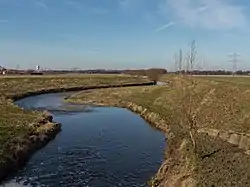 The Geleenbeek near Susteren | |
 The Geleenbeek (Gb) in South Limburg, with tributaries Roode Beek (R) and Caumerbeek (C). | |
| Location | |
| Country | Netherlands |
| Province | Limburg |
| Physical characteristics | |
| Mouth | |
• location | Meuse |
• coordinates | 51°07′12″N 5°51′19″E / 51.1199°N 5.8552°E |
| Length | 44.7 km (27.8 mi) [1] |
| Basin features | |
| Progression | Meuse→ North Sea |

The Geleenbeek near Heerlen
The Geleenbeek (Dutch pronunciation: [ɣəˈleːmbeːk]; Limburgish: Gelaenbaek [ɣəˈlɛːmbɛːk]) is a river in Limburg, the Netherlands. Its source is near the village Benzenrade, part of the city of Heerlen. It flows generally northwest, along Nuth, Schinnen, Spaubeek, turns north at Geleen, flows through the centre of Sittard, and further north through Nieuwstadt until it flows into a branch of the Meuse at Stevensweert.
Its Latin name is "Glana", which means "bright brook".
References
This article is issued from Wikipedia. The text is licensed under Creative Commons - Attribution - Sharealike. Additional terms may apply for the media files.