Gaspra
Гаспра | |
|---|---|
| Haspra | |
 Flag  Coat of arms | |
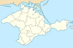
 Gaspra Location of Gaspra within the Crimea | |
| Coordinates: 44°26′10″N 34°6′38″E / 44.43611°N 34.11056°E | |
| Country | Territory of Ukraine, occupied by Russia[1] |
| Republic | Crimea |
| Region | Yalta Municipality |
| Elevation | 50 m (160 ft) |
| Population (2014) | |
| • Total | 10,310 |
| Time zone | UTC+4 (MSK) |
| Postal code | 98660 — 98669 |
| Area code | +380-654 |
| Climate | Cfb |
Gaspra (Ukrainian: Гаспра; Russian: Гаспра; Crimean Tatar: Gaspra; from Greek ἄσπρα áspra, 'white'), officially transliterated Haspra, is a spa town, an urban-type settlement in Yalta Municipality in the Autonomous Republic of Crimea. It is located on the Black Sea coast, west of Yalta, and is a popular holiday resort. Population: 10,310 (2014 Census).[2]
Leo Tolstoy lived in Gaspra in 1901 and 1902. Nearby are the Swallow's Nest, a modern castle and Charax, Crimea a Roman fort.
The asteroid 951 Gaspra is named after the town.
History
In the 70s of the second century - the first half of the third century, there was a fortress of Haraks (on the site of an ancient Taurian settlement), the largest base of Roman troops in the Crimea. In the Middle Ages, it was a zone of Greek colonization (Gaspra from the Greek "aspro" - white). It has been known as a settlement since the mid-eighteenth century.
After the Crimean Khanate was incorporated into the Russian Empire (1783), the lands around Gaspra were distributed to Russian aristocrats (including members of the royal family), who built their own palaces here (the most famous is the so-called romantic Alexandria of Prince A. Golitsyn).
According to the 1897 census, the number of residents was 695 (403 men and 292 women), of whom 84 were Orthodox and 605 were Mohammedans.
In 1911–1912, Baku oilman Baron V. Steingel built the so-called castle of love, known as the Swallow's Nest, on Cape Ai-Todor, one of the symbols of modern Crimea. Winemaking played a significant role in the economic development of the estate (Livadia's zone of influence).
In 1930, Gaspra was granted the status of an urban-type settlement. During the German-Soviet war, from November 1941 to April 1944, it was occupied by the Nazis.
The 1960s and 1970s saw the heyday of Gaspra as a resort. Today it is actually a single entity with the village of Koreiz and the resort area of Miskhor. On December 14, 2007, the Gaspra Village Council approved the modern coat of arms and flag of Gaspra.
Climate
Gaspra has an oceanic climate (Köppen: Cfb).
| Climate data for Gaspra | |||||||||||||
|---|---|---|---|---|---|---|---|---|---|---|---|---|---|
| Month | Jan | Feb | Mar | Apr | May | Jun | Jul | Aug | Sep | Oct | Nov | Dec | Year |
| Daily mean °C (°F) | 1.0 (33.8) |
1.6 (34.9) |
4.0 (39.2) |
9.8 (49.6) |
14.8 (58.6) |
18.9 (66.0) |
21.4 (70.5) |
20.9 (69.6) |
16.7 (62.1) |
11.8 (53.2) |
7.5 (45.5) |
3.7 (38.7) |
11.0 (51.8) |
| Average precipitation mm (inches) | 67 (2.6) |
50 (2.0) |
43 (1.7) |
36 (1.4) |
41 (1.6) |
53 (2.1) |
44 (1.7) |
43 (1.7) |
40 (1.6) |
40 (1.6) |
53 (2.1) |
77 (3.0) |
587 (23.1) |
| Source: Climate-Data.org[3] | |||||||||||||
Demographics
Distribution by native language according to the 2001 Ukrainian census:[4]
- Russian: 80.7%
- Ukrainian: 15.6%
- Crimean Tatar: 1.0%
- Armenian: 0.5%
- Belarusian: 0.2%
- Others: 0.8%
Notable landmarks
Tourist attractions in the vicinity include the Roman castrum of Charax and the romantic castle of Swallow's Nest.
People from Gaspra
Twin towns — sister cities
 Tirilye, Turkey
References
- ↑ This place is located on the Crimean peninsula, which is internationally recognized as part of Ukraine, but since 2014 under Russian occupation. According to the administrative-territorial division of Ukraine, there are the Ukrainian divisions (the Autonomous Republic of Crimea and the city with special status of Sevastopol) located on the peninsula. Russia claims these as federal subjects of the Russian Federation (the Republic of Crimea and the federal city of Sevastopol).
- ↑ Russian Federal State Statistics Service (2014). "Таблица 1.3. Численность населения Крымского федерального округа, городских округов, муниципальных районов, городских и сельских поселений" [Table 1.3. Population of Crimean Federal District, Its Urban Okrugs, Municipal Districts, Urban and Rural Settlements]. Федеральное статистическое наблюдение «Перепись населения в Крымском федеральном округе». ("Population Census in Crimean Federal District" Federal Statistical Examination) (in Russian). Federal State Statistics Service. Retrieved January 4, 2016.
- ↑ "Climate: Haspra". Climate-Data.org. Retrieved 18 April 2014.
- ↑ https://socialdata.org.ua/projects/mova-2001/
External links
 Media related to Category:Gaspra at Wikimedia Commons